

- Usage in publication:
-
- Melon Gravel*
- Modifications:
-
- Named
- Dominant lithology:
-
- Gravel
- AAPG geologic province:
-
- Snake River basin
Summary:
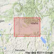
Pg. 1199 (fig. 1), 1216-1217. Melon Gravel, upper formation of Snake River Group. At type locality the gravel forms bouldery bar more than 1 mile long, one-half-mile wide, and 150 feet thick on canyon floor. About 5 miles from Melon Valley, the gravel overlies eroded Sand Springs Basalt, and farther downstream lies against canyon walls eroded in Bancroft Springs Basalt (new). Identified intermittently in Snake River Canyon as far downstream area between Murphy and Homedale --150 miles. Upstream from Melon Valley the gravel forms bars within canyon as far as Milner, 40 miles east. Underlies McKinney Basalt near Glenns Ferry. Age is late Pleistocene; fossils (mollusks, bison) found near Glenns Ferry. Report includes stratigraphic chart.
Type locality: borrow pit in Melon Valley, a wide segment in Snake River Canyon, 5 mi north of Buhl, Twin Falls Co., southern ID. Named from Melon Valley.
Source: US geologic names lexicon (USGS Bull. 1350, p. 481); GNU records (USGS DDS-6; Denver GNULEX).
- Usage in publication:
-
- Melon Gravel*
- Modifications:
-
- Overview
- AAPG geologic province:
-
- Snake River basin
Summary:
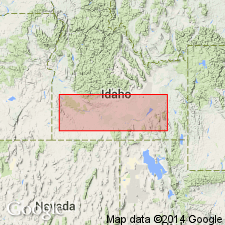
Is formation along Snake River Plain in southwest ID, Snake River basin; deposition attributed to the Bonneville Flood during its passage down the Snake River in the late Pleistocene. Displays multitude of lithologic and physiographic features that indicate torrential origin in rapidly moving deep water. Consists mostly of basalt debris derived from local lava flows; is characterized by gigantic rounded boulders (as large as 10 ft), extremely poor sorting (mainly boulders and coarse sand, but no fine sand or silt), a general lack of horizontal bedding (but common occurrence of thick sets of inclined beds), and extraordinary variation in size of debris in local deposits (the maximum particle size decreases rapidly below canyon constrictions). Physiographic features include: enormous streamlined bars veneered with boulders, usually at midcanyon locations; gravel crowded in local basins just below canyon constrictions; bars associated with marginal channels that separate the gravel from canyon walls; and tributary valleys obstructed by heaps of gravel. Initial spillover occurred about 30,000 years ago as indicated by radiocarbon date for associated molluscan fossils (late Pleistocene). Correlated with Michaud Gravel in upper Snake River Plain in vicinity of Pocatello, ID.
Source: GNU records (USGS DDS-6; Denver GNULEX).
For more information, please contact Nancy Stamm, Geologic Names Committee Secretary.
Asterisk (*) indicates published by U.S. Geological Survey authors.
"No current usage" (†) implies that a name has been abandoned or has fallen into disuse. Former usage and, if known, replacement name given in parentheses ( ).
Slash (/) indicates name conflicts with nomenclatural guidelines (CSN, 1933; ACSN, 1961, 1970; NACSN, 1983, 2005, 2021). May be explained within brackets ([ ]).