

- Usage in publication:
-
- Massacre volcanics*
- Modifications:
-
- Original reference
- Dominant lithology:
-
- Volcanics
- Tuff
- Basalt
- AAPG geologic province:
-
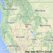
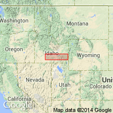
- Snake River basin
Summary:
Pg. 434-439; H.T. Stearns, 1932 (Corr. chart of Idaho compiled by M.G. Wilmarth, dated Sept. 1, 1932). Massacre volcanics. Well-consolidated red to brown basic cindery tuff, in places containing angular fragments of underlying formations. At many places contains at base a persistent fine-grained blue basalt flow 23+/- feet thick. Thickness of formation 150+/- feet. Older than Rockland Valley basalt and younger than Eagle Rock tuff. Age is Pliocene(?) (early Pliocene?).
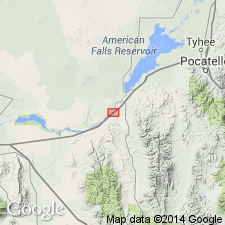
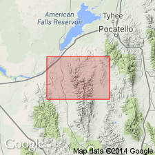
The feeder dikes form Massacre Rocks, a group of knobs of diabase, in sec. 6, T. 9 S., R. 30 E., Power Co., southern ID.
Source: US geologic names lexicon (USGS Bull. 896, p. 1317).
- Usage in publication:
-
- Massacre volcanics*
- Modifications:
-
- Principal reference
- AAPG geologic province:
-
- Snake River basin
Summary:
Pg. 32, 46-47, pls. 4, 6. Massacre volcanics. A group of knobs of dense basalt. Rocks represent denuded feeder of an ancient volcano. Shown on stratigraphic section above Eagle Rock tuff and below Rockland Valley basalt.
Principal vent at Massacre Rocks, in center of sec. 6, T. 9 S., R. 30 E., Power Co., southern ID. Named from Massacre Rocks.
Source: Publication; US geologic names lexicon (USGS Bull. 1200, p. 2415).
- Usage in publication:
-
- Massacre volcanics
- Modifications:
-
- Areal extent
- AAPG geologic province:
-
- Snake River basin
Summary:
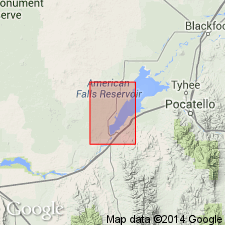
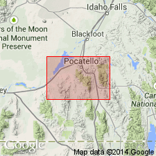
Pg. 21, 24-27, 30, 31. Massacre volcanics (Formation C). Additional principal vent identified at Eagle Rock, 7.5 miles downstream from American Falls, in center SW/4 sec. 21, T. 8 S., R. 30 E., Rockland quadrangle, Power County, southern Idaho. Comprise the whole gamut of volcanic rocks; dikes, agglutinated cinder tuffs, cinder beds full of large accidental and accessory ejecta, lava flows, tuff breccias, and tuffs. (Formation C = the cindery tuff, tuff breccia, and agglomerate deposits.) Eruption was definitely later than one at Massacre Rocks. Age is considered early Pliocene(?), although may be late Miocene.
Source: Publication.
- Usage in publication:
-
- Massacre volcanics*
- Modifications:
-
- Revised
- AAPG geologic province:
-
- Snake River basin
Summary:
Pg. G8 (fig. 2), G19-G21, pl. 1. Massacre volcanics of Stearns and others (1938) and Stearns and Isotoff (1956) restricted to the younger group of volcanic rocks above the unconformity. The older and more widespread group of volcanic rocks are named Little Creek formation. (See Little Creek entry.)
Source: Modified from US geologic names lexicon (USGS Bull. 1350, Little Creek entry p. 428-429).
- Usage in publication:
-
- Massacre Volcanics*
- Modifications:
-
- Revised
- Age modified
- AAPG geologic province:
-
- Snake River basin
Summary:
Massacre Volcanics. Stratigraphically extended by inclusion of basalts formerly assigned to †Rockland Valley Basalt (abandoned) and uppermost basalt formerly assigned to Little Creek Formation. Age changed from Pleistocene(?) --to-- late Pliocene or early Pleistocene, based on stratigraphic position.
Source: Changes in stratigraphic nomenclature, 1976 (USGS Bull. 1435-A, A60, A89-A90); supplemental information from GNU records (USGS DDS-6; Denver GNULEX).
- Usage in publication:
-
- Massacre Volcanics*
- Modifications:
-
- Mapped
- AAPG geologic province:
-
- Snake River basin
Summary:
Massacre Volcanics. Diktytaxitic, locally olivine-bearing basalt lava, and pyroclastic tuffs and tuff-breccias. Unconformably overlies Little Creek Formation. Thickness up to 300 feet (91 m). Interpreted to be a basalt eruptive center. Recognized in Power County, southeastern Idaho. Age is considered late Miocene and Pliocene. (Follows Trimble and Carr, 1976.)
Source: Publication.
For more information, please contact Nancy Stamm, Geologic Names Committee Secretary.
Asterisk (*) indicates published by U.S. Geological Survey authors.
"No current usage" (†) implies that a name has been abandoned or has fallen into disuse. Former usage and, if known, replacement name given in parentheses ( ).
Slash (/) indicates name conflicts with nomenclatural guidelines (CSN, 1933; ACSN, 1961, 1970; NACSN, 1983, 2005, 2021). May be explained within brackets ([ ]).