

- Usage in publication:
-
- Marsh Creek Sandstone Tongue*
- Modifications:
-
- Named
- Dominant lithology:
-
- Sandstone
- AAPG geologic province:
-
- Appalachian basin
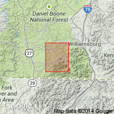
Summary:
Marsh Creek Sandstone Tongue (new name) of Lee Formation mapped in Hollyhill quadrangle. Consists mostly of light-gray quartzose fine- to medium-grained thickly cross-bedded sandstone that weathers pink, brownish yellow, and brown. Locally coarse grained and sparsely conglomeratic. Upper and lower few feet commonly fine grained, thinly ripple bedded, and platy. Contains thin shale lenses locally. Thins southward and pinches out in Marsh Creek valley north of Clear Creek and probably south of Pleasant Run. Tongue is conformable with shaly units of Breathitt Formation immediately above and below. Thickness 0 to 150 ft. Tongue is not shown on Cumberland Falls side of the border with Hollyhill, but may be equivalent to a mapped sandstone in the Lee in this approximate stratigraphic position farther north in Cumberland Falls quadrangle. Age is Early Pennsylvanian.
Source: GNU records (USGS DDS-6; Reston GNULEX).
- Usage in publication:
-
- Marsh Creek Sandstone Member*
- Modifications:
-
- Revised
- AAPG geologic province:
-
- Appalachian basin
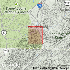
Summary:
Marsh Creek Sandstone Member of Lee Formation mapped in Williamsburg quad. Thickness 40 to 80 ft. Overlies unnamed shale in Lee Formation. Underlies River Gem (Swamp Angel) coal bed in Breathitt Formation.
Source: GNU records (USGS DDS-6; Reston GNULEX).
For more information, please contact Nancy Stamm, Geologic Names Committee Secretary.
Asterisk (*) indicates published by U.S. Geological Survey authors.
"No current usage" (†) implies that a name has been abandoned or has fallen into disuse. Former usage and, if known, replacement name given in parentheses ( ).
Slash (/) indicates name conflicts with nomenclatural guidelines (CSN, 1933; ACSN, 1961, 1970; NACSN, 1983, 2005, 2021). May be explained within brackets ([ ]).