- Usage in publication:
-
- Lousetown series
- Lousetown andesite
- Modifications:
-
- Original reference
- Dominant lithology:
-
- Basalt
- AAPG geologic province:
-
- Great Basin province
Summary:
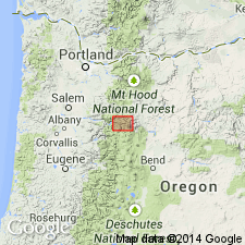
Pg. 1648-1650. Lousetown series, and Lousetown andesite. Lavas of the series, in its type area, are all of olivine basalts. They range from pale- or medium-gray porous lavas to fine-grained glassy dark flows. All types have a characteristic sheen on certain surfaces in hand specimen, owing to fluidal arrangement of feldspar laths. Prominent pyroxene phenocrysts rather common in coarser varieties. Related rocks in southern part of Comstock Lode district referred to as Lousetown pyroxene andesite and described as being more or less platy and in places with good columnar structure. Volcanics at the most are a few hundred feet thick. Overlies other volcanics of [late] Miocene or [early] Pliocene age. Age is late Pliocene or early Pleistocene.
Source: US geologic names lexicon (USGS Bull. 1200, p. 2246).
- Usage in publication:
-
- Lousetown formation
- Modifications:
-
- Revised
- Dominant lithology:
-
- Andesite
- AAPG geologic province:
-
- Great Basin province
Summary:
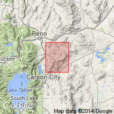
Pg. 57-58, pl. 3. Lousetown formation. Formation ranges from fine-grained pyroxene andesite with basaltic habit and appearance to olivine basalt. Flows less than 50 feet thick, with vesicular tops. Commonly lies with marked angular unconformity on Truckee formation and older rocks. In Steamboat Hills, probably contemporaneous with or younger than Steamboat Hills rhyolite; elsewhere younger. [Age is] late Pliocene or early Pleistocene.
Source: US geologic names lexicon (USGS Bull. 1200, p. 2246).
- Usage in publication:
-
- Lousetown flows
- [Lousetown Formation]
- Modifications:
-
- [Revised]
- Dominant lithology:
-
- Latite
- Basalt
- Alluvium
- AAPG geologic province:
-
- Sierra Nevada province
Summary:
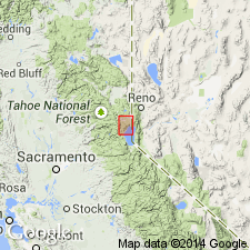
Pg. 1453-1464. Lousetown flows. Discussion of Pleistocene vulcanism and deformation of Truckee area, north of Lake Tahoe, [northeastern] California. Pleistocene latite and basalt flows crop out along the upper Truckee Canyon, located immediately downstream from Lake Tahoe, and throughout Truckee basin, an intermontane basin at north end of the canyon. The flows postdate the major Pliocene-Pleistocene deformation of the Sierra Nevada and appear to predate oldest recognized glaciation in this part of the Sierra Nevada. They are correlated with Lousetown Formation of western Nevada. For clarity in presentation, the flows or groups of flows and associated alluvial deposits are treated as members. This member usage is intended to be informal. Named units are: Dry Lake flows, Fir Crags gravel, Tahoe City olivine latites (flow), Big Chief basalt, Prosser Creek alluvium, Hirschdale flow, Juniper Flat alluvium, Alder Hill basalts, Boca Ridge flows, Polaris olivine latite, and Bald Mountain flow or olivine latite. Hirschdale olivine latite is youngest of Lousetown flows in Truckee area. Term Lousetown lavas also used in Truckee area.
[Note to me: appears Lousetown flows = Lousetown Formation (vs. Lousetown flows are a part of Lousetown Formation, as heading in Bull. 1350, p. 441 suggests).]
Source: US geologic names lexicon (USGS Bull. 1350, p. 441-442).
- Usage in publication:
-
- Lousetown flows
- Modifications:
-
- Overview
- AAPG geologic province:
-
- Great Basin province
Summary:
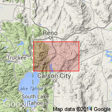
Pg. A17-19. Discussion of Steamboat Springs area, Washoe County, Nevada. Term Lousetown flows used interchangeably with Lousetown Formation.
Source: US geologic names lexicon (USGS Bull. 1350, p. 441-442).
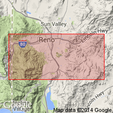
- Usage in publication:
-
- Lousetown formation
- Lousetown flows
- Modifications:
-
- Paleomagnetics
- Overview
- AAPG geologic province:
-
- Great Basin province
Summary:
Discussion of paleomagnetism of Plio-Pleistocene Lousetown formation, Virginia City, Nevada. In Virginia Range the Lousetown flows form two thick sections at Lousetown Creek and Clark Mountain. To west, in Carson Range and Truckee basin, the flows cover broad erosional surfaces and generally are single flows with limited areal extent. For most part the flows are flat lying or have several degrees of dip. Although the major Cenozoic deformation occurred before eruption of the Lousetown flows, the Lousetown formation has several hundred feet of structural relief. In Carson Range the Lousetown flows lie on post-mature erosion surface cut on Truckee and pre-Truckee formations. As Truckee formation is Pliocene in age, the Lousetown formation must be Pliocene or younger. As evidenced by degree of erosional dissection, the Carson Range flows are older than late Pleistocene. On basis of its magnetic direction alone this flow is tentatively correlated with the Clark Mountain flows. Clark Mountain flows cannot be definitely assigned to a given polarity epoch on the basis of available geologic controls. The Clark Mountain flows are overlain by Mustang andesite, which is considerably less eroded and deformed than Lousetown formation. Although considerable time appears to have elapsed, the time interval between the formations cannot be determined precisely. The Mustang andesite has a Brunhes normal polarity at Clark Mountain, and the Clark Mountain Lousetown flows appear to be either early Matuyama (approx. 2.4 [Ma]) or late Gilbert (approx. 3.4 [Ma]), depending on the magnitude of this time interval. In contrast to the relatively young ages of most of the Lousetown formation, flow 2 at Lousetown Creek has been dated at 6.8 [Ma]. Thus although the Lousetown flows are petrographically similar, the type section of the Lousetown formation is significantly older than the remainder of the Lousetown flows. Text also mentions Truckee basin flows and Lousetown Creek flows.
[GNC remark (ca. 1970, US geologic names lexicon, USGS Bull. 1350, p. 441-442): Inasmuch as this report does not follow the Stratigraphic Code relative to capitalization of formally named units, for example, Lousetown Formation, it is not possible to determine which, if any, of the flows mentioned the author intended should have formal status.]
[Note to me: Lousetown flows = Lousetown formation? Lousetown flows part of Lousetown formation? Heading for Lousetown (in US geologic names lexicon, USGS Bull. 1350, p. 441) is Lousetown flows in Lousetown Formation.]
Source: US geologic names lexicon (USGS Bull. 1350, p. 441-442).
For more information, please contact Nancy Stamm, Geologic Names Committee Secretary.
Asterisk (*) indicates published by U.S. Geological Survey authors.
"No current usage" (†) implies that a name has been abandoned or has fallen into disuse. Former usage and, if known, replacement name given in parentheses ( ).
Slash (/) indicates name conflicts with nomenclatural guidelines (CSN, 1933; ACSN, 1961, 1970; NACSN, 1983, 2005, 2021). May be explained within brackets ([ ]).

