

- Usage in publication:
-
- Lockatong series
- Modifications:
-
- Named
- Dominant lithology:
-
- Shale
- Argillite
- Limestone
- AAPG geologic province:
-
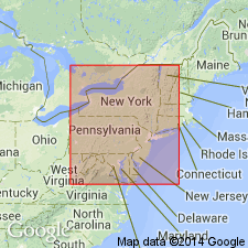
- Piedmont-Blue Ridge province
- Newark basin
Summary:
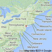
Hard, dark carbonaceous shale, massive black and purple argillite, gray and green flagstone, dark red shale, and thin limestone layers exposed along Lockatong Creek, Hunterdon Co., NJ, are here named the Lockatong series of the Newark system. It occurs in three belts in southwestern NJ, repeated by faulting. Ripple marks and mud cracks indicate shallow water deposits. Overlies the Stockton series; underlies the Brunswick series. Thickness is 3,600 ft (1,100 m). Age is Late Triassic.
Source: GNU records (USGS DDS-6; Reston GNULEX).
- Usage in publication:
-
- Lockatong formation*
- Modifications:
-
- Revised
- Areal extent
- AAPG geologic province:
-
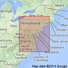
- Newark basin
- Piedmont-Blue Ridge province
Summary:
The classification of the Newark group, established in NJ, is here adopted by the USGS in PA. It comprises the Stockton formation, Lockatong formation, and Brunswick shale, which are approximately equivalent to the Norristown, Gwynedd, and Lansdale shales, respectively, which have not been found acceptable because of their indefinite application.
Source: GNU records (USGS DDS-6; Reston GNULEX).
- Usage in publication:
-
- Lockatong formation
- Modifications:
-
- Revised
- AAPG geologic province:
-
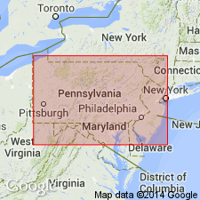
- Newark basin
Summary:
Alternating red and gray argillite members in the upper part of the Lockatong formation in the Tohickon Creek and Delaware River sections are named the first thin red, first big red, triple red, black shale A1, Smiths Corner red, black shale A2, double red, and black shale B members. The contact of the Lockatong with the overlying Brunswick is placed at the top of black shale B which marks the change from dominant gray to dominant red shale.
Source: GNU records (USGS DDS-6; Reston GNULEX).
- Usage in publication:
-
- Lockatong formation
- Modifications:
-
- Principal reference
- AAPG geologic province:
-
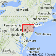
- Newark basin
Summary:
A composite type section of the Lockatong formation extends along both sides of the Delaware River from northwest of Lumberville and Raven Rock to Point Pleasant, Bucks Co., PA, and Hunterdon Co., NJ.
Source: GNU records (USGS DDS-6; Reston GNULEX).

- Usage in publication:
-
- Lockatong lithofacies
- Modifications:
-
- Revised
- AAPG geologic province:
-
- Newark basin
- Piedmont-Blue Ridge province
Summary:
The terms Stockton, Lockatong, and Brunswick lithofacies are used here because these units are intertonguing lithologic facies rather than distinct time stratigraphic units.
Source: GNU records (USGS DDS-6; Reston GNULEX).
- Usage in publication:
-
- Lockatong lithosome
- Modifications:
-
- Revised
- AAPG geologic province:
-
- Newark basin
- Piedmont-Blue Ridge province
Summary:
The Lockatong and Brunswick Formations are here designated lithosomes, intertonguing mutually exclusive lithostratigraphic bodies which can be repeated in a vertical succession of strata. Isolated outcrop units are thought to join downdip with their respective main bodies, or were once part of the main bodies.
Source: GNU records (USGS DDS-6; Reston GNULEX).
- Usage in publication:
-
- Lockatong Formation
- Modifications:
-
- Age modified
- Biostratigraphic dating
- AAPG geologic province:
-
- Newark basin
- Piedmont-Blue Ridge province
Summary:
The age of the Lockatong Formation is late Carnian, based on fossil fish.
Source: GNU records (USGS DDS-6; Reston GNULEX).
- Usage in publication:
-
- Lockatong Formation*
- Modifications:
-
- Revised
- AAPG geologic province:
-
- Newark basin
- Piedmont-Blue Ridge province
Summary:
Sedimentary detrital and chemical cycles in the Lockatong Formation are described. The Lockatong is tentatively divided into [informal] 100 m members exposed along the Delaware River in the Hunterdon Plateau fault block. These are named, in ascending order, the Hoboken, Weehawken, Gwynedd I, Gwynedd II, Byram, Skunk Hollow, and McLaughlin's (1944) first thin red, triple red, A1, A2, and B members.
Source: GNU records (USGS DDS-6; Reston GNULEX).
- Usage in publication:
-
- Lockatong Formation*
- Modifications:
-
- Overview
- AAPG geologic province:
-
- Newark basin
Summary:
The Lockatong Formation of the Newark Supergroup contains both chemical and detrital cycles. It interfingers laterally and gradationally and conformably overlies the Stockton Formation and wedges out between the Stockton and the Hammer Creek Formation to the west near the Schuylkill River. It gradationally interfingers with the overlying Passaic Formation.
Source: GNU records (USGS DDS-6; Reston GNULEX).
- Usage in publication:
-
- Lockatong Formation*
- Modifications:
-
- Areal extent
- AAPG geologic province:
-
- Newark basin
Summary:
The Lockatong Formation conformably overlies the Stockton Formation through most of the Newark basin in NJ and PA. Mapping in the northern part of the basin shows Stockton lithology both below and above the Lockatong and confirms that the Lockatong intertongues with the Stockton near their intrusion by the Palisade Diabase, and eventually pinches out northeast of Alpine, NJ. The Passaic Formation directly overlies the Stockton everywhere in the northern part of the Newark basin.
Source: GNU records (USGS DDS-6; Reston GNULEX).
- Usage in publication:
-
- Lockatong Formation
- Modifications:
-
- Areal extent
- Overview
- AAPG geologic province:
-
- Piedmont-Blue Ridge province
Summary:
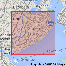
Lockatong Formation occurs in a wide belt across western Staten Island, NY, in the same orientation as the adjacent Palisades Diabase. Unit is a light gray, grayish black or grayish green shale.
Source: GNU records (USGS DDS-6; Reston GNULEX).
For more information, please contact Nancy Stamm, Geologic Names Committee Secretary.
Asterisk (*) indicates published by U.S. Geological Survey authors.
"No current usage" (†) implies that a name has been abandoned or has fallen into disuse. Former usage and, if known, replacement name given in parentheses ( ).
Slash (/) indicates name conflicts with nomenclatural guidelines (CSN, 1933; ACSN, 1961, 1970; NACSN, 1983, 2005, 2021). May be explained within brackets ([ ]).