

- Usage in publication:
-
- Idaho Group*
- Modifications:
-
- Revised
- AAPG geologic province:
-
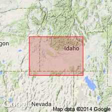
- Snake River basin
Summary:
Idaho Group. Rank raised in southwestern Idaho. Divided into 7 formations (in ascending order): Poison Creek Formation, Banbury Basalt, Chalk Hills Formation (new), Glenns Ferry Formation (new), Tuana Gravel (new), Bruneau Formation (new), and Black Mesa Gravel (new). Formations are nowhere exposed in a continuous sequence; typical exposures occur almost continuously along Snake River from Homedale to Hagerman. A composite section would be nearly 5,000 feet thick. Unconformably overlies Idavada Volcanics (new); underlies Snake River Group (revised). Age is early Pliocene to middle Pleistocene, based largely on fossils.
Source: Modified from GNU records (USGS DDS-6; Denver GNULEX).
- Usage in publication:
-
- Idaho Group*
- Modifications:
-
- Geochronologic dating
- AAPG geologic province:
-
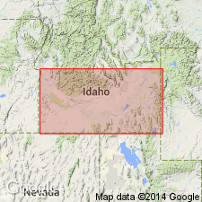
- Snake River basin
Summary:
Idaho Group, southern Idaho. Samples from Bruneau Formation, Glenns Ferry Formation, Chalk Hills Formation, Banbury Basalt, and Poison Creek Formation, yielded K-Ar ages between about 10.6 and 1.4 Ma; [North American land mammal ages Irvingtonian to Clarendonian (Evernden and others, 1964, Amer. Jour. Sci., v. 262, p. 145-198)]. Report includes sample locality map, schematic stratigraphic-chronologic diagram, table of K-Ar ages.
See also entries under individual formations.
Source: Modified from GNU records (USGS DDS-6; Denver GNULEX).
- Usage in publication:
-
- Idaho Group
- Modifications:
-
- Overview
- AAPG geologic province:
-
- Snake River basin
Summary:
Consists of four formations in study area, Owyhee Co, ID in Snake River basin: Poison Creek (base), Chalk Hills, Glenns Ferry, and Bruneau (top) Formations. Shoofly oolite named as informal, unranked unit that occurs as part of basal unit of Glenns Ferry along western margin of Snake River Plain. Fossil fish and mollusks indicate deposition in a fresh-water lake. Age given as Miocene and Pliocene.
Source: GNU records (USGS DDS-6; Denver GNULEX).
- Usage in publication:
-
- Idaho Group*
- Modifications:
-
- Areal extent
- AAPG geologic province:
-
- Snake River basin
Summary:
Deposits in three areas upstream from Bliss through Hagerman Valley to Melon Valley, ID, in Snake River basin, misidentified as Bruneau Formation of Idaho Group. Pleistocene Bruneau geographically restricted to area west of Bliss. Deposits at Bliss, and in the Hagerman and Melon Valleys, renamed Yahoo Clay of Pleistocene age and included as part of Snake River Group.
Source: GNU records (USGS DDS-6; Denver GNULEX).
- Usage in publication:
-
- Idaho Group*
- Modifications:
-
- Revised
- AAPG geologic province:
-
- Snake River basin
Summary:
Several unnamed basalts mapped along Snake River in Twin Falls and Jerome Cos, ID, Snake River basin, assigned to Idaho Group. Basalts are informally referred to as basalt member one (youngest) to seven and eleven to fourteen (oldest) (basalt member seven is older than member eleven and coeval with member twelve). Stratigraphic relationships of these basalts to other units within Idaho Group are uncertain; however, authors state that basalts are younger than Glenns Ferry Formation. Basalt flows placed in Idaho rather than Snake River Group because they have been faulted, whereas basalts of Snake River have not been faulted in study area. Basalts are believed to have filled tributary canyons entering ancestral Snake River from south. Basalt member one unconformably underlies Melon Gravel; basalt member fourteen is oldest unit mapped. Basalts assigned a Pleistocene? age.
Source: GNU records (USGS DDS-6; Denver GNULEX).
For more information, please contact Nancy Stamm, Geologic Names Committee Secretary.
Asterisk (*) indicates published by U.S. Geological Survey authors.
"No current usage" (†) implies that a name has been abandoned or has fallen into disuse. Former usage and, if known, replacement name given in parentheses ( ).
Slash (/) indicates name conflicts with nomenclatural guidelines (CSN, 1933; ACSN, 1961, 1970; NACSN, 1983, 2005, 2021). May be explained within brackets ([ ]).