

- Usage in publication:
-
- Glenns Ferry Formation*
- Modifications:
-
- Named
- Dominant lithology:
-
- Silt
- Sand
- Clay
- Shale
- AAPG geologic province:
-
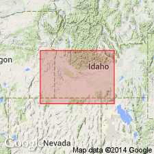
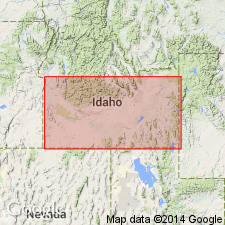
- Snake River basin
Summary:
Pg. 1199 (fig. 1), 1206-1209, pI. 1. Glenns Ferry Formation of Idaho Group. A collection of nonindurated, complexly intertonguing lake and stream deposits of great areal extent and thickness. Three principal facies recognized: lacustrine, fluviatile, and floodplain; facies rarely continuously exposed and many of their intertonguing relations are still poorly understood. Exposed thickness about 2,000 feet in type area. From type area formation is exposed continuously upstream as far as canyon wall west of Hagerman where it includes part of Hagerman Lake Beds as used by Stearns (1936). Near Glenns Ferry and Hagerman, overlies Banbury Basalt; from Bruneau River to Sinker Creek overlies Chalk Hills Formation (new); farther west overlies Poison Creek Formation. Underlies Tuana Gravel (new) with angular unconformity. South of Snake River, near Glenns Ferry, beds of Glenns Ferry and Bruneau (new) Formations are extensively beveled by erosion surface that terminates 550 feet above river level. This surface is covered by gravel herein named Black Mesa. Age is considered late Pliocene and early Pleistocene, based on fossils; fresh water mollusks interpreted as largely Pliocene and [vertebrates] as early Pleistocene, despite apparent intertonguing of sedimentary facies containing both. Report includes generalized geologic map, cross section, stratigraphic chart.
Type area: typical exposures begin 11 mi east of Glenns Ferry, Elmore Co., at junction of Hog Creek and Clover Creek and extend westward along canyon walls of Snake River to Indian Cove, 14 mi west of Glenns Ferry. Named from Glenns Ferry, Elmore Co., southwestern ID.
Source: US geologic names lexicon (USGS Bull. 1350, p. 292).
- Usage in publication:
-
- Glenns Ferry Formation*
- Modifications:
-
- Geochronologic dating
- AAPG geologic province:
-
- Snake River basin
Summary:
Glenns Ferry Formation of Idaho Group, southern Idaho. Most reliable K-Ar ages range from 4.4 to 6.2 Ma which are older than the Blancan dates reported by other workers. Report includes sample locality map, schematic stratigraphic-chronologic diagram, table of K-Ar ages.
Source: Modified from GNU records (USGS DDS-6; Denver GNULEX).
- Usage in publication:
-
- Glenns Ferry Formation
- Modifications:
-
- Overview
- AAPG geologic province:
-
- Snake River basin
Summary:
Is one of four formations making up Idaho Group in the study area, Owyhee Co, ID in Snake River basin. Unconformably overlies Chalk Hills Formation and underlies Bruneau Formation, both of Idaho Group. Shoofly oolite named as informal, unranked unit that occurs as part of basal unit of Glenns Ferry along western margin of Snake River Plain. Fossil fish and mollusks indicate deposition in a fresh-water lake. Age given as Pliocene.
Source: GNU records (USGS DDS-6; Denver GNULEX).
- Usage in publication:
-
- Glenns Ferry Formation
- Modifications:
-
- Not used
Summary:
Not used in study area in northeast Owyhee Co, ID, Snake River basin. Sediments above basalt units in north part of sheet 1 of mapped area that were mapped by Malde and others (1963) as Tuana Gravel and Glenns Ferry are here reassigned to undivided sediments of Pliocene or Pleistocene age. Sediments mapped by Malde and others (1963) as Tuana, Glenns Ferry and Chalk Hills Formation in northwest corner of sheet 1 of mapped area are here reassigned to sediments of the Hot Creek area of Miocene to Pleistocene age. Included in sediments of the Hot Creek area are all sediments between basalt of Hot Creek and basalt of Winter Camp Butte. In northeast and east parts of sheet 1 of mapped area, basalt here assigned to basalt of Winter Camp Butte was mapped by Malde and others (1963) as both basalt within Glenns Ferry and as Banbury Basalt. Because of uncertainty of age of basalts due to lack of radiometric age dates and because of confusion as to assignment of same basalt to both Glenns Ferry and Banbury, it is unrealistic to assign sediments and basalt to previously established stratigraphic units; authors have mapped these deposits as separate, informal units.
Source: GNU records (USGS DDS-6; Denver GNULEX).
For more information, please contact Nancy Stamm, Geologic Names Committee Secretary.
Asterisk (*) indicates published by U.S. Geological Survey authors.
"No current usage" (†) implies that a name has been abandoned or has fallen into disuse. Former usage and, if known, replacement name given in parentheses ( ).
Slash (/) indicates name conflicts with nomenclatural guidelines (CSN, 1933; ACSN, 1961, 1970; NACSN, 1983, 2005, 2021). May be explained within brackets ([ ]).