

- Usage in publication:
-
- Gartra grit member
- Modifications:
-
- Named
- Dominant lithology:
-
- Grit
- AAPG geologic province:
-
- Uinta basin
Summary:
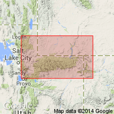
Named as basal member of Stanaker formation for Gartra Spring in sec 11, T2S, R21E, Uintah Co, UT in the Uinta basin. Type section measured north of Vernal from sec 7, T3S, R22E, northward to a gorge tributary to a gorge of Brush Creek near northwest corner of sec 32, T2S, R22E and west of Vernal-Manila Hwy. Recognized in measured sections at Manila on the north side of the Uintas and on the Weber River, on the Uinta uplift, and in Duchesne and Uintah Cos in the Uinta basin. Ranges from 26 ft thick on the Duchesne River to 93 ft thick at Split Mountain. Is composed of gray, poorly-sorted, massive, cross-bedded feldspathic quartz grit. Has sporadic quartz pebbles up to 1 in diameter at type, where it is 60 ft thick. Unconformably overlies Woodside shale in the eastern outcrops. Underlies upper part of Stanaker. Assigned to the Late Triassic.
Source: GNU records (USGS DDS-6; Denver GNULEX).
- Usage in publication:
-
- Gartra grit member*
- Modifications:
-
- Revised
- AAPG geologic province:
-
- Wasatch uplift
- Uinta uplift
Summary:
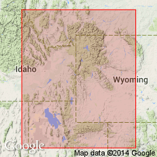
Removed from Stanaker formation and assigned to Ankareh formation as its middle member. Occurs in the central Wasatch Mountains and western Uinta Mountains of UT on the Wasatch and Uinta uplifts, respectively. Unconformably overlies Mahogany member of Ankareh. Underlies Stanaker member of Ankareh. Correlated (correlation chart) with Higham grit of southeast ID and Shinarump conglomerate of the eastern Uinta Mountains. Ranges between 26 to 93 ft thick. Cross sections. Of Late Triassic age.
Source: GNU records (USGS DDS-6; Denver GNULEX).
- Usage in publication:
-
- Gartra Member*
- Modifications:
-
- Revised
- Redescribed
- Dominant lithology:
-
- Sandstone
- Conglomerate
- AAPG geologic province:
-
- Uinta uplift
- Green River basin
- Eagle basin
Summary:
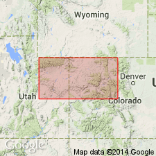
Removed from Stanaker Formation and placed in Chinle Formation as its basal member. Term Stanaker not used; term grit removed from formal name for Gartra. Composed of light-colored sandstone, conglomeratic sandstone, and some conglomerate. Sandstone is subangular to well-rounded quartz grains and granules of quartz, some feldspar, sparse chert, quartzite, matrix and cement are clay minerals, calcite, and locally silica. Gravels are subround to well-rounded pebbles and cobbles of quartz, chert, quartzite, feldspar, sandstone, limestone. Ranges from 1 to 3 inches in diameter. Thought to be younger than Shinarump and Moss Back Members of Chinle of central and southern UT. Decrease in grain size and westerly dip of cross strata indicate deposition by westerly flowing streams. Depositional limits in northern UT, Uinta basin and Uinta uplift, southwest WY in Greater Green River basin and northwest CO in Greater Green River, Piceance, and Eagle basins shown on map. As much as 100 ft thick. Unconformably overlies Maroon, Weber, or Moenkopi Formations depending on locality. Assigned to Late Triassic.
Source: GNU records (USGS DDS-6; Denver GNULEX).
- Usage in publication:
-
- Gartra Member
- Modifications:
-
- Revised
- AAPG geologic province:
-
- Uinta basin
- Uinta uplift
Summary:
Revised in that Gartra Member, the 10 to 90 ft thick basal member of the Chinle Formation, underlies a redbed sequence assigned as the Stanaker Member of the Chinle. Stanaker, as originally defined, included both the Gartra and Stanaker of this report. Report area concerns the eastern Uinta Mountain area of UT in the Uinta uplift and Uinta basin. Gartra unconformably overlies Moenkopi Formation and lies itself within a redbed sequence whose age limits are uncertain. Author suggests a tentative Late Triassic age. Nomenclature chart. Detailed description of lithology.
Source: GNU records (USGS DDS-6; Denver GNULEX).
For more information, please contact Nancy Stamm, Geologic Names Committee Secretary.
Asterisk (*) indicates published by U.S. Geological Survey authors.
"No current usage" (†) implies that a name has been abandoned or has fallen into disuse. Former usage and, if known, replacement name given in parentheses ( ).
Slash (/) indicates name conflicts with nomenclatural guidelines (CSN, 1933; ACSN, 1961, 1970; NACSN, 1983, 2005, 2021). May be explained within brackets ([ ]).