

- Usage in publication:
-
- Ely limestone
- Modifications:
-
- First used
- Dominant lithology:
-
- Limestone
- AAPG geologic province:
-
- Great Basin province
Summary:
First published use of name for about 1,500 feet of thick bedded, regularly stratified, cherty limestone. Intent to name, source of name, designation of a type locality not stated. Report area lies in White Pine Co., NV, Great Basin province. Forms bold cliffs. Weathers gray. Carboniferous fossil crinoids. Overlies White Pine shale. Underlies Arcturus formation (first used).
Source: GNU records (USGS DDS-6; Denver GNULEX).
- Usage in publication:
-
- Ely limestone*
- Modifications:
-
- Overview
- AAPG geologic province:
-
- Great Basin province
Summary:
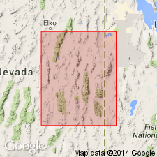
Name has been applied to lowest formation of Pennsylvanian age in the Ely district in the Egan Range of White Pine Co., NV in the Great Basin province. Mapped (geologic map) west and north of town of Ely. Forms castellated summits and slopes. Is 2,000 to 2,500? ft thick. Made up of gray to bluish, dense, massive limestone. Chert nodules. Some gray shale near base. Fossils (brachiopods, corals, fusulinids listed).
Source: GNU records (USGS DDS-6; Denver GNULEX).
- Usage in publication:
-
- Ely limestone*
- Modifications:
-
- Areal extent
- Overview
- AAPG geologic province:
-
- Great Basin province
Summary:
Present in 5 outcrop areas in Confusion Range, Millard Co., UT, Great Basin province --at Granite Mountain, on west side of range east of Foote Ranch, on west flank Desolation anticline, Conger Range, and Burbank Range. Is 1,850 to 2,000 ft thick in Confusion Range. Cross sections. Overlies Chainman shale; contact marked by break in slope (Chainman) to ledges of Ely. Overlain by Arcturus formation; contact marked at top of resistant limestone or dolomite (Ely) with slope-forming sandstone of Arcturus. Basal Ely has a gray coarse grained organic detrital limestone 5 to 40 ft thick capped by 10 ft red-weathering claystone with red and green limestone nodules; contains abundant corals up to 5 ft long. The overlying alternating beds are of resistant, gray limestone and slope-forming, slabby limestone. Organic detritus, fragments of echinoid spines and plates, brachiopod shells, crinoid columnals, calcareous mud pellets, forams, oolites. Siliceous limestone concretions as large as 6 ft long and 4 ft thick, some with laminations in middle part. Thin bedded chert and chert nodules abundant in lower 600-700 ft. Some dolomite beds locally. Late Mississippian fossils in lower part (15-60 ft thick) at Skunk Spring, Indian Pass, and at Foote Ranch. No Mississippian in northern Confusion Range. Pennsylvanian part (1,450-1,750 ft thick) mostly Atokan. Permian part (top 150-350 ft) Wolfcamp age. Fossils listed.
Source: GNU records (USGS DDS-6; Denver GNULEX).
- Usage in publication:
-
- Ely limestone
- Modifications:
-
- Contact revised
- AAPG geologic province:
-
- Great Basin province
Summary:
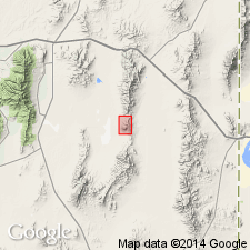
Upper contact revised in that Ely underlies the newly named Ferguson Mountain formation, a name that supercedes Ferguson Spring formation known only in an unpublished thesis (Steele, 1959). However, according to this author, the upper and lower contacts of the Ferguson Mountain and Ferguson Spring are not the same. Consists of gray, resistant, thick bedded limestone cliffs (5-40 ft thick) and gray slope-forming platy limestone. Organic detritus (bryozoan fragments, crinoid columnals) occur sporadically in both limestone types. Brown to black chert, bedded and nodular, common throughout Ely. Cyclic patterns of deposition. About 1411.4 ft thick. Fossils abundant in platy beds. Stratigraphic section in Ferguson Mountain shown graphically; upper 171 ft of Virgilian age assigned to Strathearn? equivalent on this figure (assigned to upper part of Ely in text). Fusulinid identifications allow assignment of Ely to the Morrowan, Derryan, Desmoinesian, Missouri, and Virgilian. An unconformity shown representing all of Missourian time on the correlation chart. A second unconformity shown on same chart at base of Ely that would represent Springer and late Chesterian. Deposited in a sea which fluctuated from open marine to shallow water marine. Mapped (geologic map) at 3 major localities on south and west sides of the Ferguson Mountains, T29 and 30N, R69E, Elko Co., NV in the Great Basin province.
Source: GNU records (USGS DDS-6; Denver GNULEX).
- Usage in publication:
-
- Ely limestone
- Modifications:
-
- Revised
- AAPG geologic province:
-
- Great Basin province
Summary:
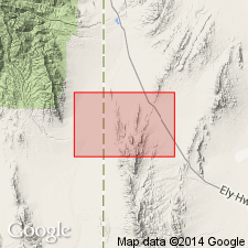
Pg. 93 (chart 1), 99-100, 101. Ely limestone. Pennebaker (1932) redefined Ely by placing upper contact at base of yellow and tan sand sequence, formerly assigned to Arcturus limestone, which he named Rib Hill formation (†Rib Hill herein abandoned); lower contact remained at top of Chainman. Ely is herein restricted to those limestones lying stratigraphically above Chainman shale or Scotty Wash quartzite, whichever is present, and below regional middle Pennsylvanian unconformity --that is, to the limestones described by Pennebaker as having abundant bedded and nodular chert. Because of nature of unconformity, overlying unit may be the South Ridge sandstone (new) [as in Butte Mountains of White Pine County, Nevada, or to north of South Ridge exposures], or that part of the Ely taken away from the unit as restricted in this paper. Upper 300 feet of massive coralline limestones without chert above the unconformity, and removed from Ely, is here named Riepe Spring limestone. Thickness of Ely (restricted) varies from 2,500 feet at type area to less than 500 feet at north end of Pequop Range. At reference section, herein designated, Ely overlies Scotty Wash quartzite (Illipah sandstone) and underlies Riepe Spring limestone. Disconformably underlies Ferguson Springs formation (new) at type locality of that unit. [Outcrops of Ely (restricted) distributed over area of 18,000 sq. mi. in White Pine, Elko, and Nye Counties, Nevada, and Juab and Millard Counties, Utah (Great Basin province); see areal extent map. Age is Pennsylvanian (Morrowan to middle Desmoinesian), based on fossils (fusulinids). Basal beds contain Morrowan fusulinids; upper beds are Atokan to middle Desmoinesian. Report includes correlation chart.]
Reference section: along U.S. Highway 50, between Illipah Creek and Moorman Ranch, in secs. 7 and 8, T. 17 N., R. 59 E., White Pine Co., NV. This is 30 mi west of type area.
Source: US geologic names lexicon (USGS Bull. 1200, p. 1254-1255); supplemental information (in brackets) modified from GNU records (USGS DDS-6; Denver GNULEX).
- Usage in publication:
-
- Ely Limestone
- Modifications:
-
- Contact revised
- AAPG geologic province:
-
- Great Basin province
Summary:
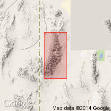
Upper contact of Ely revised in the central Pequop Mountains in that Ely unconformably underlies the newly named Hogan Formation of middle and late Desmoinesian age. Mapped (geologic map) in the central Pequop Mountains of Elko Co., NV, Great Basin province above the Diamond Peak Formation. Divisible
Source: GNU records (USGS DDS-6; Denver GNULEX).
- Usage in publication:
-
- Ely Limestone*
- Modifications:
-
- Mapped 1:24k
- Dominant lithology:
-
- Limestone
- Shale
- Dolomite
- Gypsum
- AAPG geologic province:
-
- Great Basin province
Summary:
Is Lower Permian, Pennsylvanian, and Upper Mississippian formation mapped as two units in the Mountain Home Range in western Millard Co, southwestern UT (Great Basin province). Overlies Chainman Formation (Mississippian). Overlain by Arcturus Formation (Lower Permian). Upper limestone described as cyclic, cherty, medium- to light-gray limestone that forms characteristic ledge-slope topography; ledges are 80% wackestone and packstones with less than 10% dolomite and mudstone interbeds; slopes are thin-bedded limestone, shale, dolomite, and gypsum; Ely in section 2, T 25 S, R 19 W has been described in detail by St. Aubins-Hietpas (1983) who lists 25 fusulinid genera that date this cherty Ely as Morrowan, Atokan, Desmoinesian, and Wolfcampian, and measured 775 m of Pennsylvanian and Permian Ely; the Desmoinesian-Wolfcampian unconformity is not marked by an obvious change in lithology here so that the Wolfcampian Ely, elsewhere called the Riepe Spring Limestone by stratigraphers (for example Bissel, 1964) was not recognized as a separate formation here; approximate position of base of the Wolfcampian part of the Ely Limestone is indicated on the map by a line marked -P -where large PSEUDOSCHWAGERINA are often conspicuous in strata. Lower limestone map unit described as limestone, medium to light gray on both fresh and weathered surfaces, forms ledge-slope topography; lacks chert; contains foraminifer ZELLERINA of Chesterian age (St. Aubins-Hietpas, 1983, fig. 7); thickness 60 m.
Source: GNU records (USGS DDS-6; Denver GNULEX).

- Usage in publication:
-
- Ely Limestone*
- Modifications:
-
- Mapped 1:24k
- Dominant lithology:
-
- Limestone
- Shale
- Dolomite
- Gypsum
- AAPG geologic province:
-
- Great Basin province
Summary:
Is Lower Permian, Pennsylvanian, and Upper Mississippian formation mapped as two units in central part of the Mountain Home Range in western Millard Co, southwestern UT (Great Basin province). Overlies Chainman Formation (Mississippian). Overlain by Arcturus Formation (Lower Permian). Usage of Ely follows that of Hose and Repenning (1959). Upper map unit (Wolfcampian, Desmoinesian, Atokan, and Morrowan) described as cyclically bedded, cherty, medium- to light-gray limestone that forms characteristic ledge-slope topography; ledges are 80% wackestone and packstones with less than 10% dolomite and mudstone interbeds; slopes are thin-bedded limestone, shale, dolomite, and gypsum; in adjacent Mormon Gap quadrangle to the north, St. Aubins-Hietpas (1983) measured 775 m of Ely Limestone that contains fusulinids considered to be Morrowan, Atokan, Desmoinesian, and Wolfcampian in age. Lower map unit (Chesterian) described as limestone, medium to light gray on both fresh and weathered surfaces, that forms ledge-slope topography; lacks chert; contains foraminifer ZELLERINA of Chesterian age (St. Aubins-Hietpas, 1983, fig. 7); thickness 60 m.
Source: GNU records (USGS DDS-6; Denver GNULEX).
- Usage in publication:
-
- Ely Limestone*
- Modifications:
-
- Mapped 1:50k
- Dominant lithology:
-
- Limestone
- AAPG geologic province:
-
- Great Basin province
Summary:
Mapped in southernmost part of study area in central Deep Creek Mountains, Juab Co, UT, Great Basin province. Consists of medium-gray, medium- to thick-bedded limestone having abundant fossils [not described] and orange chert, and minor thin fine-grained sandstone interbeds. Forms ledges. Exposed thickness is about 300 ft. Shown on correlation of map units as unconformably below Oligocene volcanic rocks; conformably overlies Mississippian Woodman Formation. Assigned Pennsylvanian age. [Basis of age not discussed, apparently following age assignments of workers in NV.]
Source: GNU records (USGS DDS-6; Denver GNULEX).
For more information, please contact Nancy Stamm, Geologic Names Committee Secretary.
Asterisk (*) indicates published by U.S. Geological Survey authors.
"No current usage" (†) implies that a name has been abandoned or has fallen into disuse. Former usage and, if known, replacement name given in parentheses ( ).
Slash (/) indicates name conflicts with nomenclatural guidelines (CSN, 1933; ACSN, 1961, 1970; NACSN, 1983, 2005, 2021). May be explained within brackets ([ ]).