

- Usage in publication:
-
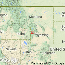
- Devils Basin Formation*
- Modifications:
-
- Named
- Dominant lithology:
-
- Sandstone
- Siltstone
- Claystone
- Coal
- AAPG geologic province:
-
- Yellowstone province
Summary:
Named for Devils Basin Creek, Sheridan Pass quad, Teton Co, WY. Rocks were mapped previously as Fort Union Formation or as greenish-gray and brown sandstone and shale sequence. Type section measured in secs 8 and 9, T41N, R110W, Teton Co. Covers an area of 25 sq mi on outcrop; probably present in at least 75 sq mi in subsurface. Is about 1,500 ft thick at type; is 600 ft thick on Cottonwood Creek and disappears 4 mi north of creek under Tripod thrust fault. Five mi south of type it is covered by younger strata. Has been removed locally by erosion. Geologic map. Composed of: gray, soft, lenticular, poorly bedded sandstone; gray and pale green, evenly bedded, siltstone and claystone; brown to black, thin-bedded, carbonaceous shale; thin (1-2 ft thick) coal beds. Overlies Pinyon Conglomerate (top picked at top of highest quartzite clast conglomerate; Pinyon probably intertongues with Devils basin). Pinyon and Devils Basin may intertongue. Underlies Wind River Formation conformably (base picked at top of prominent sandstone below soft gray carbonaceous shale of Wind River). Contains fossil leaves, freshwater clams, land snails, and vertebrates. Is same age as part of Fort Union Formation of Wind River and Bighorn basins and as lower part of Hoback Formation of Greater Green River basin. Is of middle Tiffanian, late Paleocene age.
Source: GNU records (USGS DDS-6; Denver GNULEX).
For more information, please contact Nancy Stamm, Geologic Names Committee Secretary.
Asterisk (*) indicates published by U.S. Geological Survey authors.
"No current usage" (†) implies that a name has been abandoned or has fallen into disuse. Former usage and, if known, replacement name given in parentheses ( ).
Slash (/) indicates name conflicts with nomenclatural guidelines (CSN, 1933; ACSN, 1961, 1970; NACSN, 1983, 2005, 2021). May be explained within brackets ([ ]).