

- Usage in publication:
-
- Danger Point tuff*
- Modifications:
-
- Named
- Dominant lithology:
-
- Tuff
- AAPG geologic province:
-
- Great Basin province
Summary:
Pg. M10. Danger Point tuff. Essentially glassy volcanic debris of andesitic to rhyolitic composition. Glass is largely altered to montmorillonite clay. Total thickness probably not more than 400 feet, of which less than half is exposed in scattered sections representing different parts. Underlies Jarbidge rhyolite. Rests unconformably on Paleozoic(?) metamorphic rocks, Dead Horse tuff, and Meadow Fork formation (new). Age is late(?) Miocene; lithologic resemblance and stratigraphic relationship with Jarbidge suggests units are approximately same age. Report includes geologic map. Adopted by the USGS.
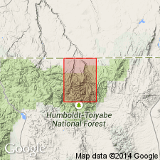
Type locality: Danger Point, a prominent ridge on east side of Coon Creek valley, in southwest part of Jarbidge quadrangle, Elko Co., northeastern NV. Named from Danger Point. Also exposed on eastern side of Copper Basin.
Source: US geologic names lexicon (USGS Bull. 1350, p. 192); supplemental information from GNU records (USGS DDS-6; Denver GNULEX).
For more information, please contact Nancy Stamm, Geologic Names Committee Secretary.
Asterisk (*) indicates published by U.S. Geological Survey authors.
"No current usage" (†) implies that a name has been abandoned or has fallen into disuse. Former usage and, if known, replacement name given in parentheses ( ).
Slash (/) indicates name conflicts with nomenclatural guidelines (CSN, 1933; ACSN, 1961, 1970; NACSN, 1983, 2005, 2021). May be explained within brackets ([ ]).