

- Usage in publication:
-
- Crowsnest Gravel*
- Modifications:
-
- Original reference
- Dominant lithology:
-
- Gravel
- AAPG geologic province:
-
- Snake River basin
Summary:
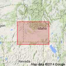
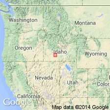
Pg. 1199 (fig. 1), 1215, pl. 1. Crowsnest Gravel of Snake River Group. Varies in lithology according to area of outcrop. Near Hagerman, consists mostly of pebbles derived from Idavada Volcanics (new) with lesser chert and quartzite. In Glenns Ferry-Grand View area, Elmore and Owhyee Counties, Idaho, composition closely resembles Sugar Bowl Gravel (new) though is more coarse-grained; consists of quartzite, porphyry, and granite cobbles. Thickness 25 to 50 feet at type locality where base is about 200 feet above Snake River. On the opposite (eastern) wall of canyon the Crowsnest overlies Thousand Springs Basalt and clay of Bruneau Formation (new). Older than Sand Springs Basalt. Probably deposited during runoff from glacial melt. Age is late Pleistocene. Report includes generalized geologic map, cross section, stratigraphic chart.
Type locality: typical exposures in gravel pits near lower end of Crowsnest Road [Crows Nest Road], which leads from highway, 4 mi south of Hagerman, Gooding Co., ID, to upland plains west of Snake River.
[Gravel pits (east-southeast of Hagerman Fossil Beds National Monument and southwest of Hagerman Wildlife Management Area) in sec. 2, T. 8 S., R. 13 E., approx. Lat. 42 deg. 45 min. 25 sec. N., Long. 114 deg. 53 min. 50 sec. W., Hagerman 7.5-min quadrangle, Twin Falls Co., southwestern ID (from USGS GNIS database, ACME Mapper 2.0, Montana State Univ. Graphical Locator, accessed April 2, 2010).]
Source: US geologic names lexicon (USGS Bull. 1350, p. 187); supplemental information from GNU records (USGS DDS-6; Denver GNULEX).
- Usage in publication:
-
- Crowsnest Gravel*
- Modifications:
-
- Revised
- AAPG geologic province:
-
- Snake River basin
Summary:
Pleistocene Crowsnest Gravel of Snake River Group in Snake River basin, formerly thought to overlie Thousand Springs Basalt and underlie Sand Springs Basalt, now considered to be a younger unit. Overlies Yahoo Clay (new name) and underlies Melon Gravel.
Source: GNU records (USGS DDS-6; Denver GNULEX).
For more information, please contact Nancy Stamm, Geologic Names Committee Secretary.
Asterisk (*) indicates published by U.S. Geological Survey authors.
"No current usage" (†) implies that a name has been abandoned or has fallen into disuse. Former usage and, if known, replacement name given in parentheses ( ).
Slash (/) indicates name conflicts with nomenclatural guidelines (CSN, 1933; ACSN, 1961, 1970; NACSN, 1983, 2005, 2021). May be explained within brackets ([ ]).