

- Usage in publication:
-
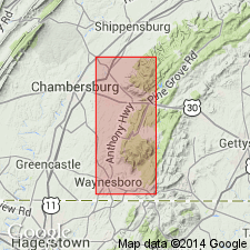
- Chambersburg limestone*
- Modifications:
-
- Named
- Dominant lithology:
-
- Limestone
- AAPG geologic province:
-
- Appalachian basin
Summary:
Named Chambersburg limestone for Chambersburg, Franklin Co., PA. Consists of dark crystalline limestone at base with shaly or argillaceous limestone in upper part. Upper part is fossiliferous containing Chazyan and Blackriveran faunas (as identified by E.O. Ulrich). Unit is more than 1000 feet thick. Overlies Stones River limestone and underlies Martinsburg group. The Chambersburg is of Middle Ordovician age.
Source: GNU records (USGS DDS-6; Reston GNULEX).
- Usage in publication:
-
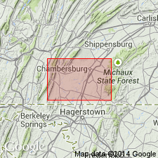
- Chambersburg limestone*
- Modifications:
-
- Overview
- AAPG geologic province:
-
- Appalachian basin
Summary:
The Chambersburg limestone is characterized by fossiliferous, thin-bedded limestones with argillaceous partings. Thickness varies along strike from a maximum of 750 feet in the Chambersburg belt to about 100 feet in McConnellsburg Cove. This folio contains abundant fossil information. The unit is thin-bedded, tough dark limestone, usually very fossiliferous, with irregular clayey partings giving rise to limestone "cobble" on weathering. Contains interbedded shale at top of formation in most places that forms a transition into the overlying Martinsburg.
Source: GNU records (USGS DDS-6; Reston GNULEX).

- Usage in publication:
-
- Chambersburg limestone*
- Modifications:
-
- Revised
- AAPG geologic province:
-
- Appalachian basin
Summary:
Pl. 27. Transferred to Martinsburg shale the shaly beds [0 to 245 feet thick] at top of Chambersburg limestone, thus including in the Martinsburg all beds of Trenton age. This modified definition was adopted by the USGS in 1927.
Source: US geologic names lexicon (USGS Bull. 896, p. 395).
- Usage in publication:
-
- Chambersburg limestone
- Modifications:
-
- Revised
- AAPG geologic province:
-
- Appalachian basin
Summary:
The Chambersburg limestone is revised to include only the part of the original Chambersburg overlying the Lowville equivalent. The thickness of the unit on Tumbling Run, 1-1/2 miles southwest of Strasburg, VA, is 563 feet. The Chambersburg overlies the Lenoir limestone and underlies the Martinsburg shale.
Source: GNU records (USGS DDS-6; Reston GNULEX).
- Usage in publication:
-
- Chambersburg limestone
- Modifications:
-
- Revised
- AAPG geologic province:
-
- Appalachian basin
Summary:
The Chambersburg is divided into three formations with type sections 2 miles southwest of Marion, PA; (ascending) Shippensburg formation (500 feet of dark gray limestone, cobbly below and even-bedded above), Mercersburg formation (150 feet of dark gray, thin irregular and thick even-bedded limestone with a siltstone and metabentonite at base), and Greencastle formation (63 feet of black, massive limestone with thin basal calcarenite).
Source: GNU records (USGS DDS-6; Reston GNULEX).
- Usage in publication:
-
- Chambersburg limestone
- Modifications:
-
- Revised
- AAPG geologic province:
-
- Appalachian basin
Summary:
A new classification is proposed for the lower Middle Ordovician. The Lincolnshire limestone includes lower beds of Chambersburg limestone as identified by Butts (1940). The Edinburg formation corresponds to a substantial part of the Chambersburg of PA. The Oranda formation corresponds to the "CHRISTIANIA" [BIMURIA] bed of the Chambersburg of southern PA.
Source: GNU records (USGS DDS-6; Reston GNULEX).
- Usage in publication:
-
- Chambersburg Limestone
- Modifications:
-
- Revised
- AAPG geologic province:
-
- Appalachian basin
Summary:
On the State geologic map of WV, the Trenton Group is described to include the upper part of the Chambersburg Limestone in northeastern WV.
Source: GNU records (USGS DDS-6; Reston GNULEX).
- Usage in publication:
-
- Chambersburg Formation
- Modifications:
-
- Overview
- AAPG geologic province:
-
- Appalachian basin
Summary:
In Franklin Co., PA, Chambersburg Formation consists of dark gray, cobbly limestone, argillaceous, with abundant irregular shaly partings. Some metabentonite beds are present. Unit has the characteristic of weathering to cobbles. This cobbly weathering is the result of wavy laminations or shaly partings that cross bedding at high angles. The Chambersburg is 750 feet thick.
Source: GNU records (USGS DDS-6; Reston GNULEX).
- Usage in publication:
-
- Chambersburg Limestone
- Modifications:
-
- Overview
- AAPG geologic province:
-
- Appalachian basin
Summary:
The Chambersburg Limestone is exposed in narrow bands on both sides of the Martinsburg Shale outcrop belt in the Conococheague Creek valley. Unit is composed of dark-gray, fine- to medium-grained, thin-bedded argillaceous limestones. Thickness is 100-225 feet. The Chambersburg is characterized by sinkholes west of Conococheague Creek.
Source: GNU records (USGS DDS-6; Reston GNULEX).
- Usage in publication:
-
- Chambersburg Formation
- Modifications:
-
- Overview
- AAPG geologic province:
-
- Appalachian basin
Summary:
The Chambersburg Formation in PA consists of dark-gray limestone at the top, gray argillaceous limestone in the middle, and dark-gray cobbly limestone at the base. Unit only occurs southwest of the Susquehanna River. Its maximum thickness is about 770 feet. A reference section has been designated along spur of railroad northwest of Kauffman, in eastern Franklin Co. The unit is well bedded and is characteristically thin to flaggy. It is moderately resistant and weathers to a moderate depth.
Source: GNU records (USGS DDS-6; Reston GNULEX).

- Usage in publication:
-
- Chambersburg Limestone*
- Modifications:
-
- Biostratigraphic dating
- AAPG geologic province:
-
- Appalachian basin
Summary:
Conodont biostratigraphy indicates that the Chambersburg Limestone in the Winchester 30 X 60 minute quadrangle is of Middle Ordovician (Blackriveran) age. Conodonts were recovered from the BALTONIODUS GERDAE Subzone of the AMORPHOGNATHUS TVAERENSIS Zone to a level above the B. GERDAE Subzone in the A. TVAERENSIS Zone.
Source: GNU records (USGS DDS-6; Reston GNULEX).
For more information, please contact Nancy Stamm, Geologic Names Committee Secretary.
Asterisk (*) indicates published by U.S. Geological Survey authors.
"No current usage" (†) implies that a name has been abandoned or has fallen into disuse. Former usage and, if known, replacement name given in parentheses ( ).
Slash (/) indicates name conflicts with nomenclatural guidelines (CSN, 1933; ACSN, 1961, 1970; NACSN, 1983, 2005, 2021). May be explained within brackets ([ ]).