

- Usage in publication:
-
- Cedar Mountain formation
- Modifications:
-
- Named
- Dominant lithology:
-
- Shale
- AAPG geologic province:
-
- Paradox basin
Summary:
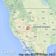
Named for exposures at southwest flank of Cedar Mountain, Emery Co, UT in Paradox basin. These are "the type section and locality." Is composed of variegated shale. Basal contact with Burro Canyon conglomerate is sharp. Upper contact with Dakota? sandstone is gradational to sharp. Most exposures covered with weathered-out concretions and nodules. Scattered dinosaur remains found. Thins eastward. Is 272 ft thick at type. Is 10 ft thick on Little Snake River in CO. Of Early Cretaceous age.
Source: GNU records (USGS DDS-6; Denver GNULEX).
- Usage in publication:
-
- Cedar Mountain formation
- Modifications:
-
- Overview
- Areal extent
- Revised
- AAPG geologic province:
-
- Paradox basin
- Uinta basin
- Piceance basin
Summary:
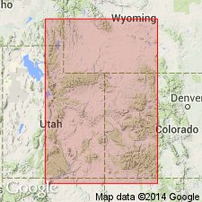
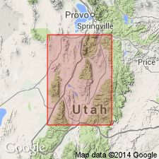
Term Cedar Mountain formation used west of Colorado River in east-central UT and northwest CO in Uinta, Piceance, and Paradox basins. Basal contact revised to include the underlying conglomerate previously called Buckhorn conglomerate. Buckhorn reduced in stratigraphic rank to member. A section measured at Buckhorn Reservoir in sec 9, T18S, R10E showed the Buckhorn as 30 ft thick. The member is discontinuous in distribution and is generally too thin to map. Is generally equivalent to Burro Canyon formation. The two formations are in physical continuity near Dewey, Grand Co, UT. Assigned an Early Cretaceous age. Fossil fish scales, freshwater ostracods, pelecypods, and plants found. Is a nonmarine unit.
Source: GNU records (USGS DDS-6; Denver GNULEX).
- Usage in publication:
-
- Cedar Mountain formation
- Modifications:
-
- Areal extent
- AAPG geologic province:
-
- Paradox basin
- Piceance basin
Summary:
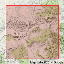
Pg. 17-21. Cedar Mountain formation of Dakota group. Described in Grand Junction area, Colorado, where it disconformably underlies Naturita formation (new). Consists of basal conglomeratic sandstone unit and overlying variegated mudstone unit. In most localities, basal sandstone is massive cliff-forming unit with undulatory base and sharply defined upper surface. Farther west in Utah, three such sandstones, separated by mudstone units, are present in formation. These sandstones are termed Lower, Middle, and Upper Cedar Mountain sandstones. Lower, which is probably equivalent to Stokes' Buckhorn is present in deeper scours in Grand Junction area and is directly overlain in these scours by Middle sandstone. Where Lower sandstone is absent, the Middle sandstone constitutes the basal sandstone. Where only Middle sandstone is present basal unit averages about 25 feet thick, but where both sandstones are present it may be as much as 80 feet thick. Mudstone unit averages about 35 feet in Grand Junction area but slightly thicker along western edge. Included in Dakota group. [Age is Early Cretaceous.]
Source: US geologic names lexicon (USGS Bull. 1200, p. 689-690).
- Usage in publication:
-
- Cedar Mountain Formation*
- Modifications:
-
- Areal extent
- AAPG geologic province:
-
- Green River basin
Summary:
Mapped in northern part of quad in Moffat Co, CO in the Greater Green River basin, thus extending the name farther east and north than in many earlier reports. Divided into: Buckhorn Conglomerate Member, adopted at base for a 0-80 ft thick sandstone and conglomerate; and the shale member, a 95 ft thick grayish-green and grayish-red soft, clayey shale interbedded with greenish-gray nodular limestone of fresh-water origin, and some gray medium-grained sandstone. Unconformably overlies Morrison Formation. Unconformably underlies Dakota Sandstone. Of Early Cretaceous age (columnar section).
Source: GNU records (USGS DDS-6; Denver GNULEX).
- Usage in publication:
-
- Cedar Mountain Formation*
- Modifications:
-
- Mapped 1:24k (Moffat Co, CO)
- Dominant lithology:
-
- Shale
- Mudstone
- Conglomerate
- Grit
- Sandstone
- Limestone
- AAPG geologic province:
-
- Green River basin
Summary:
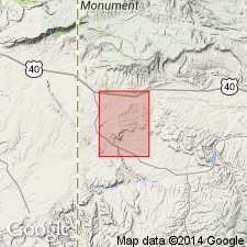
Is Lower Cretaceous formation mapped in southwest Moffat Co, CO (Greater Green River basin). Unconformably overlies Morrison Formation (Upper Jurassic); unconformably underlies Dakota Sandstone (Lower Cretaceous). Contains two members: an upper shale member of soft purple, gray, and greenish-gray shale, mudstone, and minor limestone; and the lower Buckhorn Conglomerate Member of resistant medium-gray, light-gray, and tan medium-bedded, cross-bedded sandy pebble conglomerate, grit, pebbly sandstone, and fine- to coarse-grained sandstone. Overlying shale member rarely exposed. As much as 50 percent by volume of the clasts in the Buckhorn Conglomerate Member consist of gray to black chert. Correlation and usage after Anderman (1961), Cullins (1969), and Hansen (1969a). Unit correlated with the Burro Canyon(?) Formation in the Skull Creek area 15 km (9 mi) east of the mapped area (Cadigan, 1972). Formation about 32 m (105 ft) thick--equally divided between the shale member and the Buckhorn Member--on Buckwater Ridge northwest of Gadd Cabin, but is estimated to be as much as 60 m (200 ft) thick elsewhere in the mapped area.
Source: GNU records (USGS DDS-6; Denver GNULEX).
- Usage in publication:
-
- Cedar Mountain Formation*
- Modifications:
-
- Overview
- AAPG geologic province:
-
- Paradox basin
Summary:
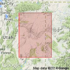
Is a stream deposit recognized west of the Colorado River in the Paradox basin. Divided into Buckhorn Conglomerate Member at base, a lenticular, yellow-gray, scour-fill sandstone with some granule cobble conglomerate and an upper shale member at top, a pastel-colored claystone and mudstone with a few yellow-gray, locally light gray, scour-fill, fine-grained limestone beds at top of member. Overlies Brushy Basin Member of Morrison Formation. Underlies Dakota Sandstone. Equivalent to Burro Canyon Formation east of Colorado River. Of late or latest Early (post-mid-) Albian age determined from palynomorphs found near top of formation.
Source: GNU records (USGS DDS-6; Denver GNULEX).
- Usage in publication:
-
- Cedar Mountain Formation
- Modifications:
-
- Age modified
Summary:
Fission-track data give an age of 105.7 +/-7.1 m.y. for bentonites directly below Buckhorn Conglomerate Member of Cedar Mountain Formation; an age of 134.7 +/-5.5 m.y. 15 m below Buckhorn; an age of 133.8 +/-9.3 m.y. 25 m below Buckhorn; and 134.3 +/-6.7 m.y. 30 m below Buckhorn [suggesting that the Upper Jurassic-Lower Cretaceous boundary is within, rather than at the top of, Morrison Formation].
Source: GNU records (USGS DDS-6; Denver GNULEX).
- Usage in publication:
-
- Cedar Mountain Formation*
- Modifications:
-
- Areal extent
- Biostratigraphic dating
- AAPG geologic province:
-
- Paradox basin
- Uinta basin
- Piceance basin
Summary:
Divided into a thin basal conglomeratic sandstone, Buckhorn Conglomerate Member, and the upper shale member. Most believe the Cedar Mountain and Burro Canyon Formations are physically continuous. Authors place an arbitrary limit for the two formations with Burro Canyon being used east of Colorado River and Cedar Mountain west of Colorado River (Areal distribution map shows Cedar Mountain in eastern UT in the Paradox and Uinta basins, and in northwest CO in the Piceance basin). Can also be distinguished from Burro Canyon by presence of swelling clays, abundance of limestone nodules that cover the weathered slopes, and by its coloration (pastel purple, red, and green). Palynomorph collection near top of late or latest Albian age, younger than the palynomorphs at the top of the Burro Canyon. Difference in age between these two formations may be due to erosion of some of the upper Burro Canyon. Faunal listings. Graphic sections.
Source: GNU records (USGS DDS-6; Denver GNULEX).
- Usage in publication:
-
- Cedar Mountain Formation*
- Modifications:
-
- Areal extent
- AAPG geologic province:
-
- Wasatch uplift
Summary:
Extended into Sanpete-Sevier Valley area, Sanpete and Sevier Cos, UT, Wasatch uplift. Replaces in part rocks previously assigned to Morrison? of Spieker (1946). Spieker's Morrison? can be divided into upper and lower units. The lower unit is here assigned to Cedar Mountain. The upper unit, consisting of coarse conglomerate, is either a newly recognized lithologic unit at top of Cedar Mountain, a conglomeratic facies of the overlying Indianola Group, or part Cedar Mountain and part Indianola. Unequivocal Morrison Formation is thought to pinchout west of San Rafael Swell, whereas upper unit of this report pinches out east of Sanpete-Sevier Valley area; both pinchouts are hidden beneath Wasatch Plateau. Unconformably overlies Twist Gulch Formation. (Twist Gulch appears to grade into Cedar Mountain, thus Twist Gulch, though dated as Middle Jurassic, may extend into Late Jurassic. However, as there is no fossil evidence to support younger age, a hiatus is shown between Twist Gulch and Cedar Mountain on stratigraphic chart). Plant microfossils from upper unit indicate an Early Cretaceous age; no palynomorphs from lower unit are diagnostic of an Early Cretaceous age. Measured section; fossil list; history-of-usage chart.
Source: GNU records (USGS DDS-6; Denver GNULEX).
- Usage in publication:
-
- Cedar Mountain Formation
- Modifications:
-
- Areal extent
- AAPG geologic province:
-
- Great Basin province
- Wasatch uplift
Summary:
Some rocks formerly assigned by various authors to the Morrison? Formation, to the Morrison? Formation and Indianola Group, or to Cedar Mountain and Indianola Group are named Pigeon Creek Formation. The new name will be used on the Wasatch and Gunnison Plateaus of central UT, in eastern Juab Co (Great Basin province), and from Thistle on north to Salina on south (Wasatch uplift). Pigeon Creek unconformably overlies Jurassic Twist Gulch Formation, unconformably underlies Indianola Group, and is of Neocomian, Aptian and Albian ages. Stratigraphic figures.
Source: GNU records (USGS DDS-6; Denver GNULEX).
- Usage in publication:
-
- Cedar Mountain Formation
- Modifications:
-
- Areal extent
- Overview
- AAPG geologic province:
-
- Wasatch uplift
Summary:
Cedar Mountain and an overlying new unnamed basal unit of the Indianola Group (revised) replaces use of Morrison or Morrison? Formation of earlier workers for rocks along west side of Gunnison Reservoir and extending southwestward for about 5 mi to U.S. Highway 89, Sanpete Co, UT, Wasatch uplift. Cedar Mountain overlies Twist Gulch Formation (nature of contact is uncertain). Schwans (same volume, p. 531-556) assigns these same rocks (Morrison?) to his newly named Pigeon Creek Formation. Lower part of Pigeon Creek is "coextensive" with Cedar Mountain of this paper and upper part of Pigeon Creek grades southeastward by facies change and intertonguing into new unnamed basal unit of Indianola Group of this paper. Map (fig. 1) shows larger outcrop areas of Cedar Mountain from Cedar Hills on the north to Gunnison on the south. Stratigraphic column. Tables 1 and 2 are condensed stratigraphic sections at and south of Radio Tower Valley; thicknesses of the partly exposed Cedar Mountain are 93.5 m and 133.5 m, respectively. Shown as Early Cretaceous (Barremian to Albian) age on column, though author states that Cedar Mountain is probably late Albian age.
Source: GNU records (USGS DDS-6; Denver GNULEX).
- Usage in publication:
-
- Cedar Mountain Formation
- Modifications:
-
- Geochronologic dating
- Areal extent
- AAPG geologic province:
-
- Wasatch uplift
Summary:
A 1,000 ft thick sequence of interbedded conglomerate, sandstone, and bentonitic mudstone exposed in lower Salina Canyon, Sevier Co, UT on the Wasatch uplift, is reassigned from the Morrison or Morrison? Formation to the Cedar Mountain Formation. The sequence unconformably overlies the Twist Gulch Formation and gradationally underlies Indianola Group. Five bentonitic mudstone samples from the central part of the sequence using zircons by the fission track method yielded dates ranging from 103 +/-8 to 85 +/-5 Ma. Three samples with apatite yielded ages of 105 +/-10 to 95 +/-6 Ma. The mean for zircon is 92 +/-5 Ma and for apatite is 96 +/-9 Ma. An Albian age suggested. A major unconformity separates Twist Gulch from Cedar Mountain. Morrison Formation probably pinches out beneath the Wasatch plateau.
Source: GNU records (USGS DDS-6; Denver GNULEX).
- Usage in publication:
-
- Cedar Mountain Formation*
- Modifications:
-
- Age modified
- AAPG geologic province:
-
- Uinta basin
- Paradox basin
- Piceance basin
Summary:
Unconformably or disconformably overlies Morrison Formation throughout most of the report area. Underlies Dakota Sandstone; contact varies from gradational to unconformable to intertonguing. Is generally 200 to 300 ft thick but increases in thickness to more than 1,000 ft west of Farnham dome in Carbon Co, UT, Uinta basin. Present on north side of basin and on south side from Emery Co (Paradox basin) to Rangely area, Rio Blanco Co, CO, in the Piceance basin. Basal conglomerate, the Buckhorn Conglomerate Member, is easily recognized on west side of basin, but is missing locally on east side of basin. Age modified; is Aptian and Albian on north side of basin, and Aptian, Albian, and early Cenomanian? on the south and east sides of the basin. Early Cenomanian? age assignment determined by its intertonguing relationship with the Dakota Sandstone which in turn intertongues with the Mowry Shale. (The age of the Mowry has been changed to early Cenomanian? because its fossil NEOGASTROPLITES is now considered to be Cenomanian). Cross sections. Stratigraphic chart.
Source: GNU records (USGS DDS-6; Denver GNULEX).
For more information, please contact Nancy Stamm, Geologic Names Committee Secretary.
Asterisk (*) indicates published by U.S. Geological Survey authors.
"No current usage" (†) implies that a name has been abandoned or has fallen into disuse. Former usage and, if known, replacement name given in parentheses ( ).
Slash (/) indicates name conflicts with nomenclatural guidelines (CSN, 1933; ACSN, 1961, 1970; NACSN, 1983, 2005, 2021). May be explained within brackets ([ ]).