

- Usage in publication:
-
- Bull Canyon Formation
- Modifications:
-
- Overview
- AAPG geologic province:
-
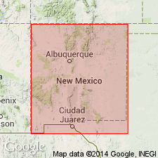
- Palo Duro basin
Summary:
Three premaxillary teeth of a small herbivorous dinosaur REVUELTOSAURUS CALLENDERI found in Quay Co, NM, Palo Duro basin in the Bull Canyon Formation.
Source: GNU records (USGS DDS-6; Denver GNULEX).

- Usage in publication:
-
- Bull Canyon Formation
- Modifications:
-
- Named
- Dominant lithology:
-
- Mudstone
- Sandstone
- AAPG geologic province:
-
- Palo Duro basin
Summary:
Name applied to a unit formerly designated upper shale member of Chinle Formation in earlier reports. Named for Bull Canyon, a long north-south canyon in eastern Guadalupe Co, NM. Type section is near canyon mouth in sec 10, T9N, R26E, Guadalupe Co, NM in the Palo Duro basin where it is 95 m thick. Consists mostly of mudstone (80 percent), some sandstone (16 percent), and trace amounts of siltstone and conglomerate. Overlies Trujillo Formation (a name that replaces Cuervo Member of Chinle). Conformably underlies Redonda Formation. Lower contact at type measured section is a gray-red silty mudstone (Bull Canyon) over a pale green gray quartzose sandstone (Trujillo). Upper contact is a pale red silty mudstone with green mottles (Bull Canyon) below gray red sandstone and siltstone (Redonda). At the Bull Canyon type: 1) mudstone is gray red to red brown, calcareous to noncalcareous, some mottling; 2) sandstone varies from well to poorly sorted, well rounded to subangular; it may be micaceous, quartzose, massive to bioturbated, very fine to coarse grained, olive gray to gray red, calcareous to noncalcareous, silty; 3) conglomerate has siltstone clasts and petrified wood. Large vertebrate fauna (listed), invertebrates, microfossils, plant fossils. Nomenclature chart, columnar section. Assigned a Late Triassic age.
Source: GNU records (USGS DDS-6; Denver GNULEX).
- Usage in publication:
-
- Bull Canyon Formation
- Modifications:
-
- Areal extent
- AAPG geologic province:
-
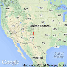
- Las Vegas-Raton basin
- Palo Duro basin
Summary:
Can be recognized as far north as Naranjos, Mora Co, NM in the Las Vegas-Raton basin. Ranges between 14.9 and 29.6 m thick south of Naranjos. Presence north of Naranjos cannot be established. It might be represented in mudstones near base of Johnson Gap Formation, but it was more likely pinched out or eroded prior to deposition of Johnson Gap. The unit called lower member of Chinle Formation at La Cueva by Baltz and O'Neill (1984) is the Bull Canyon. Identified in measured sections at San Sebastian Canyon, San Miguel Co in Palo Duro Co and north at La Cueva and at Naranjos, Mora Co in the Las Vegas-Raton basin. Overlies Trujillo Formation; underlies Redonda Formation. Of Late Triassic, Norian age.
Source: GNU records (USGS DDS-6; Denver GNULEX).
For more information, please contact Nancy Stamm, Geologic Names Committee Secretary.
Asterisk (*) indicates published by U.S. Geological Survey authors.
"No current usage" (†) implies that a name has been abandoned or has fallen into disuse. Former usage and, if known, replacement name given in parentheses ( ).
Slash (/) indicates name conflicts with nomenclatural guidelines (CSN, 1933; ACSN, 1961, 1970; NACSN, 1983, 2005, 2021). May be explained within brackets ([ ]).