

- Usage in publication:
-
- Bruneau Formation*
- Modifications:
-
- Named
- Dominant lithology:
-
- Clay
- Silt
- Diatomite
- Sand
- Basalt
- AAPG geologic province:
-
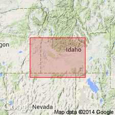
- Snake River basin
Summary:
Pg. 1199 (fig. 1), 1210-1212, pI. 1. Bruneau Formation of Idaho Group. Characterized by lake and stream deposits and basaltic lava flows. Sedimentary deposits mainly laminated tan clay and massive silt layers 50+ feet with thinner beds of diatomite and fine sand. Widespread layers, up to 25 feet thick, of iron-stained, well-sorted pebble gravel are intercalated with finer material. Volcanics consist of lava flows and pyroclastic debris of olivine basalt derived from several sources. In places basalt is columnar, has pillow structures or is characterized by dense texture, inflated vesicles and abundant microphenocrysts of plagioclase. Locally, volcanics are interbedded with sedimentary deposits. Thickest sections lie close to present course of Snake River and outline ancient canyon fill about 800 feet thick. Sedimentary deposits of canyon fill are exposed from type area upstream to Hagerman and downstream to vicinity of Murphy. Basaltic material of the Bruneau forms canyon fill more than 1,000 feet thick near mouth of Sinker Creek east of Murphy and a fill 500 feet at Crane Falls on Snake River north of Bruneau. Basaltic flows also mantle plateau from Nampa to Glenns Ferry north of Snake River. In canyon walls west of Hagerman the Bruneau lies against steep former canyon wall eroded in Glenns Ferry Formation (new) and in overlying Tuana Gravel (new). At Bruneau, the formation similarly lies against steep slope eroded in the Glenns Ferry and in overlying pediment gravel. Not in actual contact with Tuana Gravel but relations show that the Bruneau is stratigraphically younger. Underlies Black Mesa Gravel (new). Age is middle Pleistocene, based on fossils (mammals, mollusks) and stratigraphic position. Report includes generalized geologic map, cross section, stratigraphic chart.
Type locality: typical exposures begin east of mouth of Bruneau River about 9 mi northwest of Bruneau and extend southeastward to pediment gravel 6 mi southeast of Bruneau. Named from exposures near town of Bruneau, Owyhee Co., southwestern ID. Named from town of Bruneau.
Source: US geologic names lexicon (USGS Bull. 1350, p. 96); GNU records (USGS DDS-6; Denver GNULEX).
- Usage in publication:
-
- Bruneau Formation*
- Modifications:
-
- Geochronologic dating
- AAPG geologic province:
-
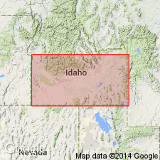
- Snake River basin
Summary:
Pg. 239. Bruneau Formation of Idaho Group. Lake and stream deposits and basaltic flows (many named) in western Snake River Plain, southern Idaho. Average reliable K-Ar age 1.41 Ma (whole-rock), most accurate is 1.35 +/-0.07 Ma from Deadman Canyon lava flow; Irvingtonian North American land mammal age, early to middle Pleistocene (Evernden and others, 1964, Amer. Jour. Sci., v. 262, p. 145-198). Report includes sample locality map, schematic stratigraphic-chronologic diagram, table of K-Ar ages.
Source: Publication.
- Usage in publication:
-
- Bruneau Formation*
- Modifications:
-
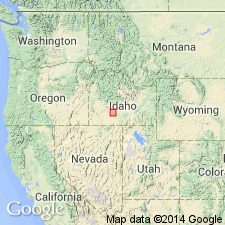
- Areal extent
- AAPG geologic province:
-
- Snake River basin
Summary:
Deposits in three areas upstream from Bliss through Hagerman Valley to Melon Valley, ID, in Snake River basin, misidentified as Bruneau Formation of Idaho Group. Pleistocene Bruneau geographically restricted to area west of Bliss. Deposits at Bliss, and in the Hagerman and Melon Valleys, named Yahoo Clay and included as part of Snake River Group.
Source: GNU records (USGS DDS-6; Denver GNULEX).
- Usage in publication:
-
- Bruneau Formation*
- Modifications:
-
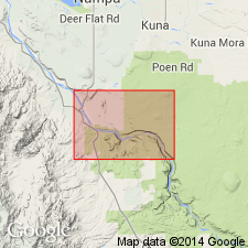
- Areal extent
- AAPG geologic province:
-
- Snake River basin
Summary:
Detailed mapping extends unit into portions of Canyon, Ada, Elmore and Owyhee Cos, ID, Snake River basin. [See adjoining quadrangles in U.S. Geological Survey Miscellaneous Field Studies Maps MF-2063-B, MF-2063-C, MF-2063-D, and MF-2063-E.] Divided into up to four canyon fill deposits each consisting of various deposits including basalts, gravel shore deposits and lake bed deposits. Unconformably overlies Glenns Ferry Formation; underlies basalts or Melon Gravel of Snake River Group. Pleistocene age.
Source: GNU records (USGS DDS-6; Denver GNULEX).
For more information, please contact Nancy Stamm, Geologic Names Committee Secretary.
Asterisk (*) indicates published by U.S. Geological Survey authors.
"No current usage" (†) implies that a name has been abandoned or has fallen into disuse. Former usage and, if known, replacement name given in parentheses ( ).
Slash (/) indicates name conflicts with nomenclatural guidelines (CSN, 1933; ACSN, 1961, 1970; NACSN, 1983, 2005, 2021). May be explained within brackets ([ ]).