

- Usage in publication:
-
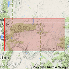
- Bishop Mountain conglomerate*
- Modifications:
-
- Original reference
- Dominant lithology:
-
- Conglomerate
- AAPG geologic province:
-
- Green River basin
Summary:
Pg. 40, 44, 62, 169. Bishop Mountain conglomerate. Composed of bowlders and pebbles of sandstone, quartzite, and crystalline schists, but sandstones and quasi quartzites greatly prevail. Found only in isolated patches as remnants adventitiously preserved from general erosion to which this widely spread formation has been subjected. Thickness 300 feet [on p. 40, but on p. 170 he says 1,000 feet at head of Sheep Creek]. Can be seen on summit of Bishop Mountain, where it lies unconformably on eroded beds of Bitter Creek group. A fine exposure can also be seen on summit of Queen Hornet Mountain, where it rests on Lower Green River beds. On north side of Sage Creek it unconformably overlies beds of Lower Green River age. [In columnar section on p. 40 he shows this conglomerate unconformably on Brown's Park group, but in text he does not say that it anywhere rests on Brown's Park, although on p. 62 he says: The Bishop Mountain conglomerate is found at different places to lie unconformably upon every group of the table which is represented in Uinta Mountains and adjacent country.]
[GNC remark (ca. 1930, GNC index card files): Type locality = Bishop Mountain, Sweetwater Co., southwestern WY, which is now known as Pine Mountain. See map in USGS Bull. 702, in which Pine Mountain is shown and another mountain is wrongly called Bishop Mountain by Schultz, according to W.H. Bradley. (See also Powell's Uinta Atlas map, which shows Bishop Mountain in Wyoming N. of 41 deg. And just E. of 109 deg.)
GNC remark (May 27, 2010): Pine Mountain, just north of WY-CO State bdry, approx. Lat. 41 deg. 02 min. N., Long. 108 deg. 59 min. 20 sec. W., Sweetwater Co., WY.]
Source: US geologic names lexicon (USGS Bull. 896, p. 194); supplemental information from GNC index card files.
- Usage in publication:
-
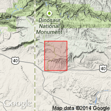
- Bishop Conglomerate*
- Modifications:
-
- Mapped 1:24k (Moffat Co, CO)
- Dominant lithology:
-
- Conglomerate
- Sandstone
- AAPG geologic province:
-
- Green River basin
Summary:
Is Oligocene formation mapped along northern part of map area in southwest Moffat Co, CO (Greater Green River basin). Unconformably overlies various Mesozoic formations; is youngest formal bedrock unit mapped in quadrangle. Map unit described as poorly consolidated light-gray, tan, or white thin-bedded poorly sorted medium-grained fluvial sandstone and interbedded poorly sorted pebble, cobble, and boulder fluvial conglomerate. Locally tuffaceous. Boulders as much as 1 m (3 ft) long in conglomerate consist largely of red sandstone derived from the Uinta Mountain Group (Precambrian Y) and to a lesser extent of light- to medium gray limestone derived from Paleozoic rock units. Unit fills a broad valley cut on Mesozoic rocks. Unit in large part overlain by tan sandy Quaternary deposits, mostly derived from erosion of the Glen Canyon Sandstone. Unit might be correlated with the Browns Park Formation (Miocene), but its high present elevation near the crest of this part of the Uinta Mountains, and its lithology suggest that it is better assigned to the Bishop Conglomerate. The age of the Bishop Conglomerate is problematical, but based on K-Ar ages of tuff beds exposed in the unit elsewhere in the eastern Uinta Mountains (G. R. Winkler, written commun., 1969), it is generally considered to be Oligocene. Thickness probably as much as 50 m (150 ft).
Source: GNU records (USGS DDS-6; Denver GNULEX).
- Usage in publication:
-
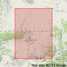
- Bishop Conglomerate*
- Modifications:
-
- Overview
- AAPG geologic province:
-
- Green River basin
- Uinta basin
- Uinta uplift
Summary:
Remnants of Bishop are present on both flanks of the Uinta Mountains, Uinta basin, Uinta uplift, and Greater Green River basin, but remnants are more extensive on south flank of mountains. A few remnants found in Greater Green River basin 50-80 km north of Uintas. Consists of loosely cemented bouldery, cobbly conglomerate and coarse, poorly sorted, pebbly, friable sandstone. Clasts of Red Creek Quartzite, Mississippian Madison Limestone, and Pennsylvanian Round Valley Limestone, and some reworked Eocene found in Bishop. Deposited during a time of protected crustal stability. Probably formed a continuous bajada around north, south, and east flanks of Uintas. Direction of drainage reversed after Bishop time. Bishop deposition was from south; Browns Park deposition was from north. Reversal caused by tilting. Tuff (at several horizons) yielded K-Ar ages on biotite and hornblende of 29 m.y. Deposition ended when tilting and faulting changed the hydrologic regime and initiated dissection. Oligocene age assigned.
Source: GNU records (USGS DDS-6; Denver GNULEX).
- Usage in publication:
-
- Bishop Conglomerate*
- Modifications:
-
- Areal extent
- AAPG geologic province:
-
- Uinta basin
- Piceance basin
Summary:
Some conglomerates mapped by earlier workers as Bishop Conglomerate are mapped as Starr Flat Member of Duchesne River Formation in this report. Doesn't seem to be any significant difference in lithology and age between the Starr Flat and Bishop. Bishop mapped along north side from eastern Duchesne into Uintah Co, UT, Uinta basin, and eastward into Moffat Co, CO, Piceance basin. Mapped as a cap on flat-topped, southward-protruding shoulders of the Uinta Mountains that seldom form outcrops because it is weakly cemented and commonly covered by well-developed soil. Oligocene age.
Source: GNU records (USGS DDS-6; Denver GNULEX).
For more information, please contact Nancy Stamm, Geologic Names Committee Secretary.
Asterisk (*) indicates published by U.S. Geological Survey authors.
"No current usage" (†) implies that a name has been abandoned or has fallen into disuse. Former usage and, if known, replacement name given in parentheses ( ).
Slash (/) indicates name conflicts with nomenclatural guidelines (CSN, 1933; ACSN, 1961, 1970; NACSN, 1983, 2005, 2021). May be explained within brackets ([ ]).