

- Usage in publication:
-
- Atwater member
- Modifications:
-
- Original reference
- Dominant lithology:
-
- Silt
- Clay
- Ash
- AAPG geologic province:
-
- Anadarko basin
Summary:
Pg. 55 (fig. 1), 58. Atwater member of Crooked Creek formation of Meade group. Named and described as consisting of sandy silty, silt, silty clay, and clay which contains Pearlette ash lentil, when present; massive caliche generally present at top of member. Thickness about 50 feet. Overlies Stump Arroyo sand and gravel member of Crooked Creek; unconformably underlies Kingsdown formation of Sanborn group. Fossils (Borchers local fauna, Cudahy fauna). Age is Pleistocene (Kansan and Yarmouthian).
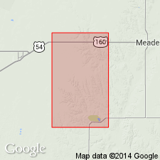
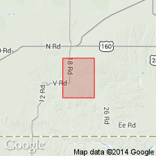
Type section: on east side of Crooked Creek, in N/2 sec. 21, T. 33 S., R. 28 W., Meade Co., southwestern KS. Named from old Atwater P.O. [in Meade Co.].
Source: Publication; US geologic names lexicon (USGS Bull. 1200, p. 169).
- Usage in publication:
-
- Atwater Silt Member
- Modifications:
-
- Age modified
- Biostratigraphic dating
- AAPG geologic province:
-
- Anadarko basin
Zakrzewski, R.J., 1975, Pleistocene stratigraphy and paleontology in western Kansas; The state of the art, 1974: University of Michigan, Museum of Paleontology Papers on Paleontology, no. 12., Claude W. Hibbard Memorial Volume, no. 3
Summary:
Pg. 122 (fig. 1), 124 (fig. 2), 125 (fig. 3). Atwater Silt Member of Crooked Creek Formation. Includes Borchers ash, = Pearlette type B ash bed [Huckleberry Ridge ash bed]. Lies below Pearlette type O ash bed [Lava Creek B ash bed] and above Stump Arroyo Gravel Member of Crooked Creek Formation. Fossils (Borchers fauna). Age is Pliocene (Blancan NALMA); Plio-Pleistocene boundary placed at base of Irvingtonian NALMA (base of Nebraskan-Aftonian), = 1.8 Ma.
Source: Publication.
- Usage in publication:
-
- Atwater Member*
- Modifications:
-
- Not used
- AAPG geologic province:
-
- Anadarko basin
Summary:
Strata of the type Atwater Member of Crooked Creek Formation (Hibbard, 1958) are included in the lower part of upper unnamed member of Crooked Creek Formation.
[Type Atwater located along western edge of quadrangle, at approx. Lat. 37 deg. 10 min.; includes Borchers fauna and Huckleberry Ridge ash beds.]
Source: Publication.
- Usage in publication:
-
- Atwater Member*
- Modifications:
-
- Revised
- AAPG geologic province:
-
- Anadarko basin
Martin, R.A., Honey, J.G., and Pelaez-Camponanes, Pablo, 2000, The Meade basin [Kansas] rodent project; a progress report: Paludicola, v. 3, no. 1, p. 1-32.
Summary:
Atwater Member of Crooked Creek Formation is retained. Replaces unnamed upper member of Izett and Honey (1995); =Atwater Member + overlying unnamed Kansan and Yarmouth (Irvingtonian NALMA) deposits of Zakrzewski (1975). Overlies Pliocene Stump Arroyo Member of Crooked Creek. Underlies unnamed Pleistocene (Rancholabrean NALMA) and Recent deposits (= Kingsdown and Vanhem formations of Hibbard and Taylor, 1960, and Zakrzewski, 1975). Age is Pliocene and Pleistocene (Blancan and Irvingtonian NALMA), based on isotopic dating and fossils. [Plio-Pleistocene boundary placed at 1.8 Ma; = Blancan-Irvingtonian boundary.]
Contains, descending:
Lava Creek B ash bed (0.67 +/-0.01 Ma, Irvingtonian) at top;
Cudahy and Arklan local faunas (Irvingtonian);
Cerro Toledo B ash bed (1.47 to 1.23 Ma, Irvingtonian);
Aries B, Rick Forrester, and Aries A (= original Aries quarry of Izett and Honey, 1995) local faunas (Irvingtonian);
Nash local fauna (Irvingtonian) [approx. Blancan-Irvingtonian boundary; considered Aftonian (early to middle Irvingtonian) by Eshelman and Hibbard (Univ. Michigan Mus. Paleo. Contrib., v. 25, no. 16, p. 317-326, 1981), and early Irvingtonian by Izett and Honey, 1995];
Borchers local fauna (late Blancan);
Huckleberry Ridge ash bed (2.10 +/-0.02 Ma, late Blancan); and
Margaret 1 fauna (Blancan) at base.
Source: Publication.
For more information, please contact Nancy Stamm, Geologic Names Committee Secretary.
Asterisk (*) indicates published by U.S. Geological Survey authors.
"No current usage" (†) implies that a name has been abandoned or has fallen into disuse. Former usage and, if known, replacement name given in parentheses ( ).
Slash (/) indicates name conflicts with nomenclatural guidelines (CSN, 1933; ACSN, 1961, 1970; NACSN, 1983, 2005, 2021). May be explained within brackets ([ ]).