

- Usage in publication:
-
- Ajibik quartzite*
- Modifications:
-
- Original reference
- Dominant lithology:
-
- Quartzite
- AAPG geologic province:
-
- Lake Superior region
Summary:
Pg. 549+. Ajibik quartzite in Lower Marquette series. Has two main areas: a western one in which it rests upon Archean, and an eastern one in which it rests on Wewe slate. Where it rests on Archean the basal part is a conglomerate or recomposed rock, the material of which is derived mainly from immediately subjacent formation. These basal conglomerates, slates, and graywackes quickly grade up into quartzite. Where the Ajibik rests on Wewe slate there is usually an intermediate phase or interstratification of the two. In one exceptional locality (in sec. 6, T. 47 N., R. 25 W.) the basal member of the quartzite is a conglomerate interstratified with slate, the fragments of the conglomerate being mainly from Wewe slate. Central part of formation in its ordinary phases is a rather pure, typical, vitreous quartzite. In some places this quartzite becomes conglomeratic and bears small pebbles of white quartz or red jasper. In other places it is interstratified with belts of mica slate or graywacke. Thickness of formation 700 to 900 feet; estimates difficult due to complicated folding. Conformably underlies Siamo slate. Age is Precambrian (middle Huronian). Report includes geologic map.
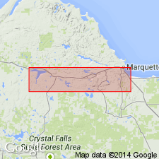
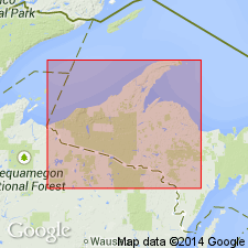
Typical exposures on Ajibik Hills, northeast of Palmer, Marquette district, [Marquette Co.], Northern Peninsula, northwestern MI.
Source: US geologic names lexicon (USGS Bull. 896, p. 20); supplemental information from GNU records (USGS DDS-6; Denver GNULEX).
- Usage in publication:
-
- Ajibik quartzite*
- Modifications:
-
- Areal extent
- AAPG geologic province:
-
- Wisconsin arch
Summary:
Pg. 1436 (table 1), 1461. Palmer gneiss, previously considered pre-Huronian, consists of metamorphic Mesnard quartzite, Kona dolomite, Wewe slate, and Ajibik quartzite. Table 1 shows middle Huronian sequence in Marquette area (ascending): Ajibik quartzite, Siamo slate, and Negaunee iron-formation.
Source: US geologic names lexicon (USGS Bull. 1200, p. 33).
- Usage in publication:
-
- Ajibik quartzite*
- Modifications:
-
- Areal extent
- AAPG geologic province:
-
- Wisconsin arch
Summary:
Pg. 11 (table 3). Ajibik quartzite. Thickness 700 to 900 feet in Marquette district. Underlies Siamo slate. Overlies Wewe slate; unconformity. Age is Precambrian (middle Huronian).
Source: US geologic names lexicon (USGS Bull. 1200, p. 33).
- Usage in publication:
-
- Ajibik Quartzite*
- Modifications:
-
- Age modified
- AAPG geologic province:
-
- Lake Superior region
- Wisconsin arch
Summary:
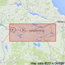
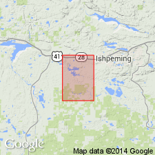
Pg. 47-48. Ajibik Quartzite. Placed in the Menominee Group of the Animikie series. Present in Marquette and Sands 7.5-min quadrangles, Marquette County, northwestern Michigan. Is similar to Mesnard Quartzite of Chocolay Group in most places. Described as a thick- to thin-bedded, white-weathering to light-pink, vitreous quartzite; thin slate interbeds are seen in a few places. Thickness approximately 650 feet. At base of formation, in SE/4 sec. 6, T. 47 N., R. 25 W., a 1 to 2 feet thick bed of conglomerate containing angular fragments of Wewe Slate, and some rounded pebbles and small cobbles of quartzite or vein quartz, rests on Wewe Slate with little or no angular discordance. Boundary between the conglomerate and the Wewe is irregular with about 6 inches of relief, indicating some erosion of Wewe prior to deposition of the Ajibik. This erosional interval probably corresponds to the hiatus between Palms Quartzite and Bad River Dolomite in the Gogebic Range, and to the inferred interval between Felch Formation and Randville Dolomite in Dickinson County. Hence Ajibik is considered equivalent to the Palms and to lower part of Felch, and is early middle Animikie age (middle Precambrian). Basal conglomerate of Ajibik believed to be result of mild disturbance and of slight uplift of the Wewe to sea level or a little higher between Wewe and Ajibik times. Report includes geologic maps, correlation chart.
Source: Publication; Changes in stratigraphic nomenclature, 1968 (USGS Bull. 1294-A, p. A2).
- Usage in publication:
-
- Ajibik Quartzite*
- Modifications:
-
- Overview
- AAPG geologic province:
-
- Lake Superior region
Summary:
Pg. 2845 (fig. 2, stratigraphic chart compiled from Leith and others, 1935; James, 1958; Gair and Thaden, 1968). Ajibik Quartzite of Menominee Group of Marquette Range Supergroup. Present in Marquette Range, northwestern Michigan. Unconformably or disconformably overlies Wewe Slate of Chocolay Group; underlies Siamo Slate of Menominee Group. Age is middle Precambrian. (Marquette Range Supergroup, new, replaces †Animikie series of James, 1958, south of Lake Superior, in Michigan and Wisconsin.)
Source: Publication.
- Usage in publication:
-
- Ajibik Quartzite*
- Modifications:
-
- Areal extent
- AAPG geologic province:
-
- Lake Superior region
Summary:
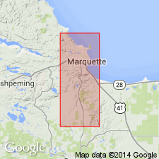
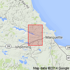
Ajibik Quartzite of Menominee Group of Marquette Range Supergroup. Mapped together with overlying Siamo Slate, also of Menominee Group, in Marquette County, Michigan. Combined map unit described. Very poorly exposed units ranging from vitreous quartzite to slate or schist. By analogy with nearby areas of more complete exposure, quartzite is probably most abundant near base and slate or schist more abundant in higher parts of section. Quartzite is thick-bedded (6 inches to 1 foot) and is largely 0.1 to 0.2 mm quartz grains, some with preserved clastic outlines. Also contains smaller amounts of muscovite, biotite and garnet, and thin seams rich in magnetite. Sphene and carbonate are accessory minerals. Argillaceous units vary from quartz-chlorite-biotite slate (low metamorphic grade) to quartz-biotite-garnet schist (higher grade). In fault contact with Precambrian W rocks; grades up into the Negaunee Iron-formation through a zone rich in grunerite and magnetite. Combined thickness is 200 to 400 feet. Age is Precambrian X.
Source: Modified from GNU records (USGS DDS-6; Denver GNULEX).
- Usage in publication:
-
- Ajibik Quartzite*
- Modifications:
-
- Areal extent
- Dominant lithology:
-
- Quartzite
- Slate
- Graywacke
- AAPG geologic province:
-
- Lake Superior region
Summary:
Ajibik Quartzite, basal formation of Menominee Group of Marquette Range Supergroup. Mapped in southern part of Negaunee quadrangle, Marquette County, Michigan. Described as gray to white vitreous quartzite with sericitic slate and graywacke near base. Locally iron-stained pink to purple. Ripple marks and crossbeds common. Marker bed containing pink chert granules near base. Thickness averages 150 feet. Contacts are not well exposed. Appears to be abruptly overlain by Siamo Slate of Menominee Group; unconformably overlies Wewe Slate. Near Teal Lake, overlaps older formations. Tracing the unique granule marker bed proves that the Ajibik cuts the Mesnard Quartzite and Kona Dolomite and possibly the Wewe Slate; evidence is inconclusive regarding whether or not the Ajibik is the western equivalent of the Mesnard, Kona, and Wewe. Age is middle Precambrian.
Source: Modified from GNU records (USGS DDS-6; Denver GNULEX).
For more information, please contact Nancy Stamm, Geologic Names Committee Secretary.
Asterisk (*) indicates published by U.S. Geological Survey authors.
"No current usage" (†) implies that a name has been abandoned or has fallen into disuse. Former usage and, if known, replacement name given in parentheses ( ).
Slash (/) indicates name conflicts with nomenclatural guidelines (CSN, 1933; ACSN, 1961, 1970; NACSN, 1983, 2005, 2021). May be explained within brackets ([ ]).