The National Geologic Map Database is migrating to a new infrastructure. We apologize for any service disruptions during this process.
|
|---|


- Usage in publication:
-
- Prospect Mountain quartzite*
- Modifications:
-
- Named
- Dominant lithology:
-
- Quartzite
- Conglomerate
- Shale
- AAPG geologic province:
-
- Great Basin province
Summary:
Named for Prospect Peak, Eureka district, NV, where it reaches its broadest development and forms western slope. Consists of bedded brownish-white quartzites weathering dark brown. At base beds composed of conglomerates and brecciated masses firmly cemented together with ferruginous material. Interstratified are occasional bands of fine-grained arenaceous and micaceous shales. Beds are whiter near upper part of unit. Thickness is 1500 ft. Is oldest sedimentary rock exposed in Eureka district. Directly overlain by Prospect Mountain limestone [name now replaced by Eldorado limestone]. Stratigraphic section shows Cambrian age.
Source: GNU records (USGS DDS-6; Menlo GNULEX).
- Usage in publication:
-
- Prospect Mountain formation*
- Modifications:
-
- Areal extent
- Dominant lithology:
-
- Sandstone
- AAPG geologic province:
-
- Great Basin province
Summary:
Named for exposures at Prospect Peak, Eureka district, Eureka Co, NV in the Great Basin province; extended into House Range of UT. Is a gray to brown quartzitic sandstone. Is 1,500 ft thick at Prospect Peak; is estimated to be 1,200 ft thick on western face House Range, Millard Co, UT. Underlies Pioche formation (new). Has annelid and trilobite tracks. Assigned to the Early Cambrian.
Source: GNU records (USGS DDS-6; Denver GNULEX).
- Usage in publication:
-
- Prospect Mountain quartzite*
- Modifications:
-
- Revised
- Areal extent
- AAPG geologic province:
-
- Great Basin province
Summary:
Underlies the newly named Cabin shale in the Gold Hill quad, Tooele Co, UT in the Great Basin province. The massively bedded quartzite of the Eureka, NV area is present eastward. In report area, the formation also includes several shale beds in upper part, has several lenticular conglomerate beds. Several dark micaceous shales interbedded with quartzite present at base. No fossils found. Of Early Cambrian age.
Source: GNU records (USGS DDS-6; Denver GNULEX).

- Usage in publication:
-
- Prospect Mountain quartzite
- Modifications:
-
- Areal extent
- AAPG geologic province:
-
- Great Basin province
Summary:
Pg. 1139-1140, 1141 (fig. 5), 1142, 1156-1158. Prospect Mountain quartzite. In House Range area, Utah, underlies Pioche shale. Thickness about 1,000 feet. In Highland Range, Nevada, underlies Pioche shale; thickness about 450 feet. [Age is Early Cambrian.]
Source: US geologic names lexicon (USGS Bull. 1200, p. 3142).
- Usage in publication:
-
- Prospect Mountain quartzite*
- Modifications:
-
- Areal extent
- AAPG geologic province:
-
- Great Basin province
Summary:
Mapped in Ivanpah 1 deg by 1 deg quad, CA and NV where, together with Noonday dolomite and Pioche shale, it makes up what is termed western facies of the Cambrian. Is well exposed and underlies large areas in broad belt that extends from Clark Mountains 30 mi northwest to hills that lie 10 mi north of Kingston Range, San Bernardino and Inyo Cos, CA. Age is Early Cambrian.
Source: GNU records (USGS DDS-6; Menlo GNULEX).
- Usage in publication:
-
- Prospect Mountain quartzite*
- Modifications:
-
- Areal extent
- AAPG geologic province:
-
- Great Basin province
Summary:
Described in vicinity of Eureka, NV, where total outcrop is about 0.5 sq mi. Forms discontinuous hook-shaped band that extends northward from west slope of Prospect Peak to south of Ruby Hill and then swings southward along east side of ridge nearly to Eureka Tunnel; discontinuity due in part to transgression of outcrop band by Spring Valley fault. Total thickness unknown as base not exposed. Conformable below Pioche shale.
Source: GNU records (USGS DDS-6; Menlo GNULEX).
- Usage in publication:
-
- Prospect Mountain quartzite*
- Modifications:
-
- Areal extent
- AAPG geologic province:
-
- Great Basin province
Summary:
Unit geographically extended to northern Shoshone Range, NV. Shown in stratigraphic section.
Source: GNU records (USGS DDS-6; Menlo GNULEX).
- Usage in publication:
-
- Prospect Mountain quartzite
- Modifications:
-
- Revised
- AAPG geologic province:
-
- Great Basin province
Summary:
Formerly included about 6,000 ft of rocks that conformably overlie Precambrian metamorphic rocks and underlie the Pirche shale. Restricted in this report in the Deep Creek Mountains of Juab and Tooele Cos, UT Great Basin province to only the upper massive quartzites that are 3,000 ft thick. The lower 3,000 ft of quartzite (and some interbedded shale) is reassigned to the newly named Goshute Canyon formation. Precambrian in age.
Source: GNU records (USGS DDS-6; Denver GNULEX).
- Usage in publication:
-
- Prospect Mountain quartzite*
- Modifications:
-
- Areal extent
- AAPG geologic province:
-
- Great Basin province
Summary:
Is lowest stratigraphic unit exposed in Drum Mountains, west-central UT where underlies Cabin shale. Consists of thick sequence of white, pink, or gray medium- to coarse-grained cross-bedded quartzite, interbedded with shale, pebbly quartzite, and a little conglomerate. Stratigraphic section shows age as Early Cambrian with notation that "lower part may include beds of Precambrian age". Base is not exposed. Thickness is estimated to be as much as 9000 ft.
Source: GNU records (USGS DDS-6; Menlo GNULEX).
- Usage in publication:
-
- Prospect Mountain Quartzite
- Modifications:
-
- Revised
- AAPG geologic province:
-
- Great Basin region
Summary:
Is restricted to about 2200 to 2300 ft of gray to brown quartzite disconformably? above the Stella Lake Quartzite and beneath the Pioche Shale. Stella Lake is named as the upper unit and one of six units removed from the Prospect Mountain Quartzite and reassigned to the McCoy Creek Group (new). Is a brown-weathering quartzite easily separated from the white, massive quartzite of the Stella Lake. A 2 ft thick fine quartz-pebble conglomerate succeeded by 1) a few inches of argillite, and 2) gray, rusty-brown weathering quartzite in beds 1 ft or less to 3 ft thick, that are cross-bedded. A 50-60 ft. thick brown, micaceous, fucoidal, slabby argillaceous siltstone and fine-grained quartzitic sandstone that is in turn overlain by 40 ft of white quartzite makes up the upper part of the Prospect Mountain. Geologic map; mapped in the eastern northwestern part of the southern Snake Range, White Pine Co, NV in the Great Basin region. Of late Precambrian age.
Source: GNU records (USGS DDS-6; Menlo GNULEX).
- Usage in publication:
-
- Prospect Mountain quartzite*
- Modifications:
-
- Areal extent
- AAPG geologic province:
-
- Great Basin province
Summary:
Prospect Mountain quartzite is extended to the Snake Range, White Pine Co, NV, where two subunits are recognized: upper and lower sandy quartzite, middle argillite and sandy argillite. Unit is mapped as Cambrian, but explanation states that argillite and lower quartzite subunits may be Precambrian in age.
Source: GNU records (USGS DDS-6; Menlo GNULEX).
- Usage in publication:
-
- Prospect Mountain Quartzite*
- Modifications:
-
- Areal extent
- AAPG geologic province:
-
- Great Basin province
Summary:
Prospect Mountain Quartzite is geographically extended to the Pioche mining district, Lincoln Co, NV. In nearly all respects the quartzite at Pioche resembles closely that of the type area, and in both districts these strata conformably underlie Lower Cambrian strata containing OLENELLUS [trilobite]. Partial section (no base present) measured at about 2400 ft. Trace fossils (SCOLITHUS [SKOLITHOS]) present in upper part of formation. Age is shown as Early Cambrian. Columnar sections and correlation diagram included.
Source: GNU records (USGS DDS-6; Menlo GNULEX).
- Usage in publication:
-
- Prospect Mountain quartzite*
- Modifications:
-
- Areal extent
- Overview
- AAPG geologic province:
-
- Great Basin province
Summary:
Mapped in Dugway Range, Tooele Co, UT and in several small knolls to the northeast of the Thomas Range, Juab Co, UT in the Great Basin province. Mapped area lies between Oquirrh Range, UT to northeast where Gilluly (1932) mapped it and Drum Mountains, UT to southwest where Crittenden, Straczek, Roberts (1961) mapped it. Is the most widespread Cambrian unit in this part of Great Basin. Composed of white or tan massive quartzite and purplish-red quartzite, quartz pebble conglomerate, shale, and siltstone. Nearly 12,000 ft thick. Sequence varies from one fault block to another. Underlies Cabin shale. No diagnostic fossils found. Correlation with rocks of Precambrian age elsewhere not possible. Authors believe greater part of Prospect Mountain in Dugway Range is only Early Cambrian. Geologic map. Stratigraphic sections.
Source: GNU records (USGS DDS-6; Denver GNULEX).
- Usage in publication:
-
- Prospect Mountain Quartzite*
- Modifications:
-
- Areal extent
- AAPG geologic province:
-
- Great Basin province
Summary:
Strata in Desert Range, Lincoln Co, NV, mapped as Prospect Mountain Quartzite by Tschanz and Pampeyan (1961) are here recognized as geographic extensions of Stirling Quartzite, Wood Canyon Formation, Zabriskie Quartzite, and Carrara Formation.
Source: GNU records (USGS DDS-6; Menlo GNULEX).
- Usage in publication:
-
- Prospect Mountain Quartzite*
- Modifications:
-
- Areal extent
- AAPG geologic province:
-
- Great Basin province
Summary:
Mapped on south trending ridge that culminates on Green Mountain, Ruby Mountains, Jiggs 15' quad, Elko Co, NV. Described as generally thick-bedded, cross-stratified quartzite characterized by shale partings between beds. Two mi to east and outside Jiggs quad basal 300 ft of unit consists of thick beds of quartzite-pebble conglomerate, cross-stratified quartzite, and arkosic sandstone which disconformably overlies sillimanite-staurolite-biotite-muscovite schists. Age shown as Cambrian.
Source: GNU records (USGS DDS-6; Menlo GNULEX).
- Usage in publication:
-
- Prospect Mountain Quartzite*
- Modifications:
-
- Areal extent
- AAPG geologic province:
-
- Great Basin province
Summary:
Use of same Prospect Mountain Quartzite is restricted from Providence Mountains, Kingston Range, and Clark Mountain areas in favor of Johnnie Formation, Stirling Quartzite, Wood Canyon Formation, and Zabriskie Quartzite.
Source: GNU records (USGS DDS-6; Menlo GNULEX).
- Usage in publication:
-
- Prospect Mountain Quartzite*
- Modifications:
-
- Age modified
- AAPG geologic province:
-
- Great Basin province
Summary:
Occurs in four general areas: (1) Groom and Papoose Ranges along west edge of Lincoln Co, NV; (2) in Desert Range; (3) in Highland, Bristol, and Ely Ranges, on Chief Mountain, and in Delamar and Pennsylvania districts, all in east-central part of county; and (4) in southern Creek Range and Patterson Pass district at north edge of Lincoln Co. In Desert Range area, mapped with Sterling Quartzite and Wood Canyon Formation. Age is considered partly Cambrian and partly Precambrian on basis of regional stratigraphic correlations.
Source: GNU records (USGS DDS-6; Menlo GNULEX).
- Usage in publication:
-
- Prospect Mountain Quartzite*
- Modifications:
-
- Areal extent
- AAPG geologic province:
-
- Great Basin province
Summary:
Prospect Mountain Quartzite. Recognized in Beaver Mountains, Utah, where it overlies seven numbered units tentatively considered Precambrian. Prospect Mountain Quartzite is estimated to be 4,000 feet thick. Age is Early Cambrian.
Source: Modified from GNU records (USGS DDS-6; Menlo GNULEX).
- Usage in publication:
-
- Prospect Mountain Quartzite*
- Modifications:
-
- Mapped
- AAPG geologic province:
-
- Great Basin province
Summary:
Mapped as single small outcrop on south side of Ruby Hill, extreme lower left corner of Eureka 15' quad, Eureka Co, NV. Is 100 ft thick, white to gray, crushed quartzite that weathers pinkish to light brown. Age is Early Cambrian.
Source: GNU records (USGS DDS-6; Menlo GNULEX).
- Usage in publication:
-
- Prospect Mountain Quartzite*
- Modifications:
-
- Age modified
- AAPG geologic province:
-
- Great Basin province
Summary:
Prospect Mountain Quartzite is excluded from Delamar, Caliente, and Pioche areas in favor of Stirling Quartzite (except in Pioche area), Wood Canyon Formation and Zabriskie Quartzite. In Patterson Mountain, Prospect Mountain Quartzite (3600 ft thick) is divided into six numbered units. On basis of correlation presented in report only upper part of Prospect Mountain Quartzite which is correlated with Wood Canyon Formation should be Early Cambrian; the remainder should be Precambrian. Unit assigned Precambrian Z [Late Proterozoic] and Early Cambrian age.
Source: GNU records (USGS DDS-6; Menlo GNULEX).
- Usage in publication:
-
- Prospect Mountain Quartzite*
- Modifications:
-
- Areal extent
- AAPG geologic province:
-
- Great Basin province
Summary:
Prospect Mountain Quartzite is geographically extended into the Swasey Mountains, Juab and Millard Cos, UT. Age is Early Cambrian.
Source: GNU records (USGS DDS-6; Menlo GNULEX).
- Usage in publication:
-
- Prospect Mountain Quartzite*
- Modifications:
-
- Areal extent
- Age modified
- AAPG geologic province:
-
- Great Basin province
Summary:
Prospect Mountain Quartzite (unrestricted) is geographically extended into the northern Ruby Mountains, NV. Lithology is brown foliated metaquartzite, feldspathic and micaceous. Includes minor schist and calc-silicate. Age is Precambrian(?) and Early Cambrian.
Source: GNU records (USGS DDS-6; Menlo GNULEX).
- Usage in publication:
-
- Prospect Mountain Quartzite
- Modifications:
-
- Revised
- AAPG geologic province:
-
- Great Basin province
Summary:
Newly assigned as the upper formation (of four) to the Brigham Group in the Sheeprock Mountains of north-central UT in the Great Basin province. Section 785-1,350 m thick is well exposed in report area. Consists of white or gray, fine- to medium-grained, slightly to moderately feldspathic cross-bedded quartzite. Has even parallel laminations. Thin layers of pebbles in lower part. This quartzite was assigned by Cohenour (1959) to the Tintic Quartzite, but present author follows practice of correlating quartzite above the Tintic Valley Thrust with Prospect Mountain Quartzite of the Gold Hill area (Nolan, 1935). Overlies Mutual Formation of Brigham Group. Underlies Pioche Shale. Most of Prospect Mountain is Early Cambrian but lower part may be Proterozoic.
Source: GNU records (USGS DDS-6; Denver GNULEX).
- Usage in publication:
-
- Prospect Mountain Quartzite*
- Modifications:
-
- Areal extent
- AAPG geologic province:
-
- Great Basin province
Summary:
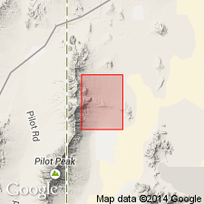
Prospect Mountain Quartzite is extended into Pilot Range, NV and UT. Tentative correlation with the Harrison Summit Quartzite in the Albion Mountains, ID is made. Age is shown as Proterozoic Z (Late Precambrian) and Cambrian.
Source: GNU records (USGS DDS-6; Menlo GNULEX).
- Usage in publication:
-
- Prospect Mountain Quartzite*
- Modifications:
-
- Geochronologic dating
- AAPG geologic province:
-
- Great Basin province
Summary:
Base and top of Prospect Mountain Quartzite not preserved in Elko Co, NV. Unit in Elko Co is assigned a presumed Early Cambrian age on basis of whole rock Rb-Sr age of 550 +/-30 Ma for metamorphic event that affected underlying schist but not the quartzite in Ruby Mountains, south of Elko Co (Kistler IN Kistler and Willden, 1969). This age assignment does not negate Stewart's (1974) conclusion that the unit in southern NV and southeastern CA [!] is of Precambrian Z and Early Cambrian. ["The base of the Prospect Mountain Quartzite is probably time transgressive" (Coats, written commun., 11/14/84)]
Source: GNU records (USGS DDS-6; Menlo GNULEX).
- Usage in publication:
-
- Prospect Mountain Quartzite*
- Modifications:
-
- Areal extent
- AAPG geologic province:
-
- Great Basin province
Summary:
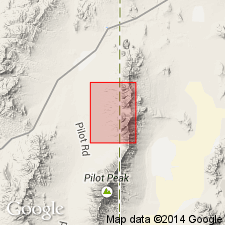
Unit geographically extended into report area [Pilot Range, Toana Range, and Silver Island Mountains (Leppy Range), UT and NV]. Age is Late Proterozoic and Early Cambrian.
Source: GNU records (USGS DDS-6; Menlo GNULEX).
- Usage in publication:
-
- Prospect Mountain Quartzite*
- Modifications:
-
- Areal extent
- AAPG geologic province:
-
- Great Basin province
Summary:
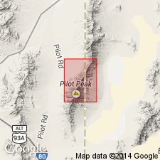
Prospect Mountain Quartzite is geographically extended into report area [northern Pilot Range, Crater Island NW 7.5' quad, Box Elder Co, UT]. Age shown as Late Proterozoic and Cambrian.
Source: GNU records (USGS DDS-6; Menlo GNULEX).
- Usage in publication:
-
- Prospect Mountain Quartzite*
- Modifications:
-
- Areal extent
- AAPG geologic province:
-
- Great Basin province
Summary:
Prospect Mountain Quartzite geographically extended into report area [Pilot Range, Patterson 7.5' quad, Box Elder Co, UT and Elko Co, NV]. Age given as Late Proterozoic and Cambrian.
Source: GNU records (USGS DDS-6; Menlo GNULEX).
- Usage in publication:
-
- Prospect Mountain Quartzite*
- Modifications:
-
- Areal extent
- AAPG geologic province:
-
- Great Basin province
Summary:
Prospect Mountain Quartzite geographically extended into report area [south Pilot Range]. Age given as Late Proterozoic.
Source: GNU records (USGS DDS-6; Menlo GNULEX).
For more information, please contact Nancy Stamm, Geologic Names Committee Secretary.
Asterisk (*) indicates published by U.S. Geological Survey authors.
"No current usage" (†) implies that a name has been abandoned or has fallen into disuse. Former usage and, if known, replacement name given in parentheses ( ).
Slash (/) indicates name conflicts with nomenclatural guidelines (CSN, 1933; ACSN, 1961, 1970; NACSN, 1983, 2005, 2021). May be explained within brackets ([ ]).