The National Geologic Map Database is migrating to a new infrastructure. We apologize for any service disruptions during this process.
|
|---|


- Usage in publication:
-
- Zuni sandstones*
- Modifications:
-
- Original reference
- Dominant lithology:
-
- Sandstone
- Shale
- AAPG geologic province:
-
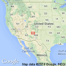
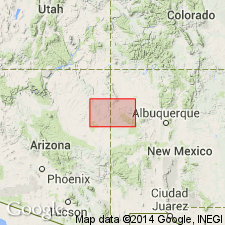
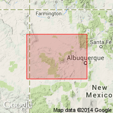
- San Juan basin
Summary:
Pl. 16, p. 137. Zuni sandstones. Sandstones and sandy shales, with occasional masses of gypsum; wonderfully banded; variegated colors. Thickness 800 to 1,300 feet. Underlies Dakota sandstone and overlies Wingate sandstones in Zuni Plateau, [San Juan County], northwestern New Mexico. [Age is Late Jurassic.]
Source: US geologic names lexicon (USGS Bull. 896, p. 2395).

- Usage in publication:
-
- Zuni sandstone†
- Modifications:
-
- Abandoned
- AAPG geologic province:
-
- San Juan basin
Summary:
According to A.A. Baker, C.H. Dane, and J.B. Reeside, Jr. (USGS Prof. Paper 183, 1936, p. 43 and chart opp. p. 43), the Zuni sandstone of Dutton (1885) and N.H. Darton (USGS Santa Fe Railway Guidebook, 1915) is same as Morrison formation, the intervening Summerville, Curtis, Entrada, Carmel, Navajo, and Kayenta formations being absent in Zuni Plateau.
Source: US geologic names lexicon (USGS Bull. 896, p. 2395).
- Usage in publication:
-
- Zuni Sandstone
- Modifications:
-
- Not used
Summary:
Name Cow Springs Sandstone used in Lupton-Zuni area, Apache Co, AZ in the Black Mesa basin and adjoining McKinley Co, NM in the San Juan basin, in place of Dutton's (1885) term Zuni Sandstone.
Source: GNU records (USGS DDS-6; Denver GNULEX).
- Usage in publication:
-
- Zuni Sandstone*
- Modifications:
-
- Overview
- AAPG geologic province:
-
- San Juan basin
Summary:
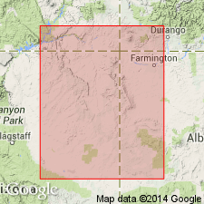
The history of usage of Zuni Sandstone in the San Juan basin of NM traced from Dutton's (1885) report to present day. History of nomenclature chart. Author proposes a modern definition for the Zuni by applying the name to undivided equivalents of the Entrada and Cow Springs Sandstones, a usage that corresponds to Dutton's. Type locality designated on Taaiyalone Mesa, Zuni 7 1/2 quad, sec 36, T10N, R19W, and sec 1, T9N, R19W, Valencia Co. Zuni is 500 ft thick at the type where it overlies Rock Point Member of Wingate Sandstone, underlies Dakota Sandstone, and is separated into two parts by a 2-4 in thick, grayish-red, silty sandstone that forms a notch or recess between the upper and lower parts. The lower part is a light-gray sandstone that is slightly coarser grained and better sorted than the grayish-pink upper part. The notch or recess interval is thought to represent the Todilto Limestone. Author assigns Zuni to the Upper Jurassic.
Source: GNU records (USGS DDS-6; Denver GNULEX).
- Usage in publication:
-
- Zuni Sandstone*
- Modifications:
-
- Areal extent
- AAPG geologic province:
-
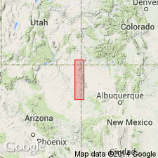
- Basin-and-Range province
Summary:
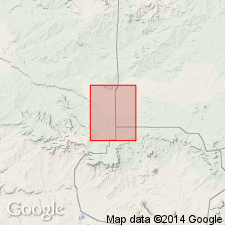
Name used in preference to Cow Springs Sandstone in this part of the Basin-and-Range province. Unconformably overlies Rock Point Member of Chinle Formation; unconformably underlies main body of Dakota Sandstone. Assigned a Jurassic age.
Source: GNU records (USGS DDS-6; Denver GNULEX).
- Usage in publication:
-
- Zuni Sandstone*
- Modifications:
-
- Areal extent
- AAPG geologic province:
-
- San Juan basin
Summary:
No longer used along the south rim of the San Juan basin nor in the Acoma sag, NM. The eolian sandstone, formerly assigned to the Zuni in the southeast part of the basin by some authors, is reassigned to the Recapture Member of the Morrison. Author limits use of Zuni to the area in NM of the Zuni basin which lies southeast of Lupton, AZ, where the eolian sandstone body above the Wingate Sandstone and beneath the Cretaceous is not divisible into two parts [see Anderson, 1983]. Nomenclature chart. Considered to be a formation in the San Rafael Group equivalent to the Entrada and Cow Springs Sandstones and to the Wanakah Formation. Of Middle Jurassic age.
Source: GNU records (USGS DDS-6; Denver GNULEX).
- Usage in publication:
-
- Zuni Sandstone
- Modifications:
-
- Not used
Summary:
Author does not follow recommendation of Anderson (1983) of using Zuni Sandstone for rocks equivalent to Cow Springs and Entrada. Sandstones south of the pinchout of Todilto Limestone Member of Wanakah. Pinchout occurs between Navajo, San Juan Co, and Twin Buttes Wash, McKinley Co, NM, San Juan basin. At the pinchout Cow Springs and Wanakah intertongue. South of the pinchout toward Lupton, AZ, Black Mesa basin, Cow Springs rests on Entrada. Author believes Entrada-Cow Springs contact can be picked from Twin Buttes Wash to Lupton, and no need exists for a name for the undivided Entrada and Cow Springs. Problems may still exist in subsurface where different characteristics have to be used. Author also believes Zuni is an ambiguous term that should be abandoned.
Source: GNU records (USGS DDS-6; Denver GNULEX).
For more information, please contact Nancy Stamm, Geologic Names Committee Secretary.
Asterisk (*) indicates published by U.S. Geological Survey authors.
"No current usage" (†) implies that a name has been abandoned or has fallen into disuse. Former usage and, if known, replacement name given in parentheses ( ).
Slash (/) indicates name conflicts with nomenclatural guidelines (CSN, 1933; ACSN, 1961, 1970; NACSN, 1983, 2005, 2021). May be explained within brackets ([ ]).