

- Usage in publication:
-
- Zortman member
- Modifications:
-
- Original reference
- Dominant lithology:
-
- Shale
- Conglomerate
- Limestone
- AAPG geologic province:
-
- Williston basin
Summary:
Pg. 605, 606-607. Zortman member of Emerson formation. In Big Snowy and Little Rocky Mountains and subsurface of east-central and northeastern Montana, Park shale is overlain by single indivisible unit of intercalated shales and edgewise pebble conglomerates which accumulated during entire Cambrian and earliest Ordovician (Tremadocian). Unit has been called Pilgrim by Deiss (1936, GSA Bull., v. 47, no. 8) and by Lochman (1950, Jour. Paleo., v. 24, p. 322-349) but it is neither lithic nor age equivalent of Pilgrim formation of accepted usage in southern and central Montana. Herein proposed to name unit Zortman member of Emerson formation. Consists of interbedded gray-green micaceous shales, large oblong coquina nodules, thin gray limestones, and coarse edgewise pebble conglomerates with small amounts of shale or crystalline limestone matrix. Thickness 300 to 650 feet. Age is Late Cambrian and Early Ordovician.
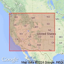
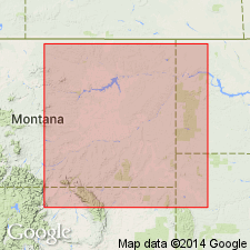
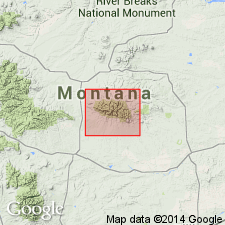
Type section (same rocks described as Pilgrim formation by Lochman, 1950): on Lodgepole Creek at mouth of Emerson Gulch, in sec. 30, T. 26 N., R. 25 E., Phillips Co., central MT. Named from the old mining town of Zortman on southeast side of Little Rocky Mountains, Phillips Co., central MT.
Source: US geologic names lexicon (USGS Bull. 1350, p. 846); supplemental information from GNU records (USGS DDS-6; Denver GNULEX).
- Usage in publication:
-
- Zortman Member
- Modifications:
-
- Overview
- AAPG geologic province:
-
- Williston basin
Summary:
Zortman Member, upper member of Emerson Formation. Stratigraphic relations with the partly equivalent Deadwood Formation are shown by means of fossil zonation; from outcrops in the Little Rocky Mountains, Blaine County, Montana, westward in subsurface of the Williston basin to Richey, Montana, and from there generally southward along the Cedar Creek anticline to outcrops in the northern Black Hills, South Dakota. Age is Late Cambrian and Early Ordovician.
Source: Modified from GNU records (USGS DDS-6; Denver GNULEX).
- Usage in publication:
-
- Zortman Member
- Modifications:
-
- Not used
Summary:
Rocks assigned to Zortman Member of Emerson Formation in Little Rocky Mountains (Lochman-Balk, 1956), Williston basin, are assigned in this report to upper part of Snowy Range Formation (age modified) in Big Snowy Mountains, Central Montana uplift. Neither Emerson nor Zortman was ever defined or adequately described.
Source: GNU records (USGS DDS-6; Denver GNULEX).
For more information, please contact Nancy Stamm, Geologic Names Committee Secretary.
Asterisk (*) indicates published by U.S. Geological Survey authors.
"No current usage" (†) implies that a name has been abandoned or has fallen into disuse. Former usage and, if known, replacement name given in parentheses ( ).
Slash (/) indicates name conflicts with nomenclatural guidelines (CSN, 1933; ACSN, 1961, 1970; NACSN, 1983, 2005, 2021). May be explained within brackets ([ ]).