

- Usage in publication:
-
- Zia Sand Formation
- Modifications:
-
- Original reference
- Dominant lithology:
-
- Sand
- Sandstone
- Siltstone
- AAPG geologic province:
-
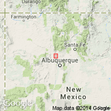
- San Juan basin
Summary:
Zia Sand Formation. Deposits of Zia Sand Formation are extremely soft sandstones composed predominantly of slightly cemented medium- to coarse-grained quartz sand. A few thin beds of fine-grained sandstone or siltstone occur in the section, and two calcareous ledges crop out. Includes Piedra Parada Member (new) in lower part and Chamisa Mesa Member (new) in upper part. Thickness about 1,000 feet along line of type section. About 400 feet above base of formation is obscure unconformity that may prove significant in future studies of stratigraphy in area. This unconformity lies at top of a 100-foot-thick set of gray sand beds characterized by large concretionary masses and ledges. Sand below the unconformity is darker than that of rest of underlying beds in the set. In type locality, Zia Sand is unconformably overlain by about 500 feet of deposits of Sante Fe Formation. At type locality, unconformably overlies laminated greenish clay deposit about 30 feet thick that in turn conformably overlies Galisteo deposits. Renick (1931, USGS Water-Supply Paper 620) described beds here named Zia Sand Formation and cited a locality in northern part of T. 14 N., R. 1 E., as point where contact of Santa Fe Formation with beds of Wasatch Formation are exposed. The Santa Fe beds cited by Renick are those designated here as part of type locality of Piedra Parada Member of the Zia. Beds thought by Renick to be Wasatch are here mapped as part of Galisteo Formation. [Age is early to middle Miocene.]
Type section: begins a few yds north of south line of NW/4 sec. 11, T. 14 N., R. 1. E., and then measured through Standing Rock quarry and continued in southerly to southeasterly direction through sec. 14 and northern part of sec. 23, T. 14 N., R. 1. E., Sandoval Co., northwestern NM. Named from Zia Indian Pueblo.
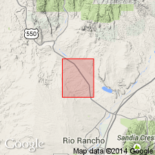
Type area: west of Jemez fault, in secs. 11, 12, 13, 23, and 24, T. 14 N., R. 1 E., New Mexico principal meridian in Sandoval Co., northwestern NM.
[Well exposed in Canyada Piedra Parada, particularly in East Fork.]
Source: US geologic names lexicon (USGS Bull. 1350, p. 845-846).
- Usage in publication:
-
- Zia Sand*
- Modifications:
-
- Revised
- AAPG geologic province:
-
- San Juan basin
Summary:
Zia Sand. Zia Marl of Regan (1903) abandoned and replaced with Zia Sand Formation of Galusha (1966), adopted as Zia Sand, and redefined to include Galusha's Zia and Santa Fe Formation. Appears to be = "Lower Gray" and "Middle Red" members of Santa Fe Formation of Bryan and McCann (1937). Unconformably overlies Permian, Triassic, and Eocene rocks; underlies Cochiti Formation to east and south and Miocene volcanic rocks to north. Age is early and middle Miocene (Valentinian and Clarendonian NALMA), based on vertebrate fossils identified from upper part.
Source: Publication; Changes in stratigraphic nomenclature, 1978 (USGS Bull. 1482-A, p. A49).
- Usage in publication:
-
- Zia Sand
- Modifications:
-
- Revised
- AAPG geologic province:
-
- Estancia basin
- San Juan basin
Summary:
Zia Sand. Divided into (ascending) Piedra Parada, Chamisa Mesa, and Canada Pilares (new) Members. Unconformably overlies Galisteo Formation; underlies rocks equivalent to Tesuque Formation.
Notable exposures in Bernalillo and Sandoval Cos., NM. Age is Miocene (Arikareean and early Hemingfordian NALMA).
"Type area" (Zia Sand and Piedra Parada Member; shown in cross section): in secs. 11, 12, 13, 23, and 24, T. 14 N., R. 1 E.
"Type area" (Chamisa Mesa Member; shown in cross section): in N/2 sec. 25, T. 16 N., R. 2 E., and sec. 30, T. 16 N., R. 3 E.
Type section (Canada Pilares Member): in sec. 12, T. 12 N., R. 1 W., and sec. 7, T. 12 N., R. 1 E.
Source: Modified from GNU records (USGS DDS-6; Denver GNULEX).
- Usage in publication:
-
- Zia Sand Formation
- Modifications:
-
- Age modified
- Areal extent
- AAPG geologic province:
-
- San Juan basin
Summary:
Upper Miocene to lower Pliocene Zia Sand Formation (following Galusha and Blick, 1971, who assigned this age) is areally restricted to northern part of Albuquerque basin, with southernmost exposures located west of the Rio Puerco, Sandoval Co, NM, San Juan basin, a short distance north of I-10 (Kelley, 1977) [this is an age modification--1978 and 1981 reports of Manley and Gawne, respectively, list age as early and middle Miocene, or just Miocene]. Although the thickness of Zia measured to west of study area is nearly 700 m (Manley, 1978), Zia exposed in study area has a thickness of 70 m of thinly to thickly bedded eolian sandstone. Thick, cross-bedded units containing pellet-sized calcareous concretions and numerous worm burrows are common. Paleo-wind direction analysis suggests that source of Zia is to the west. On basis of age, petrology, grain size, and location, dominant source of the volcanic lithic fragments in Zia appears to be the Keres Group (early Pliocene to middle Pliocene) of Jemez Mountains volcanic field--however, northward location of Jemez doesn't coincide with westerly source postulated. This can be explained by stream transport of volcanic lithics to sites of deposition west of the study area and subsequent transportation east by wind currents. The Jemez River, originating in the center of the volcanic field and flowing south-southwest to locations west of the study area, is the probable channel of stream transport.
Source: GNU records (USGS DDS-6; Denver GNULEX).
- Usage in publication:
-
- Zia Formation
- Modifications:
-
- Revised
- AAPG geologic province:
-
- San Juan basin
Connell, S.D., Koning, D.J., and Cather, S.M., 1999, Revisions to the stratigraphic nomenclature of the Santa Fe Group, northwestern Albuquerque basin, New Mexico: New Mexico Geological Society Field Conference Guidebook, no. 50, p. 337-354.
Summary:
Pg. 339 (fig. 3), 341-342. Zia Formation of Santa Fe Group. Includes Cerro Conejo Member (new) at top; previously unnamed (see Tedford and Barghoorn, 1997, New Mexico Mus. Nat. Hist. Sci. Bull., no. 11, p. 77-95). Age is early to earliest late Miocene (Arikareean to earliest Clarendonian NALMA).
Source: Publication.
- Usage in publication:
-
- Zia Formation
- Modifications:
-
- Revised
- AAPG geologic province:
-
- San Juan basin
Summary:
Pg. 328, 331. Zia Formation of Santa Fe Group. Mostly volcaniclastic and eolian in origin. Restricted to approximately original definition of Galusha. Excludes uppermost Cerro Conejo Member of Connell and others (this vol., p. 339+; = the younger unnamed member of Tedford and Barghoon, 1997). Is considered lithogenetically continuous with the overlying fluviatile deposits of Arroyo Ojito Formation. As restricted, the Zia includes (ascending): Piedra Parada Member, dune deposits, 70 m thick; Chamisa Mesa Member, fluvial deposits, 30 m thick; and Canada Pilares Member, dune deposits, 75 m thick. Rests unconformably on nonmarine Cretaceous Menefee Formation. Separated from Arroyo Ojito by unconformity (1 to 1.6 m.y. hiatus). Fossils. Age is early to early middle Miocene.
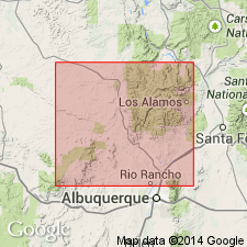
Area of study in T. 12 and 13 N., R. 1 E. and R. 1 W., along Ceja del Rio Puerco, a badland escarpment of Puerco River, [Sky Village SE and San Felipe Mesa 7.5-min quadrangles], southern Sandoval Co., northern Albuquerque basin, north-central NM; [5+ mi southwest of Cerro Conejo type locality].
Source: Publication.
- Usage in publication:
-
- Zia Formation*
- Modifications:
-
- Areal extent
- AAPG geologic province:
-
- Estancia basin
- San Juan basin
Summary:
Pg. 9-11 of pamphlet, geol. map. Zia Formation. Is = Zia Formation of Tedford and Barghoon (1999; excludes Cerro Conejo Member of Connell and others, 1999), and = "Lower Gray" member of Santa Fe Formation of Bryan and McCann (1937). Includes (descending) Canada Pilares, Chamisa Mesa, and Piedra Parada Members. Consists of gray to reddish-gray, well-sorted eolian sandstone with minor lacustrine and fluvial sandstones and mudstones. Thickness about 1,000 feet. Is basal formation of Santa Fe Group in this region. Underlies "Middle Red" formation; is separated from it by an erosional unconformity (represents hiatus from about 16 to 14 Ma). Age is early to middle Miocene.
Source: Publication.
For more information, please contact Nancy Stamm, Geologic Names Committee Secretary.
Asterisk (*) indicates published by U.S. Geological Survey authors.
"No current usage" (†) implies that a name has been abandoned or has fallen into disuse. Former usage and, if known, replacement name given in parentheses ( ).
Slash (/) indicates name conflicts with nomenclatural guidelines (CSN, 1933; ACSN, 1961, 1970; NACSN, 1983, 2005, 2021). May be explained within brackets ([ ]).