


- Usage in publication:
-
- Yaquina sandstone
- Yaquina division
- Modifications:
-
- Original reference
- Dominant lithology:
-
- Sandstone
- Shale
- Coal
- AAPG geologic province:
-
- Western Columbia basin
Summary:
Yaquina sandstone (also Yaquina division). Upper 1,300 feet consists of micaceous blue-gray sandstone, heavy-bedded, very fine-grained and very fossiliferous. Lower 1,000 to 1,300 feet consists of coarse-grained buff-colored sandstone interbedded with carbonaceous shale; some thin seams of soft coal in lower part. Underlies Acila shale and overlies Toledo division.
Source: US geologic names lexicon (USGS Bull. 896, p. 2382).
- Usage in publication:
-
- Yaquina formation
- Modifications:
-
- Revised
- AAPG geologic province:
-
- Western Columbia basin
Summary:
Yaquina formation is middle Oligocene. Underlies, apparently unconformably, Nye shale. It is believed no angular unconformity separates Yaquina and Toledo formations.
Source: US geologic names lexicon (USGS Bull. 896, p. 2382).
- Usage in publication:
-
- Yaquina formation
- Modifications:
-
- Revised
- AAPG geologic province:
-
- Western Columbia basin
Summary:
Pg. 22-31. Thickness of Yaquina formation is 4,000+/- feet, according to writer's interpretation. Type locality is town of Yaquina, Lincoln Co., northwestern Oregon. Fossils correlate with Eugene formation, Tunnel Point sandstone, Pittsburg Bluff sandstone. [Age is Oligocene.]
Source: US geologic names lexicon (USGS Bull. 896, p. 2382).
- Usage in publication:
-
- [Yaquina formation*
- Yaquina sandstone*]
- Modifications:
-
- Revised
- Overview
- AAPG geologic province:
-
- Western Columbia basin
Summary:
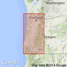
Described in coastal area near Cape Foulweather, [northwestern Oregon], as 2,500 to 3,000 feet of arenaceous sedimentary rocks, unconformably overlying Nestucca formation. Outcrop belt narrows northward as dip steepens and the Yaquina is progressively overlapped by Astoria formation. Age is late Oligocene.
Source: US geologic names lexicon (USGS Bull. 1200, p. 4317-4318).
- Usage in publication:
-
- [Yaquina formation*
- Yaquina sandstone*]
- Modifications:
-
- Adopted
- Areal extent
- AAPG geologic province:
-
- Western Columbia basin
Summary:
Described in Newport-Waldport area, [northwestern Oregon], as approximately 2,700 feet of shallow-water deposits, predominantly light-gray to brown tuffaceous and usually carbonaceous poorly consolidated sandstone, sandy tuffs, and interbedded or alternating tuffs and sandstones. Disconformably overlies Toledo formation; disconformably underlies Nye mudstone. Age is late Oligocene. (Yaquina formation and Yaquina sandstone adopted by the USGS.)
Source: US geologic names lexicon (USGS Bull. 1200, p. 4317-4318).
- Usage in publication:
-
- Yaquina Formation*
- Modifications:
-
- Overview
- AAPG geologic province:
-
- Western Columbia basin
Summary:
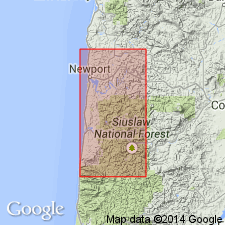
Pg. 51. Yaquina Formation. Is of rather limited distribution; restricted to coast of northwestern Oregon between Newport and Yachats. Consists of deltaic, shallow-water, light-gray to brown, poorly consolidated, fine- to medium-grained tuffaceous sandstone and mudstone; thickness approximately 2,700 feet. Locally fossiliferous sandstones rich in calcareous concretions low in the section pass upward into gritty, cross-bedded brackish and nearshore marine sandstone and siltstone. Unit also exhibits marked lateral variations; contains locally developed coal-bearing beds, conglomerates, and coarse-grained sandstones. In vicinity of Heceta Head, thick-bedded basaltic conglomerates and grits overlying the volcanic sediments of the Toledo Formation are tentatively assigned to the Yaquina Formation by Vokes and others (1949, USGS Oil and Gas Inv. Prelim. Map OM-88, scale 1:62,500). Yaquina is is gently dipping to moderately dipping in the north. Conformably overlies Toledo Formation and interfingers with the lower Nye Formation. Age is late Oligocene.
Type locality stated to be at Yaquina Bay, northwestern OR.
[See also E.M. Baldwin, 1964, Geology of Oregon, Ann Arbor, MI, Edwards Bros., Inc.; R.E. Stewart, 1956[a,b], "Stratigraphic implications of some Cenozoic Foraminifera from western Oregon," The Ore Bin, v. 18, no. 1 [and/or?] no. 7; P.D. Snavely, Jr., and others, 1969[a], "Geology of Newport area, Oregon," The Ore Bin, v. 31, nos. 2 and 3; Walter Youngquist, 1961, "Annotated lexicon of names applied to Tertiary units in Oregon and Washington west of the Cascade Mountains with bibliography," Ann Arbor, MI, Edwards Bros., Inc.]
Source: Publication.
For more information, please contact Nancy Stamm, Geologic Names Committee Secretary.
Asterisk (*) indicates published by U.S. Geological Survey authors.
"No current usage" (†) implies that a name has been abandoned or has fallen into disuse. Former usage and, if known, replacement name given in parentheses ( ).
Slash (/) indicates name conflicts with nomenclatural guidelines (CSN, 1933; ACSN, 1961, 1970; NACSN, 1983, 2005, 2021). May be explained within brackets ([ ]).