- Usage in publication:
-
- Wurtsboro Tongue*
- Modifications:
-
- Named
- Dominant lithology:
-
- Conglomerate
- Sandstone
- Siltstone
- Shale
- AAPG geologic province:
-
- Appalachian basin
Summary:
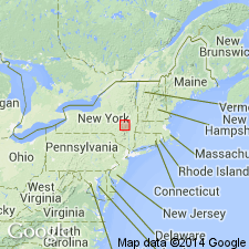
Named the Wurtsboro Tongue of the Bloomsburg Red Beds for Wurtsboro, Sullivan Co., NY. Consists of interbedded red, green, and gray, cross bedded, polymictic conglomerate, sandstone, siltstone, and shale. Lithologies occur in fining-upward cycles as much as 12 feet thick. Unit ranges in thickness from 300 feet near Port Jervis, NY to 75 feet at Accord, NY, and is 115 feet thick at the type section. The Wurtsboro conformably overlies the Shawangunk Formation and conformably underlies the Ellenville Tongue of the Shawangunk Formation. The base of the Wurtsboro Tongue is placed at the base of the lowest significant red bed; the top of the tongue is placed at the top of the blocky, moderate-grayish-brown siltstone. The Wurtsboro Tongue is of Late Silurian age.
Source: GNU records (USGS DDS-6; Reston GNULEX).
For more information, please contact Nancy Stamm, Geologic Names Committee Secretary.
Asterisk (*) indicates published by U.S. Geological Survey authors.
"No current usage" (†) implies that a name has been abandoned or has fallen into disuse. Former usage and, if known, replacement name given in parentheses ( ).
Slash (/) indicates name conflicts with nomenclatural guidelines (CSN, 1933; ACSN, 1961, 1970; NACSN, 1983, 2005, 2021). May be explained within brackets ([ ]).

