

- Usage in publication:
-
- Womble shale*
- Modifications:
-
- Original reference
- Dominant lithology:
-
- Shale
- Sandstone
- Limestone
- AAPG geologic province:
-
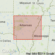
- Ouachita folded belt
Summary:
Pg. C67. Womble shale. Black graphitic shale with thin beds of sandstone near base and beds of limestone near top. The shale near base is composed of black and green layers that split at an angle with the bedding and thus show ribboned cleavage surfaces. Thickness 1,000 feet. Underlies Bigfork chert and overlies Blackely sandstone. The Womble forms upper part of "Ouachita shale" of previous reports. Fossils (graptolites). Age is Early Ordovician.
Named from town of Womble [now called Norman], part of which is on the base of this shale, Montgomery Co., west-central AR.
Source: US geologic names lexicon (USGS Bull. 896, p. 2363); supplemental information from GNU records (USGS DDS-6; Denver GNULEX).
- Usage in publication:
-
- Womble shale*
- Modifications:
-
- Revised
- AAPG geologic province:
-
- Ouachita folded belt
Summary:
Womble shale includes "Stringtown shale" and upper part of "Ouachita shale" of previous reports on Arkansas geology. Age is Early Ordovician.
[Misprint (USGS Bull. 896, p. 2363): Miser and Purdue listed as authors of this publication. Should be Purdue and Miser.]
Source: Publication; US geologic names lexicon (USGS Bull. 896, p. 2363).

- Usage in publication:
-
- Womble shale*
- Womble schistose sandstone*
- Modifications:
-
- Overview
- AAPG geologic province:
-
- Ouachita folded belt
Summary:
Womble shale (in southwestern Arkansas); Womble schistose sandstone (in southern Oklahoma). The Womble shale of Arkansas has yielded Beekmantown, Chazy, and Black River fossils. The Womble shale of Oklahoma has yielded Chazy and Black River fossils, but no fossils in lower part. The formation is at present [ca. 1936] classified as of Lower Ordovician (Beekmantown and Chazy) and Middle Ordovician (Black River) age. The name is now [ca. 1936] employed by the USGS to replace "Stringtown shale" of both Arkansas and southern Oklahoma.
Type section of Womble shale is at Crystal Mountain[s], Arkansas, according to H.D. Miser, March 1937.
Source: US geologic names lexicon (USGS Bull. 896, p. 2363).
- Usage in publication:
-
- Womble formation*
- Modifications:
-
- Areal extent
- AAPG geologic province:
-
- Ouachita folded belt
Summary:
Pg. 424 (fig. 2). Womble formation. Consists of shale, black to green, with thin layers of limestone and argillaceous sandstone in Arkansas. Predominantly schistose, micaceous, chloritic sandstone in McCurtain County, southern Oklahoma. Thickness 250 to 1,000 feet. Underlies Bigfork sandstone; overlies Blackely formation. [Age is Early and Middle Ordovician.]
Source: US geologic names lexicon (USGS Bull. 1200, p. 4286).
- Usage in publication:
-
- Womble shale*
- Modifications:
-
- Revised
- AAPG geologic province:
-
- Ouachita folded belt
Summary:
Pg. 23, 24-25. Womble shale, as defined in this report (core of Ouachita Mountains), includes stratigraphic interval between Mazarn shale below and Bigfork chert above. As originally defined, Blakely sandstone lies stratigraphically above Mazarn shale and below Womble shale. A series of beds distinct lithologically from Mazarn shale below and Womble siltstone above was noted at some localities. This [unit] could be designated as separate formation, but if it were designated in this way, it is recommended that it not be called Blakely because of findings of current field work in Blakely sandstone type area in Arkansas. [Age is Early and Middle Ordovician.]
Source: US geologic names lexicon (USGS Bull. 1200, p. 4286).
- Usage in publication:
-
- Womble Shale*
- Womble Formation*
- Modifications:
-
- Overview
- AAPG geologic province:
-
- Ouachita folded belt
Summary:
Pg. 19. Womble Shale; Womble Formation. Recognized in Ouachita Mountains, west-central Arkansas, and southern Oklahoma. Consists mostly of black shale with thin layers of limestone, silty sandstone, and some chert. Some green shales are interbedded with the black shales but less so than with the Mazarn. Cleavage at an angle to bedding frequently displays a ribboned cleavage surfaces. The sandstones are dark gray, compact, fine-grained though occasionally conglomeratic, and may be phosphatic. These sandstones are generally found in the lower part of the formation. The dense, blue-gray limestones usually occur near the top of the formation in thin to medium beds. Black chert is also present as thin layers also at the top of the formation. Large milky quartz veins often fill fractures in the formation. Thickness 500 to 1200 feet. Rests conformably on Blakely. Fossils (graptolites and conodonts). Age is Middle Ordovician.
Source: Publication.
For more information, please contact Nancy Stamm, Geologic Names Committee Secretary.
Asterisk (*) indicates published by U.S. Geological Survey authors.
"No current usage" (†) implies that a name has been abandoned or has fallen into disuse. Former usage and, if known, replacement name given in parentheses ( ).
Slash (/) indicates name conflicts with nomenclatural guidelines (CSN, 1933; ACSN, 1961, 1970; NACSN, 1983, 2005, 2021). May be explained within brackets ([ ]).