

- Usage in publication:
-
- Winsor formation*
- Modifications:
-
- First used
- Dominant lithology:
-
- Sandstone
- AAPG geologic province:
-
- Plateau sedimentary province
Summary:
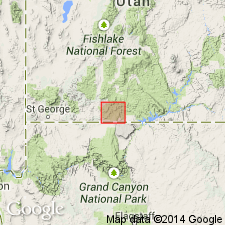
First published use of name for some Jurassic rocks that overlie the Entrada? sandstone. Intent to name, source of geographic name, and designation of a type not stated. Section 448 ft thick measured on west bank of Paria River near White House Spring where it is composed of white streaked with red sandstone and one 7 ft thick conglomerate of rounded quartz pebbles 92 ft above base. Mapped (geologic map) with other Jurassic rocks east of Red Rock Valley and the Coxcomb, Kane Co, UT in the Plateau sedimentary province. Unconformably overlain by Pliocene? conglomerate in the measured section.
Source: GNU records (USGS DDS-6; Denver GNULEX).
- Usage in publication:
-
- Winsor formation*
- Modifications:
-
- Named
- Dominant lithology:
-
- Sandstone
- AAPG geologic province:
-
- Plateau sedimentary province
Summary:
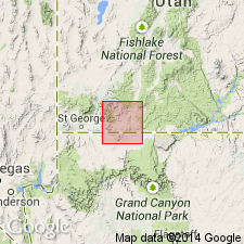
Name applied to an Upper Jurassic white and red-banded, fine-grained even-bedded sandstone that unconformably overlies Curtis formation and unconformably underlies Dakota? sandstone. Named for Winsor, the original settlement at Mount Carmel, Kane Co, UT in the Plateau sedimentary province. Type section is 3 mi south of Mt. Carmel, Kane Co, UT. Not mapped as a separate unit on the geologic map. Nomenclature charts. Is 180 to 300 ft thick in the Zion Park region, and 450 to 800 ft thick in the Paria valley. Forms cliffs. Few of the sandstone beds are more than 2 ft thick; the grains are angular or subangular, dominantly quartz. Some clay minerals, calcite or dolomite, biotite, zircon, magnetite. No feldspar identified. A few layers of concretionary limestone, rhyolite, acidic igneous rocks. These concretionary beds associated with coarser sandstone. Four measured sections.
Source: GNU records (USGS DDS-6; Denver GNULEX).
- Usage in publication:
-
- Winsor Member
- Modifications:
-
- Revised
- AAPG geologic province:
-
- Great Basin province
- Paradox basin
Summary:
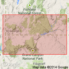
As a member of Carmel Formation, both contacts revised in that Winsor overlies the newly named Paria River Member of Carmel and underlies the newly named Wiggler Wash Member of Carmel in the area between Cedar Mountain in Iron Co, UT, Great Basin province, and Escalante in Garfield Co, UT, Paradox basin. Averages 250 ft thick in area forming weathered color-banded brown slopes. Cross sections. Measured sections. Is poorly cemented, friable. Has horizontal thick to massive beds of white, pink, brown sandstone alternating with red siltstone or mudstone. Not always easily distinguished from Paria River Member. History of usage described. [Of Middle Jurassic age; age not clearly stated.]
Source: GNU records (USGS DDS-6; Denver GNULEX).
- Usage in publication:
-
- Winsor Member*
- Modifications:
-
- Overview
- Areal extent
- AAPG geologic province:
-
- Paradox basin
- Plateau sedimentary province
- Great Basin province
Summary:
Is the upper member of Carmel Formation of San Rafael Group, Garfield Co, UT. Has not been found west of Hurricane Cliffs, Washington Co, UT. Recognized in Paradox basin, Great Basin province (eastern Washington and Iron Cos), and Plateau sedimentary province (Kane Co), UT. Reaches its maximum thickness of 204.2 m near Carly Knoll, Kane Co. Author follows usage of Cashion (1967) but recognizes that Winsor is younger near Paunsagunt fault than at its type. Lower contact placed at top of highest gypsum or limestone bed of gypsiferous member of Carmel. Upper contact not discussed. Correlates with Leeds Creek Member of Twin Creek Limestone in WY and UT, and with part of upper member of Carmel. Assigned a late Bathonian and early Callovian, Middle Jurassic age. Measured sections. Cross sections. Correlation chart.
Source: GNU records (USGS DDS-6; Denver GNULEX).
For more information, please contact Nancy Stamm, Geologic Names Committee Secretary.
Asterisk (*) indicates published by U.S. Geological Survey authors.
"No current usage" (†) implies that a name has been abandoned or has fallen into disuse. Former usage and, if known, replacement name given in parentheses ( ).
Slash (/) indicates name conflicts with nomenclatural guidelines (CSN, 1933; ACSN, 1961, 1970; NACSN, 1983, 2005, 2021). May be explained within brackets ([ ]).