- Usage in publication:
-
- Wingate sandstone*
- Modifications:
-
- Original reference
- Dominant lithology:
-
- Sandstone
- AAPG geologic province:
-
- San Juan basin
Summary:
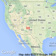
Pl. 16, p. 136. Wingate sandstones. Bright-red sandstones, 450 feet thick. Underlie Zuni sandstones in Zuni Plateau, New Mexico, and are separated from underlying Shinarump conglomerate by 1,450 to 1,550 feet of red shale and sandy shale [later named Chinle formation].
[Type locality: cliffs north of Fort Wingate, Fort Wingate 7.5-min quadrangle, McKinley Co., western NM.]
Source: US geologic names lexicons (USGS Bull. 896, p. 2351; USGS Bull. 1200, p. 4261-4262).
- Usage in publication:
-
- Wingate sandstone*
- Modifications:
-
- [Principal reference]
- Dominant lithology:
-
- Sandstone
Summary:
Gave detailed description of Wingate sandstone in Navajo country, and applied Todito formation to the beds separating it from the younger Navajo sandstone, and Chinle formation to the underlying beds. [Age is Jurassic(?).]
Source: US geologic names lexicon (USGS Bull. 896, p. 2351).
- Usage in publication:
-
- Wingate sandstone*
- Modifications:
-
- Areal extent
- AAPG geologic province:
-
- Black Mesa basin
- Paradox basin
- Piceance basin
- San Juan basin
Summary:
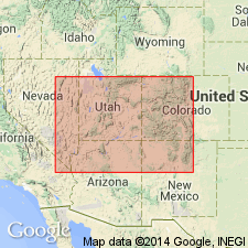
p. 4-5, pls. Wingate Sandstone of Glen Canyon Group. Summary of results of fieldwork in eastern Utah and adjacent parts of Arizona, New Mexico, and Colorado, and revision of interpretations and correlations of Jurassic formations in area. Wingate is basal unit of Glen Canyon group which is classified as Jurassic(?). The Wingate occurs in full development in southeastern Utah, northeastern Arizona, northwestern New Mexico, and apparently across north-central New Mexico. Extends eastward into Colorado but reaches mountains only in attenuated form. Northern boundary not known; probably not represented in Nugget sandstone of Wasatch Mountains. As much as 470 feet thick but in most of extent is about 300 feet. Underlies Kayenta formation; overlies Chinle formation.
Source: US geologic names lexicon (USGS Bull. 1200, p. 4261-4262).

- Usage in publication:
-
- Wingate sandstone*
- Modifications:
-
- Overview
Summary:
Subsequent work [post-USGS Prof. Paper 93, by H.E. Gregory, 1917] showed that the Todilto at its type locality in northwestern New Mexico is basal member of Morrison formation, but that in southeastern Utah and parts of southwestern Colorado the Morrison is separated from the Wingate sandstone by several intervening formations, in descending order Summerville, Curtis, Entrada, Carmel, Navajo, and Kayenta. (See A.A. Baker, C.H. Dane, and J.B. Reeside, Jr., USGS Prof. Paper 183, 1936).
Wingate sandstone of Glen Canyon group. Recognized in western New Mexico, northeastern Arizona, southeastern Utah, and southwestern and western Colorado. Age is Jurassic(?).
Source: US geologic names lexicon (USGS Bull. 896, p. 2351).
- Usage in publication:
-
- Wingate sandstone*
- Modifications:
-
- Not used
Summary:
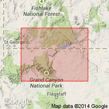
Pg. 2521, 2523. Name Lamb Point tongue (new) of Navajo sandstone is applied to rocks in Kanab area formerly classified as Wingate by Gregory (1950). Unit mapped as Wingate sandstone by Wanek and Stephens (USGS Oil and Gas Inv. Map OM-145, 1953) is here considered Springdale sandstone member of Moenave formation. Hence, name Wingate sandstone is eliminated in Kanab, Utah, area. Triassic age assigned to Wingate.
Source: US geologic names lexicon (USGS Bull. 1200, p. 4261-4262).
- Usage in publication:
-
- Wingate sandstone*
- Modifications:
-
- Revised
- AAPG geologic province:
-
- Black Mesa basin
- Paradox basin
- San Juan basin
Summary:
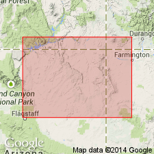
Pg. 3 (fig. 2), 8-12, pl. 2. Wingate Sandstone. Dutton described Wingate from exposures in cliffs north of Fort Wingate, New Mexico. In his description he refers to limestone unit in the Chinle, since referred to as Chinle "B" by Gregory (USGS Prof. Paper 93, 1917). Units Chinle "B" and Wingate stand out clearly in sketch included in Dutton's report. At point shown in sketch, unit described as Wingate is 658 feet thick. Of this thickness, basal 355 feet is composed of sedimentary rocks now considered to be Wingate sandstone, as recognized throughout northeastern Arizona, southeastern Utah, and parts of western Colorado. Upper 303 feet of Dutton's type Wingate is now recognized as Entrada sandstone of San Rafael group (Baker, Dane, and Reeside, 1947). Wingate sandstone is here restricted to lower half of Dutton's type section. In Navajo country, Wingate comprises two mappable units herein named (ascending) Lukachukai and Rock Point members. At type locality underlies Entrada sandstone; in Arizona underlies Kayenta formation or Moenave formation. Age is Late Triassic.
[Type locality: cliffs north of Fort Wingate, Fort Wingate 7.5-min quadrangle, McKinley Co., western NM.]
Source: Publication; US geologic names lexicon (USGS Bull. 1200, p. 4261-4262).
- Usage in publication:
-
- Wingate Sandstone*
- Modifications:
-
- Revised
- AAPG geologic province:
-
- Black Mesa basin
- San Juan basin
Summary:
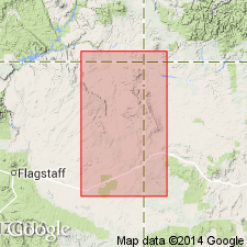
The lower member, Rock Point Member used south of Laguna Creek around the Defiance uplift in northeast AZ and northwest NM, is removed from the Wingate Sandstone of Glen Canyon Group and assigned to the Chinle Formation as its upper member. Rock Point has a distribution and lithology similar to the Chinle, but it is dissimilar from the eolian erg of the Wingate Sandstone. Also Rock Point is equivalent to the Church Rock Member of the Chinle, the name applied to rocks above the Owl Rock Member of the Chinle north of Laguna Creek. Two names have been applied to the eolian sandstone--formerly of the upper part of the Wingate--1) Lukachukai Member of Wingate, a name used locally in a few papers, and 2) Wingate Sandstone, a name applied regionally in many papers. The name Wingate is retained for the sandstone; the name Lukachukai is abandoned. Report area is concerned only with northeast AZ (Black Mesa basin) and northwest NM (San Juan basin). The restricted Wingate is assigned to the Early Jurassic following the age assignment given by most current workers.
Source: GNU records (USGS DDS-6; Denver GNULEX).
- Usage in publication:
-
- Wingate Sandstone
- Modifications:
-
- Age modified
- AAPG geologic province:
-
- Plateau sedimentary province
Summary:
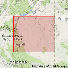
Horn-like scutes have been found in the Kayenta Formation at several localities in the Rock Head quad, Coconino Co, AZ in the Plateau sedimentary province, that match an obscure ornithisician dinosaur of the Early Jurassic of southwest England. These scutes [pictured] belonged to SCELIDOSAURUS. Possible late Hettangian or Sinemurian age suggested for lower part of the Kayenta. Along with palynomorphs in the Moenave Formation and magnetostratigraphic studies, the Early Jurassic age established for several parts of the group is assigned to the entire Glen Canyon Group. Formations of the Glen Canyon are thought to be--Wingate, Hettangian; Moenave, Hettangian and Sinemurian; Kayenta, Sinemurian and Pliensbachian; Navajo, Pliensbachian or Toarcian--all stages of the Early Jurassic. [Members of formations in Glen Canyon Group not discussed.]
Source: GNU records (USGS DDS-6; Denver GNULEX).
For more information, please contact Nancy Stamm, Geologic Names Committee Secretary.
Asterisk (*) indicates published by U.S. Geological Survey authors.
"No current usage" (†) implies that a name has been abandoned or has fallen into disuse. Former usage and, if known, replacement name given in parentheses ( ).
Slash (/) indicates name conflicts with nomenclatural guidelines (CSN, 1933; ACSN, 1961, 1970; NACSN, 1983, 2005, 2021). May be explained within brackets ([ ]).

