

- Usage in publication:
-
- Windsor Formation
- Modifications:
-
- Named
- Dominant lithology:
-
- Sand
- Gravel
- Clay
- AAPG geologic province:
-
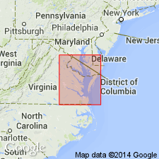
- Atlantic Coast basin
Summary:
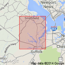
Windsor Formation here named in Isle of Wight Co., southeastern VA. Unit is described as sand and gravel grading upward into silty clay and sand. Thickness ranges from less than 1.5 m to 10.5 m. Unconformably overlies Bacons Castle, Sedley, or Yorktown Formation; unconformably underlies sand facies of Norfolk Formation. Age given as Pleistocene.
Source: GNU records (USGS DDS-6; Reston GNULEX).
- Usage in publication:
-
- Windsor Formation
- Modifications:
-
- Revised
- AAPG geologic province:
-
- Atlantic Coast basin
Summary:
Unit was previously mapped as part of Wicomico Formation by Clark and Miller (1906; 1912) and Wentworth (1930) and as Kilby Formation by Moore (1956). The upper portion of the Windsor as mapped by Bick and Coch (1969) is here called Charles City Formation (new name). The lower portions of their Windsor is here assigned to the informal late Pliocene Moorings unit (in part) or the Bacons Castle Formation. Windsor is divided into lower coarse deposits (fluvial), approximately 25 ft thick and upper silt and fine sand (bay), which range from 1 to 12 ft thick. Age is uncertain, though overlying Charles City Formation is considered early Pleistocene.
Source: GNU records (USGS DDS-6; Reston GNULEX).
- Usage in publication:
-
- Windsor Formation*
- Modifications:
-
- Overview
- Age modified
- Dominant lithology:
-
- Sand
- Gravel
- Silt
- Clay
- AAPG geologic province:
-
- Atlantic Coast basin
Summary:
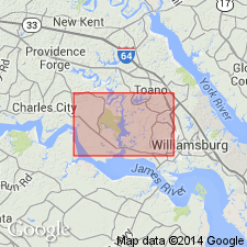
Windsor Formation (upper Pliocene or lower Pleistocene) is mapped in the Virginia Coastal Plain where it constitutes surficial deposits of extensive areas west and south of the Chesapeake Bay. Elsewhere underlies Charles City Formation. Described as gray and yellowish to reddish-brown sand, gravel, silt, and clay in a fining-upward sequence. Unit is 0-40 ft thick.
Source: GNU records (USGS DDS-6; Reston GNULEX).

- Usage in publication:
-
- Windsor Formation
- Modifications:
-
- Overview
- AAPG geologic province:
-
- Atlantic Coast basin
Summary:
Nomenclature on State map follows Coch (1968). West and south of Chesapeake Bay, unit described as gray and yellowish to reddish-brown sand, gravel, silt, and clay. Constitutes surficial deposits of extensive plain (altitude 85 to 95 ft) seaward of Surry scarp and of coeval, fluvial-estuarine terraces west of scarp. Fining-upward sequence beneath plain consists of a basal pebbly sand grading upward into cross-bedded, quartzose sand and massive, clayey silt and silty clay. Lower and upper parts of sequence were deposited, respectively, in shallow-marine or open-bay and restricted-bay or lagoonal environments. In terraces west of Surry scarp, fluvial-estuarine deposits comprise muddy, coarse, trough cross-bedded sand and gravel grading upward to sandy silt and clay. Thickness ranges from 0 to 40 ft. Age is late Pliocene or early Pleistocene.
Source: GNU records (USGS DDS-6; Reston GNULEX).
For more information, please contact Nancy Stamm, Geologic Names Committee Secretary.
Asterisk (*) indicates published by U.S. Geological Survey authors.
"No current usage" (†) implies that a name has been abandoned or has fallen into disuse. Former usage and, if known, replacement name given in parentheses ( ).
Slash (/) indicates name conflicts with nomenclatural guidelines (CSN, 1933; ACSN, 1961, 1970; NACSN, 1983, 2005, 2021). May be explained within brackets ([ ]).