

- Usage in publication:
-
- Windom shale
- Modifications:
-
- Named
- Dominant lithology:
-
- Shale
- AAPG geologic province:
-
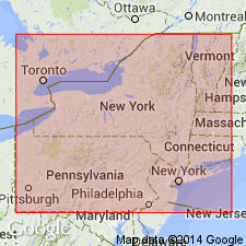
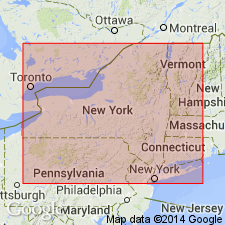
- Appalachian basin
Summary:
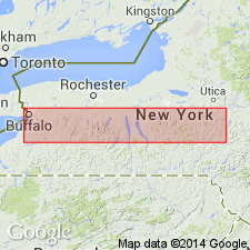
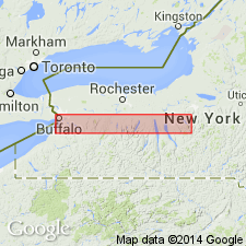
In western New York, the Tichenor limestone is not seen, and Moscow and Ludlowville shales are together reduced to thickness of 17 feet at Eighteen Mile Creek. For this 17-foot formation, which has commonly, but erroneously been called Moscow shale, author proposes name Windom shale, from exposures near village of Windom, in Erie County, western New York. Here, the Tully is scarcely represented, although there is a very persistent calcareous bed, 4 inches thick and only a few inches below top of Windom shale at Eighteen Mile Creek and on Lake Erie shore, which may indicate Tully type of sedimentation. The Windom is succeeded at the Creek by an inch or two of Genesee shale. In western Ontario, the beds equivalent to the Moscow and Ludlowville shales thicken to 150 feet. In northern Ohio, they have been eroded away.
Source: Modified from GNU records (USGS DDS-6; Reston GNULEX).
- Usage in publication:
-
- Windom member
- Modifications:
-
- Revised
- AAPG geologic province:
-
- Appalachian basin
Summary:
Revised as Windom member of Moscow formation [Moscow shale also used]. Windom was used by Grabau for the soft gray shale on Smokes Creek at Windom extending from Tichenor limestone (his Morse Creek limestone) upward to the "Pyrite." Traced eastward this shale overlies the newly named Kashong member of the Moscow formation and greatly increases in thickness from 17 ft on Eighteen Mile Creek to 50 ft at the type section [Smoke Creek], 52 ft in Genesee Valley, 120 ft in Portland Point Ravine, Cayuga Lake, 165 ft in Bucktail Ravine at Spafford Valley, and 265 ft in Unadilla Valley at New Berlin.
Source: GNU records (USGS DDS-6; Reston GNULEX).
- Usage in publication:
-
- Windom Shale Member
- Modifications:
-
- Revised
- AAPG geologic province:
-
- Appalachian basin
Summary:
Beds [informally] named in the Windom Shale Member are the Bay View coral bed in the lower part, overlain by the Smoke Creek bed (the "Coral-trilobite bed" of Brett, 1974), the Fall Brook coral bed, and the Taunton beds (the "Spirifer-coralline" zone of Stover, 1956).
Source: GNU records (USGS DDS-6; Reston GNULEX).
- Usage in publication:
-
- Windom Shale Member
- Modifications:
-
- Revised
- AAPG geologic province:
-
- Appalachian basin
Summary:
Windom Shale Member of Moscow Formation is 15 m thick in exposures along Smoke Creek in the Village of Windom, Town of Hamburg, Erie Co., NY--the type locality according to Cooper (1933). There it consists primarily of sparsely fossiliferous, medium gray mudstone with concretionary and tabular micritic limestones in the middle portion and fossil-rich-coral trilobite beds in the basal meter of the unit. More complete sections of the Windom occur in the eastern Finger Lakes area where the unit reaches 60 m and consists of medium to dark gray fossiliferous mudstones and shales with thin concretionary limestone beds. Here it is divided into many informal traceable units and a number of thin localized shell-rich beds. In ascending order, these units are 1) Little Beards Creek phosphate bed, 2) AMBOCOELIA beds, 3) DEVONOCHONETES CORONATUS beds, 4) Bay View coral bed, 5) Smoke Creek bed, 6) unnamed shale, 7) Mid Windom conodont bed, 8-10) Bear Swamp beds, 11) Fisher Gully beds, Amsdell bed, and Indian Creek bed, 12) Fall Brook coral bed, 13) Taunton beds, 14) Spezzano Gully beds, 15) Simpson Creek bed, and 16) Gage Gully beds. Between Chenango Valley in the east and Bristol Valley to the west, the Windom overlies a newly recognized but yet unnamed member of the Moscow. Age is Middle Devonian (Givetian).
Source: GNU records (USGS DDS-6; Reston GNULEX).
- Usage in publication:
-
- Windom Shale Member*
- Modifications:
-
- Overview
- AAPG geologic province:
-
- Appalachian basin
Summary:
Used as Middle Devonian Windom Shale Member of Moscow Formation.
Source: GNU records (USGS DDS-6; Reston GNULEX).
For more information, please contact Nancy Stamm, Geologic Names Committee Secretary.
Asterisk (*) indicates published by U.S. Geological Survey authors.
"No current usage" (†) implies that a name has been abandoned or has fallen into disuse. Former usage and, if known, replacement name given in parentheses ( ).
Slash (/) indicates name conflicts with nomenclatural guidelines (CSN, 1933; ACSN, 1961, 1970; NACSN, 1983, 2005, 2021). May be explained within brackets ([ ]).