


- Usage in publication:
-
- Winchell member
- Modifications:
-
- Named
- Dominant lithology:
-
- Limestone
- Shale
- Sandstone
- AAPG geologic province:
-
- Bend arch
Summary:
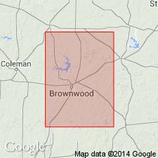
Named as uppermost member of Graford formation (revised) of Canyon group. No type locality designated. Probably named for town of Winchell, Brown Co, TX on Bend arch, near which sections are measured. Term "Merriman limestone" [of Sellards, 1932] seems undesirable, and term Winchell replaces it. Winchell is a group of thin limestones separated by thick shale beds and thin sandstones, occurring above the Cedarton shale member [of Graford] and below the shale underlying Ranger limestone member of Brad formation (which was included in the Placid shale member of Brad formation of Plummer and Moore, [1922]). This definition of Winchell includes the Clear Creek Bed of Drake (1893), plus the higher beds formerly included in Placid shale. Winchell is uppermost member of Graford in the Colorado River region of north-central TX. Upper member of Graford in Palo Pinto Co and Brazos Valley, to north, consists of similar deposits. Lowest limestone of Winchell is that which caps the escarpment west of Winchell, and top is the limestone bed that forms the broad bench about 1 mi northwest of Winchell (on which is set benchmark 1358). At the benchmark, Winchell is 72 ft thick; thickens to west. Consists mostly of limestone beds, fossiliferous, variable in thickness and character. Sandstone occurs at two horizons. Shale beds intervening between sandstones and limestones are generally gray, though some reddish and purplish beds are seen. Pennsylvanian age.
Source: GNU records (USGS DDS-6; Denver GNULEX).
- Usage in publication:
-
- Winchell limestone
- Modifications:
-
- Revised
- AAPG geologic province:
-
- Bend arch
Summary:
Winchell revised--overlies newly named Brookesmith formation in report area, Brown Co, TX on Bend arch. Name Graford formation, as defined by the USGS in 1960--with Brownwood shale member (at base), Adams Branch limestone, and Cedarton shale member (at top)--not used; Brookesmith formation, a new name, is proposed instead. Brookesmith includes Adams Branch limestone member (base) and Cedarton shale member (top). The Winchell is divided into lower, middle, and upper unnamed members. Winchell underlies the Placid shale (revised--removed as a shale member of Brad formation, which is not used, and rank raised to formational status). Stratigraphic chart. Of Canyon [Pennsylvanian] age. [Author does not capitalize rank terms; however, units are considered to be formal.]
Source: GNU records (USGS DDS-6; Denver GNULEX).

- Usage in publication:
-
- Winchell Limestone
- Modifications:
-
- Areal extent
- AAPG geologic province:
-
- Fort Worth syncline
Summary:
Mapped as a formation of Canyon Group in the southeastern part of the mapped area, north-central TX (ascending): Palo Pinto Formation, Wolf Mountain Shale, Winchell Limestone, Placid Shale, Ranger Limestone, Colony Creek Shale, and Home Creek Limestone. Farther east, Canyon is divided into (ascending): Willow Point Formation, Jasper Creek Formation and its Chico Ridge Limestone [unranked], Ventioner Formation, Ranger Limestone, and Colony Creek Shale. Winchell and the overlying Placid are partially equivalent to part of Ventioner Formation, to east. Winchell is mostly limestone, gray to white, fine grained to coarsely bioclastic, thin bedded, irregularly bedded and nodular, contains abundant phylloid algae, crinoid fragments, bryozoans, and brachiopods; locally contains intercalated shale several inches thick. Forms a prominent dip slope and escarpment in southern Jack Co (Fort Worth syncline). Continues into northernmost Palo Pinto Co (Bend arch). Is 20-40 ft thick. Age is Missouri (Late Pennsylvanian). Geologic map.
Source: GNU records (USGS DDS-6; Denver GNULEX).
For more information, please contact Nancy Stamm, Geologic Names Committee Secretary.
Asterisk (*) indicates published by U.S. Geological Survey authors.
"No current usage" (†) implies that a name has been abandoned or has fallen into disuse. Former usage and, if known, replacement name given in parentheses ( ).
Slash (/) indicates name conflicts with nomenclatural guidelines (CSN, 1933; ACSN, 1961, 1970; NACSN, 1983, 2005, 2021). May be explained within brackets ([ ]).