

- Usage in publication:
-
- Willow Gap Limestone Member
- Modifications:
-
- Named
- Biostratigraphic dating
- Dominant lithology:
-
- Limestone
- AAPG geologic province:
-
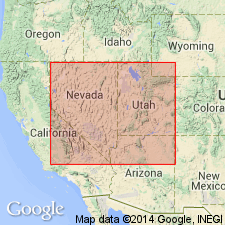
- Great Basin province
Summary:
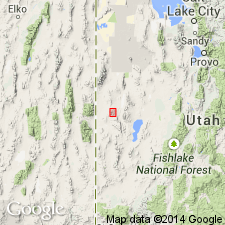
Named as second from youngest (of 6) members of Chainman Formation. Occurs along UT-NV state boundary. Forms carbonate banks 300 ft thick. Overlies Donner Member (new); underlies Jensen Member (new) (both of Chainman Formation). SPIRIFER BRAZERIANUS [brachiopod] Zone (middle late Chesterian) occurs within CRAVENOCERAS HESPERIUM Zone [cephalopod] in Willow Gap Limestone Member. CANINIA cf NEVADENSIS and CANINIA EXCENTRICA [coral] occur in upper beds. Age is Chesterian [Late Mississippian].
Source: GNU records (USGS DDS-6; Menlo GNULEX).
- Usage in publication:
-
- Willow Gap Member
- Modifications:
-
- Areal extent
- Biostratigraphic dating
- AAPG geologic province:
-
- Great Basin province
Summary:
Shown in stratigraphic section of Skunk Spring Canyon area, Confusion Range, UT, as Willow Gap Member of Sadlick (1966) (of Chainman Shale). Is 335 ft thick. Overlies unnamed middle member; underlies Jensen Member of Sadlick (1966) (both of Chainman Shale). Is Chesterian age (Late Mississippian). Is interpreted to be westward-prograding shallow-water carbonate platform. Lowest occurrence of CAVUSGNATHUS NAVICULUS permits assignment of bed to C. NAVICULUS Zone.
Source: GNU records (USGS DDS-6; Menlo GNULEX).
- Usage in publication:
-
- Willow Gap Limestone Member*
- Modifications:
-
- Mapped 1:24k
- Dominant lithology:
-
- Limestone
- Shale
- AAPG geologic province:
-
- Great Basin province
Summary:
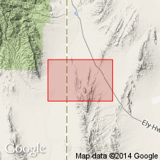
Is mapped as a member (Chesterian) of Chainman Formation (Mississippian) in northern part of Mountain Home Range in western Millard Co, southwest UT (Great Basin province). Subdivisions of the Chainman mostly follow Sadlick (1965) with addition of two members below his Needle Member. Sandberg and others (1980) have listed conodont zones using Sadlick's subdivisions. Overlies Camp Canyon Member (Chesterian and Meramecian) of Chainman. Overlain by Jensen Member (Chesterian) of Chainman. Map unit described as limestone, medium-dark-gray, silty, thick-bedded, forms ridges; lacy bryozoans, crinoid stems, gastropods, corals, and brachiopod fragments are present but not common; includes some olive-gray shale interbeds; thickness ranges from 110 m in The Cove to 80 m on to east flank of Mountain Home Range.
Source: GNU records (USGS DDS-6; Denver GNULEX).

- Usage in publication:
-
- Willow Gap Limestone Member*
- Modifications:
-
- Mapped 1:24k
- Dominant lithology:
-
- Limestone
- AAPG geologic province:
-
- Great Basin province
Summary:
Is mapped as a member (Chesterian) of Chainman Formation (Mississippian) in central part of Mountain Home Range in southwestern Millard Co, southwest UT (Great Basin province). Subdivisions of the Chainman mostly follow Sadlick (1965, 1966) with addition of Delle Phosphatic Member (Sandberg and Gutschick, 1984) at base of formation. Sandberg and others (1980) have listed Chainman conodont zones using Sadlick's subdivisions. Overlies Camp Canyon Member (Chesterian and Meramecian) of Chainman. Overlain by Jensen Member (Chesterian) of Chainman. Map unit described as medium-dark-gray, silty, thin- to medium-bedded limestone, forms ledges and low ridges; includes some zones with abundant bryozoan, crinoid, and brachiopod fragments; includes some olive-gray silty and shaly interbeds that form talus-covered slope; thickness 60-80 m.
Source: GNU records (USGS DDS-6; Denver GNULEX).
For more information, please contact Nancy Stamm, Geologic Names Committee Secretary.
Asterisk (*) indicates published by U.S. Geological Survey authors.
"No current usage" (†) implies that a name has been abandoned or has fallen into disuse. Former usage and, if known, replacement name given in parentheses ( ).
Slash (/) indicates name conflicts with nomenclatural guidelines (CSN, 1933; ACSN, 1961, 1970; NACSN, 1983, 2005, 2021). May be explained within brackets ([ ]).