The National Geologic Map Database is migrating to a new infrastructure. We apologize for any service disruptions during this process.
|
|---|


- Usage in publication:
-
- Williams Canyon limestone*
- Modifications:
-
- Original reference
- Dominant lithology:
-
- Limestone
- Shale
- Sandstone
- AAPG geologic province:
-
- Denver basin
Summary:
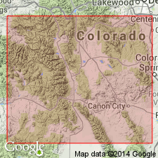
Pg. 381-396. Williams Canyon limestone. About 80 feet of thin-bedded limestones and calcareous shales occur in section along Front Range unconformably below Madison limestone (Mississippian) and unconformably above Ordovician beds (Manitou, Harding, or Fremont). Typically exposed near Cave of Winds, in Williams Canyon at Manitou, El Paso County, eastern Colorado. Excellent exposures in Manitou Park, at Perry Park, in Canyon City embayment, and at Beulah, on east slope of Wet Mountains. Consists of thin white to gray limestones 2 to 6 inches thick, with partings of gray calcareous shale and occasional thin sandstones. Occurs in all sections measured except between Manitou Springs and Oil Creek section. Maximum thickness (65 feet) at Missouri Gulch, in Manitou Park. Whitman Cross (USGS Pikes Peak folio, no. 7) applied Millsap limestone to 30 feet of thin-bedded dolomitic limestone with a few thin sandstone layers exposed between Oil and Millsap Creeks, northeast of Canyon City; chert nodules in upper part carry fossils identified as Carboniferous. This series is believed by writers to be = the thin-bedded section in Williams Canyon and the chert nodules derived from erosion of overlying Madison and deposited in the basal Pennsylvanian, which in this area overlies the thin-bedded limestones. The name Millsap might be applied to the thin-bedded section at Beulah were it not preoccupied in Texas. Careful search revealed no fossils, either macro or micro, but writers are inclined to believe the Williams Canyon limestone is = the Parting and of Devonian age. [The application in this report of Madison limestone (Mississippian) to 100 feet of light-gray, very dense, massive limestone, containing much brecciated material but practically without bedding, separating their Williams Canyon limestone from the overlying Fountain formation, is explained as follows:] "The massive limestones below the Pennsylvanian Fountain formation northwest of Beulah, at Manitou Springs, and in Manitou Park and some distance northward have been recognized as true Mississippian and essentially equivalent to the Madison of Wyoming and Montana. Although this is largely a lithologic correlation, a number of Mississippian fossils have been found at Beulah and in Manitou Park, and a crinoid (ACTINOCRINUS MARCOUI Collignon) of Kinderhook age was found by Marcou in the limestone in Williams Canyon." "The Madison is the equivalent of Leadville limestone of the west slope and essentially equivalent to the Madison of Wyoming, Idaho, and Montana." Age is Devonian(?).
Source: US geologic names lexicon (USGS Bull. 896, p. 233).
- Usage in publication:
-
- Williams Canyon limestone*
- Modifications:
-
- Areal extent
- Revised
- AAPG geologic province:
-
- Denver basin
- Las Vegas-Raton basin
Summary:
Is present at most sections measured in this report. Ranges from 16 ft near Beulah to about 55 ft thick at Missouri Gulch. Is present in Fremont, Douglas, and Pueblo Cos, CO in the Denver basin, and in Custer Co, CO in the Las Vegas-Raton basin. Usually is a thin-bedded, lavender- to purple-mottled, gray to buff, finely granular to finely crystalline limestone, dolomitic limestone, dolomite, and sandy dolomite with a few layers of pink to lavender, fine- to medium-grained sandstone. Unconformably overlies Fremont limestone; unconformably underlies Hardscrabble limestone (a new name). Is similar to Spergen limestone of subsurface of eastern CO. Mississippian age. Cross sections.
Source: GNU records (USGS DDS-6; Denver GNULEX).
- Usage in publication:
-
- Williams Canyon formation
- Modifications:
-
- Contact revised
- AAPG geologic province:
-
- Denver basin
Summary:
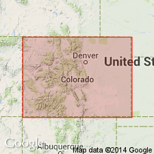
Lower contact revised in that Williams Canyon unconformably overlies the newly named Priest Canyon member, upper member of the Fremont formation in Priest Canyon (S1/2 NE1/4 sec 13, T18S, R71W), Fremont Co, CO in the Denver basin. [Age not stated.]
Source: GNU records (USGS DDS-6; Denver GNULEX).
- Usage in publication:
-
- Williams Canyon Formation*
- Modifications:
-
- Age modified
- AAPG geologic province:
-
- Denver basin
- Las Vegas-Raton basin
Summary:
Considered to be the only known Devonian unit east of the Front Range, CO in the Denver and Las Vegas-Raton basins. Areal extent map. Thought to be equivalent to the Dyer Dolomite of the Chaffee Group. Correlation chart. [Devonian age and stated possible equivalence to Dyer noted on USGS Map MF-548. Age change from Mississippian to Devonian noted in USGS Map I-1022.] Overlies Ordovician Fremont Limestone.
Source: GNU records (USGS DDS-6; Denver GNULEX).
- Usage in publication:
-
- Williams Canyon Formation*
- Modifications:
-
- Age modified
- AAPG geologic province:
-
- Denver basin
Summary:
Age modified in central CO, Denver basin, from Devonian to Early Mississippian on basis of a study (Hill, 1983, unpublished thesis) that described an intertonguing relationship between the Williams Canyon and the overlying Leadville Limestone, and presence of ostracod and brachiopod faunas.
Source: GNU records (USGS DDS-6; Denver GNULEX).
For more information, please contact Nancy Stamm, Geologic Names Committee Secretary.
Asterisk (*) indicates published by U.S. Geological Survey authors.
"No current usage" (†) implies that a name has been abandoned or has fallen into disuse. Former usage and, if known, replacement name given in parentheses ( ).
Slash (/) indicates name conflicts with nomenclatural guidelines (CSN, 1933; ACSN, 1961, 1970; NACSN, 1983, 2005, 2021). May be explained within brackets ([ ]).