

- Usage in publication:
-
- Wilhite slate
- Modifications:
-
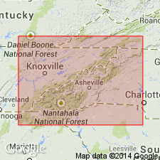
- Areal extent
- AAPG geologic province:
-
- Appalachian basin
Summary:
Pg. 196-198. Named Wilhite slate by A. Keith. Rarely exceeds 700 feet in thickness. Is capped by siliceous Citico conglomerate of Keith. Within Wilhite slate, especially in upper 200 feet, numerous beds of limestone occur. Usually a limestone conglomerate is found in same section, above the bedded limestone. Exceptional to find a bedded limestone above the conglomerates in the Wilhite slates, but large boulders of limestone were observed above main conglomerate bed in Wilhite slates on Wilhite Creek, eastern Tennessee. Age is Early Cambrian.
Source: US geologic names lexicon (USGS Bull. 896, p. 2337).
- Usage in publication:
-
- Wilhite slate*
- Modifications:
-
- Original reference
- Dominant lithology:
-
- Limestone
- Conglomerate
- Slate
- Argillite
- AAPG geologic province:
-
- Appalachian basin
Summary:
(and USGS Loudon folio, no. 25, 1896). Wilhite slate. [Consists of limestone conglomerates and sandy limestone in upper part and bluish-black argillaceous and calcareous slate in lower part; reaches a thickness of 1,000 feet; underlies Citico conglomerate; and is oldest formation in area. Age is Early Cambrian. [Is considered = lower part of Hiwassee slate.]
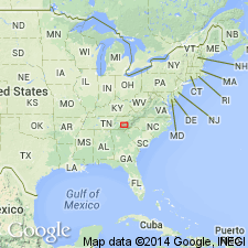
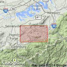
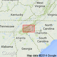
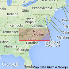
[Named from exposures on Wilhite Creek, Sevier Co., eastern TN. Extends into western NC.]
Source: US geologic names lexicon (USGS Bull. 896, p. 2337).
- Usage in publication:
-
- Wilhite slate
- Modifications:
-
- Age modified
- Areal extent
- AAPG geologic province:
-
- Appalachian basin
Summary:
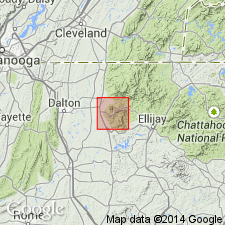
Wilhite slate mapped in Chatsworth talc district, Murray Co., GA. Doesn't seem to correspond entirely to description of Wilhite to the north; thus, its age is in question. Separately mapped from Ocoee rocks as it doesn't appear to belong to that series lithologically.
Source: GNU records (USGS DDS-6; Reston GNULEX).
- Usage in publication:
-
- Wilhite slate*
- Modifications:
-
- Revised
- AAPG geologic province:
-
- Appalachian basin
Summary:
Wilhite slate as used by Keith (1895) is considered a synonym of Sandsuck shale.
Source: GNU records (USGS DDS-6; Reston GNULEX).
- Usage in publication:
-
- Wilhite formation*
- Modifications:
-
- Revised
- Age modified
- AAPG geologic province:
-
- Appalachian basin
Summary:
Revised (redefined) as a formation in Walden Creek group of Ocoee series. Is the most varied formation of Ocoee series, but is dominated by clastic rocks with some carbonates. Near its type locality at Wilhite Creek, is divided into lower Dixon Mountain member, composed of siltstone, and upper Yellow Breeches member, composed of limestone and dolomite. Age changed to later Precambrian.
Source: GNU records (USGS DDS-6; Reston GNULEX).
- Usage in publication:
-
- Wilhite formation*
- Modifications:
-
- Areal extent
- AAPG geologic province:
-
- Appalachian basin
Summary:
Wilhite formation of Walden Creek group of Ocoee series includes both Dixon Mountain and Yellow Breeches member in map area. Were this area to be considered alone, both members would be accorded formation rank as they are distinctive assemblages; however, subdivisions cannot be made to the west. Dixon Mountain member adjoins and probably overlies slate of Richardson Cove of Shields formation. Occupies Bearwallow Mountain, Dixon Mountain, and Chestnut Ridge and smaller areas near Dockery Branch and Chavis Creek. Best exposed along Dunn Creek at east end of Short Mountain, Long Branch at east end of Dixon Mountain, and Chucky Creek at east end of Chestnut Ridge. Conformably underlies Yellow Breeches member, as seen in small quarry south of junction of Valentine Branch and Dunn Creek, and is marked by sharp break between finely sandy siltstone in upper part of Dixon Mountain and limestone and other rocks of Yellow Breeches. Dixon Mountain is in fault contact with Pigeon and Sandsuck formations; because the rocks are all similar, precise contact is often not found. Yellow Breeches member is well exposed along Yellow Breeches Creek as well as between Short and Bearwallow Mountains, and along Dunn Creek, Wilhite Creek, Long Branch, Large Branch, and Chavis Creek. Limestone of Yellow Breeches makes abundant outcrops in valleys, but its other types do not. Yellow Breeches has two divisions: a lower unit of varied pelitic rocks with lesser amounts of sandstone and carbonates, and an upper commonly sandy or conglomeratic limestone. Yellow Breeches is unique in Ocoee series in that it is the only carbonate-bearing unit. Concordantly underlies Sandsuck formation. Age is late Precambrian. Report includes geologic map, cross sections, correlation chart, and measured sections.
Source: GNU records (USGS DDS-6; Reston GNULEX).

- Usage in publication:
-
- Wilhite Formation
- Modifications:
-
- Areal extent
- AAPG geologic province:
-
- Appalachian basin
Summary:
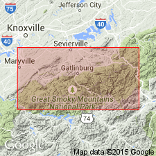
In Great Smoky Mountains, used as Precambrian Wilhite Formation of Walden Creek Group of Ocoee Supergroup.
Source: GNU records (USGS DDS-6; Reston GNULEX).
- Usage in publication:
-
- Wilhite Formation*
- Modifications:
-
- Areal extent
- AAPG geologic province:
-
- Appalachian basin
- Piedmont-Blue Ridge province
Summary:
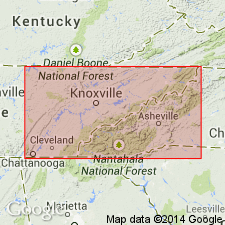
Included in Walden Creek Group of Ocoee Series. Areally extended into western NC in Great Smoky Mountains. [The names Dixon Mountain Member and Yellow Breeches Member, named by King and others (1958) are not used. Instead, the main body of Wilhite is undivided, but is described as having an upper and lower part.] Mapped in Blue Ridge belt northwest of Greenbrier-Devils Fork fault in Blount, Sevier, Cocke, and Green Cos., eastern TN, and in Madison Co., northwestern NC. Upper part is thin-bedded, dark-gray to green siltstone, silty shale, and argillite, commonly carbonatic and grading to shaly limestone, intraformational limestone conglomerate, and thick-bedded, coarse, feldspathic sandstone. Lower part is dominantly sandy metasiltstone and fine- to medium-grained, moderately feldspathic sandstone, commonly calcareous. In southwestern part of map area, contains quartz-pebble conglomerate similar to underlying Shields Formation. Includes separately mapped thick-bedded, sandy limestone unit, grading to coarse, calcareous sandstone, northeast of Pigeon River. Age is late Precambrian.
Source: GNU records (USGS DDS-6; Reston GNULEX).
- Usage in publication:
-
- Wilhite Formation
- Modifications:
-
- Areal extent
- AAPG geologic province:
-
- Piedmont-Blue Ridge province
Summary:
In Blue Ridge belt, Walden Creek Group is mapped undivided, with exception of Sandsuck Formation.
Source: GNU records (USGS DDS-6; Reston GNULEX).
- Usage in publication:
-
- Wilhite Formation
- Modifications:
-
- Age modified
- Biostratigraphic dating
- AAPG geologic province:
-
- Appalachian basin
Summary:
A newly discovered fossil assemblage in the Wilhite Formation, including trilobite, ostracode, bryozoan, and microcrinoid fragments and agglutinated foraminifers prove a Silurian or younger age for the Walden Creek Group of the Ocoee Supergroup. Deposition in a "successor" basin suggested by authors. The shale overlying the Wilhite Formation in the area south of English Mountain cannot be correlated with the Sandsuck Formation underlying the Chilhowee Group on Chilhowee Mountain and English Mountain. The name Sandsuck should not be used for this uppermost unit of the Walden Creek Group.
Source: GNU records (USGS DDS-6; Reston GNULEX).
- Usage in publication:
-
- Wilhite Formation
- Modifications:
-
- Age modified
- Geochronologic dating
- AAPG geologic province:
-
- Piedmont-Blue Ridge province
Summary:
K-Ar whole rock ages were obtained from rocks of the Wilhite Formation exposed on U.S. Hwy 129 east of Tallassee, TN. Of the five samples collected here, three have ages of approximately 480 Ma and the other two have ages of 430 Ma. This is the same location from which Unrug and Unrug (1990) reported finding middle Paleozoic microfossils.
Source: GNU records (USGS DDS-6; Reston GNULEX).
- Usage in publication:
-
- Wilhite Formation
- Modifications:
-
- Age modified
- AAPG geologic province:
-
- Piedmont-Blue Ridge province
Summary:
Discovery of shelly fossils in the Wilhite Formation by Unrug and Unrug (1990) is very important for some of the Ocoee must then be Paleozoic. A Silurian age for the Wilhite, however, has not been proven. Author suggests that fossils here belong to the Tommotian stage, known for its variety of tiny shelly fossils many without descendants.
Source: GNU records (USGS DDS-6; Reston GNULEX).
- Usage in publication:
-
- Wilhite Formation
- Modifications:
-
- Biostratigraphic dating
- Age modified
- AAPG geologic province:
-
- Appalachian basin
Summary:
New microfossil discoveries in the Little Tennessee River Valley indicate age of Walden Creek Group is Late Devonian to earliest Mississippian, and therefore related to the Acadian Orogeny. Fossils have been found along the entire outcrop belt of the Walden Creek Group from Hot Springs, NC, to the Ocoee River Gorge, TN. A conformable contact between the Walden Creek Group and the Great Smoky Group implies that the Great Smoky and possibly the entire Ocoee Supergroup are also Paleozoic. Great Smoky Group is here tentatively correlated with the Lay Dam Formation.
Source: GNU records (USGS DDS-6; Reston GNULEX).
- Usage in publication:
-
- Wilhite Formation
- Modifications:
-
- Biostratigraphic dating
- AAPG geologic province:
-
- Appalachian basin
Summary:
Upper part of the Ocoee Supergroup (the Shields, Wilhite, and Sandsuck Formations) are assigned to the Vendian (Late Proterozoic), based on occurrences of Vendian acritarchs in the Shields and Wilhite Formations. Authors state that it is beyond the scope of this paper to address the relative merits of the arguments presented by Unrug and Unrug (1990) or comment as the validity of their studies. Walker and Driese maintain that the Sandsuck, Wilhite, and Shield Formations of the Walden Creek Group form a continuous stratigraphic sequence with the overlying Chilhowee Group, which is dated here as Late Proterozoic and Early Cambrian on the basis of an assemblage of trace and body fossils --PALAEOPHYCUS, PLANOLITES, and SKOLITHOS.
Source: GNU records (USGS DDS-6; Reston GNULEX).
For more information, please contact Nancy Stamm, Geologic Names Committee Secretary.
Asterisk (*) indicates published by U.S. Geological Survey authors.
"No current usage" (†) implies that a name has been abandoned or has fallen into disuse. Former usage and, if known, replacement name given in parentheses ( ).
Slash (/) indicates name conflicts with nomenclatural guidelines (CSN, 1933; ACSN, 1961, 1970; NACSN, 1983, 2005, 2021). May be explained within brackets ([ ]).