

- Usage in publication:
-
- Wickcliff sandstone
- Modifications:
-
- Named
- Dominant lithology:
-
- Sandstone
- AAPG geologic province:
-
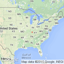
- Illinois basin
Summary:
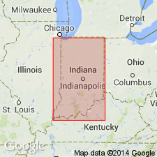
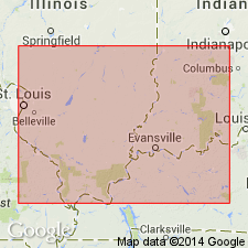
Wickcliff described as a sandstone ranging in thickness from a few ft to a maximum of 35 or 40 ft that occurs in the shales above Tar Springs sandstone and below Siberia limestone in Perry and Crawford Cos., IN, and also at Buffalo Wallow, Breckinridge Co., KY. It is usually bedded and very hard or quartzitic where its thickness is only a few ft. Where it exceeds 10 or 15 ft, it is usually quite massive and often laminated or cross-bedded. Unit is well developed along Middle Fork of Anderson Creek above Bristow to Doolittle, in Perry Co. and also along Anderson Creek northward from mouth of Sigler Creek and north of Southern Railway and south of Patoka River. Probably does not extend beyond Patoka River. Top lies about 35 ft below Siberia limestone and base is separated from underlying Tar Springs by 50 to 60 ft of shale. Wickcliff assigned to upper Chester group.
Source: GNU records (USGS DDS-6; Reston GNULEX).
- Usage in publication:
-
- Wickcliff
- Modifications:
-
- Not used
- AAPG geologic province:
-
- Illinois basin
Summary:
Wickcliff sandstone replaced by Waltersburg sandstone. Local IN names of upper Chester are dropped and formations given names of standard Chester column.
Source: GNU records (USGS DDS-6; Reston GNULEX).
- Usage in publication:
-
- Wickcliff†
- Modifications:
-
- Abandoned
- AAPG geologic province:
-
- Illinois basin
Summary:
Mentioned only in glossary where it is described as an abandoned synonym for Waltersburg Sandstone. Named by Malott (1925) for exposures of sandstone about 30 ft above massive beds of Tar Springs Sandstone where the Vienna interval is represented only by shale, near Wickcliff, Birdseye quad, Crawford Co., IN.
Source: GNU records (USGS DDS-6; Reston GNULEX).
- Usage in publication:
-
- Wickcliff Sandstone
- Modifications:
-
- Overview
- AAPG geologic province:
-
- Illinois basin
Summary:
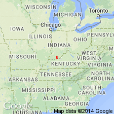
The Wickcliff Sandstone of Malott (1925). Is not equivalent to or part of the Waltersburg Formation as previously thought. Instead, the Wickcliff is very near the top of the Branchville Formation of the Buffalo Wallow Group of Indiana usage. It is equivalent to the part of the Menard Limestone that extends for a very short distance into the Indiana outcrop area. The extensive rimrock in the Newton Stewart Recreation area (Indiana) was at one time assigned to the basal Pennsylvanian Mansfield Formation by this author, but years later Chesterian conodonts were discovered in the overlying limestone (the Leopold Limestone Member of the Branchville Formation). The position of the Wickcliff appears to be the same as the productive Chapman sand in Daviess and McLean Counties, western Kentucky. Described from Survey drillhole 320, in SW/4 NW/4 SW/4, sec. 14, T. 2 S., R. 2 W., Dubois Co., IN, as 21 feet of light- to medium-gray sandstone, fine- to very fine-grained, in part interstratified with shale, lying 9.9 feet below Leopold Limestone Member and 53.2 feet above Vienna Limestone Member, which marks the base of the Branchville. The name Wickcliff has been little used and the rock unit is too insignificant to be reinstated. [Author notes that the spelling of the town for which the unit is named is Wickcliffe.]
Source: Modified from GNU records (USGS DDS-6; Reston GNULEX).
For more information, please contact Nancy Stamm, Geologic Names Committee Secretary.
Asterisk (*) indicates published by U.S. Geological Survey authors.
"No current usage" (†) implies that a name has been abandoned or has fallen into disuse. Former usage and, if known, replacement name given in parentheses ( ).
Slash (/) indicates name conflicts with nomenclatural guidelines (CSN, 1933; ACSN, 1961, 1970; NACSN, 1983, 2005, 2021). May be explained within brackets ([ ]).