The National Geologic Map Database is migrating to a new infrastructure. We apologize for any service disruptions during this process.
|
|---|


- Usage in publication:
-
- Whitwell shale*
- Modifications:
-
- Named
- Dominant lithology:
-
- Shale
- Sandstone
- Coal
- AAPG geologic province:
-
- Appalachian basin
Summary:
Named as a formation of Lee group. Named for Whitwell mines near Whitwell, Marion Co., central TN. Consists of dark, partly clayey, partly sandy shale with some thin sandstone layers and two, possibly three, coal beds including Sewanee coal at its base. Thickness is 75 to 100 ft. Overlies Sewanee conglomerate; underlies Bonair sandstone. Age is Pennsylvanian (lower Pottsville).
Source: GNU records (USGS DDS-6; Reston GNULEX).

- Usage in publication:
-
- Whitwell shale
- Modifications:
-
- Revised
- AAPG geologic province:
-
- Appalachian basin
Summary:
Whitwell shale assigned to Crab Orchard Mountains group (new). Contains Richland, Sewanee, Kelley, Slate, Oak Hill, and Clifty coals. Underlain by Sewanee conglomerate; overlain by Newton sandstone. Near Brockdell, Bledsoe Co., Whitwell is absent. Equivalent to part of Fentress formation. Age is Pennsylvanian (Pottsville series). Report includes geologic maps, cross sections, stratigraphic sections, and correlation chart.
Source: GNU records (USGS DDS-6; Reston GNULEX).
- Usage in publication:
-
- Whitwell Shale Member*
- Modifications:
-
- Revised
- AAPG geologic province:
-
- Appalachian basin
Summary:
New nomenclature defined in this report for northwest GA. Johnson's (1946) nomenclature based on miscorrelation with rock units of TN. Whitwell Shale is herein classified as a member of Crab Orchard Mountains Formation. Overlies Sewanee Member; underlies Newton Sandstone Member. Thickness 150 to 200 ft.
Source: GNU records (USGS DDS-6; Reston GNULEX).

- Usage in publication:
-
- Whitwell Shale
- Modifications:
-
- Areal extent
- AAPG geologic province:
-
- Appalachian basin
Summary:
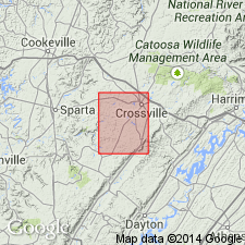
(East-central sheet; not separately mapped.) Whitwell Shale of Crab Orchard Mountains Group. Mostly dark-gray to light-brown shale with minor siltstone; locally middle part is sandstone. Richland coal near base; Sewanee coal in upper part. Thickness as much as 220 feet; average about 75 feet. Lies below Newton Sandstone and above Sewanee Conglomerate; both of Crab Orchard Mountains Group. Age is Pennsylvanian.
Source: Publication.

- Usage in publication:
-
- Whitwell Shale
- Modifications:
-
- Overview
- AAPG geologic province:
-
- Appalachian basin
Summary:
Whitwell Shale of Crab Orchard Mountains Group mapped in Roane Co., eastern TN. Consists of medium dark gray to grayish-black and black, silty shale with plant fossils and ironstone nodules scattered throughout, carbonaceous adjacent to coals. Shale is interlaminated sandstone, very fine grained, light-gray sandstone and medium dark gray, flasered, and burrowed shale. Thin Sewanee coal occurs locally just above middle, and Richland coal occurs throughout quad at or near base. Both coals underlain by seat earth, rooted medium-gray siltstone, and dark-gray to olive-black siltstone. Thickness ranges from 30 to 100 ft. Overlies Sewanee Conglomerate and underlies Newton Sandstone, both of Crab Orchard Mountains Group. Age is Early Pennsylvanian.
Source: GNU records (USGS DDS-6; Reston GNULEX).

- Usage in publication:
-
- Whitwell Shale*
- Modifications:
-
- Overview
- AAPG geologic province:
-
- Appalachian basin
Summary:
Whitwell Shale or Whitwell Formation is used only in TN. Includes all strata between Sewanee Conglomerate and Newton Sandstone.
Source: GNU records (USGS DDS-6; Reston GNULEX).
For more information, please contact Nancy Stamm, Geologic Names Committee Secretary.
Asterisk (*) indicates published by U.S. Geological Survey authors.
"No current usage" (†) implies that a name has been abandoned or has fallen into disuse. Former usage and, if known, replacement name given in parentheses ( ).
Slash (/) indicates name conflicts with nomenclatural guidelines (CSN, 1933; ACSN, 1961, 1970; NACSN, 1983, 2005, 2021). May be explained within brackets ([ ]).