The National Geologic Map Database is migrating to a new infrastructure. We apologize for any service disruptions during this process.
|
|---|


- Usage in publication:
-
- Whitsett beds
- Modifications:
-
- Original reference
- Dominant lithology:
-
- Clay
- Sand
- Ash
- AAPG geologic province:
-
- Gulf Coast basin
Summary:
Pg. 424-436. Whitsett beds. Greenish-gray and yellow waxy or carbonaceous clays and sandy clays, with some of chocolate color, interbedded with yellow, gray, pink, and brown sands; beds of volcanic ash occur. The formation is characterized by opalized wood and chalcedony; aragonite is common; dark septarial concretions occur throughout. Unconformably underlie Frio group and unconformably overlie and overlap true Fayette sandstone, but were included in Fayette sandstone as defined by writer. [These beds were included in Frio clay as mapped by A. Deussen in USGS Prof. Paper 126.]
[Exposed south of town of Whitsett, Live Oak Co., southwestern TX coastal plain, but town is built on Fayette sandstone.]
Source: US geologic names lexicon (USGS Bull. 896, p. 2328-2329).

- Usage in publication:
-
- Whitsett beds†
- Modifications:
-
- Abandoned
- AAPG geologic province:
-
- Gulf Coast basin
Summary:
†Whitsett beds. This name was in 1929 discarded by the USGS for its publications, the upper part having been included in Frio clay as mapped by Deussen in USGS Prof. Paper 126, and the lower part being the upper part of Fayette sandstone. (See Julia Gardner and A.C. Trowbridge, AAPG Bull., v. 15, 1931, no. 4, p. 470.)
Source: US geologic names lexicon (USGS Bull. 896, p. 2328-2329).
- Usage in publication:
-
- Whitsett formation
- Modifications:
-
- Principal reference
- Revised
- AAPG geologic province:
-
- Gulf Coast basin
Summary:
Pg. 1310+. Whitsett formation, upper third of Jackson group. Includes all beds from top of Manning beds of McElroy formation to base of Frio; therefore it includes Lipan beds and overlying Whitsett beds of Dumble. Unfortunately Dumble did not give type locality for his Whitsett beds. The section he described in 1902, in bluff 90 feet high on east bank of Atascosa River, near Whitsett's house in sec. 48, Reiffert and Forbese 109-acre tract of Juan Houligan survey, is included within Whitsett formation (in Dubose zone) as is here used, and is selected by writer for type locality of Whitsett formation. The formation varies in lithologic character across the State, and can be divided on the surface into lithologic as well as paleontologic zones. In southwestern Texas these zones have been named (descending): Olmos sand, Fashing clays, Calliham sand, Dubose sands and shale, Stone's Switch sand, Falls City shale, and Dillworth sand. In eastern Texas, the zone below Calliham sand have been named Glendale beds, Mitchell's Ferry beds, and Dilworth sand. Jackson group of southern Texas is here divided into (descending) Whitsett formation, McElroy formation, and Cadell formation, which are = Fayette formation of the USGS.
Source: US geologic names lexicon (USGS Bull. 896, p. 2328-2329).

- Usage in publication:
-
- Whitsett member
- Modifications:
-
- Revised
- AAPG geologic province:
-
- Gulf Coast basin
Summary:
Pg. 530, 680, 685, 686-687, 694, 695, 696. Whitsett member, upper member of Fayette formation (Jackson Eocene). Definitely limited at base by top of McElroy or Lipan member of Fayette and overlain by Frio or Catahoula formations. [He restricted McElroy member to eastern Texas and Lipan member to central and southern Texas.]
Source: US geologic names lexicon (USGS Bull. 896, p. 2328-2329).
- Usage in publication:
-
- Whitsett formation
- Modifications:
-
- Areal extent
- AAPG geologic province:
-
- Gulf Coast basin
Summary:
Pg. 501. Jackson group is here divided into (descending) Whitsett, McElroy, and Caddell, following 1933 classification of Miss Ellisor; and, also following Miss Ellisor, Fayette is abandoned and Whitsett is substituted.
Source: US geologic names lexicon (USGS Bull. 896, Fayette entry p. 723-724).
- Usage in publication:
-
- Whitsett formation
- Modifications:
-
- Areal extent
- AAPG geologic province:
-
- Gulf Coast basin
Summary:
Pg. 540. Jackson group, following Miss Ellisor, is here divided into Whitsett formation (substituted for Fayette, which is abandoned), McElroy formation and Caddell formation. [Orange, Orange County, Texas]
Source: US geologic names lexicon (USGS Bull. 896, Fayette entry p. 723-724).
- Usage in publication:
-
- Whitsett formation
- Modifications:
-
- Areal extent
- AAPG geologic province:
-
- Gulf Coast basin
Summary:
Pg. 475, 487. Continued to apply Whitsett formation to all beds from base of Dilworth sand up to base of the Vicksburg, and divided it into (descending) Olmos sand, Fashing clays, Calliham sand, Dubose sands and clays, Stone's Switch sand, Falls City shales, and Dilworth sand.
Source: US geologic names lexicon (USGS Bull. 896, p. 2328-2329).
- Usage in publication:
-
- Whitsett formation
- Modifications:
-
- Revised
- AAPG geologic province:
-
- Gulf Coast basin
Summary:
Table opp. p. 17, and p. 43-55. Restricted Whitsett formation to beds above his expanded Manning formation and below Catahoula sandstone, and defined it as consisting of 75 to 132 feet of cross-bedded sand and sandstone interbedded with some tuffaceous shale and containing opalized logs and fossil leaves. In Brazos County contains fine sandy tuff beds. Is mostly nonmarine but contains a few marine lentils in Fayette and Gonzales Counties. His restricted Whitsett formation is placed 0 to 25 feet above his Yuma sandstone, which he states may possibly be same as Dilworth sand of Ellisor, but which he places 25 to 40 feet above the Dilworth. Ellisor treated Dilworth sand as basal member of Whitsett.
Source: US geologic names lexicon (USGS Bull. 896, p. 2328-2329).
- Usage in publication:
-
- Whitsett formation*
- Modifications:
-
- Revised
- Adopted
- AAPG geologic province:
-
- Gulf Coast basin
Summary:
Pg. 2624 (fig. 1), 2626 (table 1), 2631-2634. Whitsett formation of Jackson group. Formation includes (ascending) Stones Switch sandstone, Dubose, Calliham sandstone, and Fashing clay members. Characterized chiefly by preponderance of sandstone near base and of carbonaceous tuffs and bentonitic clays near top. Overlies McElroy formation (redefined); overlain by Olmos sand of Ellisor (1933); this sand is apparently overlapped by the Catahoula. Present in south-central Texas. Age is late Eocene. Additional information on type locality.
Source: US geologic names lexicon (USGS Bull. 1200, p. 4220-4221)
- Usage in publication:
-
- Whitsett Formation
- Modifications:
-
- Mapped 1:250k
- Dominant lithology:
-
- Sand
- AAPG geologic province:
-
- Gulf Coast basin
Summary:
Pamphlet [p. 2]. Whitsett Formation. Quartz sand, fine- to medium-grained, tuffaceous, lignitic, argillaceous, locally silica cemented, light-gray. Weathers dark-gray. Fossil wood abundant. Thickness 30 to 70 feet. Lies below Catahoula Formation (Miocene) and above Manning Formation (Eocene). Age is considered Eocene or Oligocene.
[Mapped in Grimes, Polk, Trinity, Tyler, and Walker Cos., TX.]
Source: Publication.

- Usage in publication:
-
- Whitsett Formation
- Modifications:
-
- Mapped 1:250k
- Dominant lithology:
-
- Clay
- Sandstone
- AAPG geologic province:
-
- Gulf Coast basin
Summary:
Whitsett Formation. Clay, sandstone, siltstone, and tuff. Includes (descending) Dubose, Deweesville Sandstone, Conquista Clay, and Dilworth Sandstone Members (not separately mapped). Thickness 205 feet. Overlies Manning Formation (Eocene); underlies Catahoula Formation (Miocene). Age is considered Eocene and Oligocene(?).
Mapped in Karnes, Gonzales, Lavaca, and Fayette Cos., southeastern TX.
Source: Modified from GNU records (USGS DDS-6; Denver GNULEX).

- Usage in publication:
-
- Whitsett Formation
- Modifications:
-
- Mapped 1:250k
- Dominant lithology:
-
- Clay
- Sandstone
- AAPG geologic province:
-
- Gulf Coast basin
Summary:
Whitsett Formation of Jackson Group. Includes (descending) Fashing Clay Member, Calliham Sandstone Member, Dubose Clay Member, Deweesville Sandstone Member, Conquista Clay Member, and Dilworth Sandstone Member. [Composite thickness as much as 325 feet.] Is uppermost formation of Jackson Group. [Overlies Manning Formation of Jackson Group. Underlies Frio Formation (Oligocene); where Frio is absent, underlies Catahoula Formation (Miocene).] Age is Eocene.
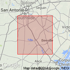
[Mapped in McMullen, Atascosa, Live Oak, Karnes, and Wilson Cos., southern TX.]
Source: Publication.
- Usage in publication:
-
- Whitsett Formation*
- Modifications:
-
- Overview
- AAPG geologic province:
-
- Gulf Coast basin
Summary:
Is upper Eocene formation studied in Karnes County, Texas (Gulf Coast basin). The Calliham and Tordilla Sandstone Members of the Whitsett Formation (upper Eocene) in south Texas have been considered by Eargle (1972) to be stratigraphic equivalents. He used the term Tordilla for a fine-grained beach sandstone unit in western Karnes County and the term Calliham for medium to coarse-grained sandstone deposited in distributary channels in Atascosa and McMullen Counties to the southwest. Studies by Dickinson of new exposures provided by the uranium mining in Karnes County show that the Calliham channels were scoured into the Tordilla beach sand, and though they are deposited physically at about the same horizon, the Calliham deposits are younger. The Calliham is equivalent in age to the Fashing Clay Member, which overlies the Tordilla in Karnes County.
Source: GNU records (USGS DDS-6; Denver GNULEX).
For more information, please contact Nancy Stamm, Geologic Names Committee Secretary.
Asterisk (*) indicates published by U.S. Geological Survey authors.
"No current usage" (†) implies that a name has been abandoned or has fallen into disuse. Former usage and, if known, replacement name given in parentheses ( ).
Slash (/) indicates name conflicts with nomenclatural guidelines (CSN, 1933; ACSN, 1961, 1970; NACSN, 1983, 2005, 2021). May be explained within brackets ([ ]).