The National Geologic Map Database is migrating to a new infrastructure. We apologize for any service disruptions during this process.
|
|---|


- Usage in publication:
-
- Whitmore Point Member
- Modifications:
-
- Named
- Dominant lithology:
-
- Siltstone
- Claystone
- AAPG geologic province:
-
- Plateau sedimentary province
- Great Basin province
Summary:
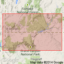
Named as middle member of Moenave Formation of Glen Canyon Group. Type section (measured) designated at Whitmore Point [for which unit was probably named] in sec 15, T40N, R5W, Mohave Co, AZ, [Plateau sedimentary province]. Unit outcrops along Vermilion Cliffs from about 10 mi east of Kanab, Kane Co, UT, to northwest end of Vermilion Cliffs at Zion National Park [Plateau sedimentary and Great Basin provinces]; along White Cliffs and Hurricane Cliffs from Zion north to Cedar City, Iron Co, UT; and around flanks of Harrisburg Dome and on northeast flank of Beaver Dam Mountains, Washington Co, UT. At type unit consists of alternating thin to thick sets of gray, greenish-gray, grayish-red, and pale-brown siltstone and claystone; minor sandy siltstone also present; stratification ranges from thin laminae to very thin beds. Eastward from type unit becomes increasingly sandy due to intertonguing of overlying Springdale Sandstone Member of Moenave; unit pinches out just west of Flag Point, about 13.5 mi northeast of Kanab. Weathers to distinctive grayish-colored slope that contrasts markedly with overlying Springdale and underlying Dinosaur Canyon Member of Moenave. Contact with underlying Dinosaur Canyon is sharp and conformable. Thickness ranges up to 116 ft at Kanab, UT; at type is 70 ft. Cross section. Fresh-water Holostean fish fossils suggest deposition in a lacustrine environment. Assigned Late Triassic? age.
Source: GNU records (USGS DDS-6; Denver GNULEX).
- Usage in publication:
-
- Whitmore Point Member*
- Modifications:
-
- Overview
- AAPG geologic province:
-
- Plateau sedimentary province
- Great Basin province
Summary:
Is the middle member of the Moenave Formation of Glen Canyon Group in southwestern UT and northwestern AZ, Plateau sedimentary and Great Basin provinces. Overlies Dinosaur Canyon Sandstone Member and underlies Springdale Sandstone Member of Moenave. Tentatively assigned an Early Jurassic, Sinemurian and Pliensbachian age on basis of palynomorphs found in member about 32 km southwest of Kanab. [Retained as Late Triassic? age by USGS.]
Source: GNU records (USGS DDS-6; Denver GNULEX).

- Usage in publication:
-
- Whitmore Point Member*
- Modifications:
-
- Areal extent
- AAPG geologic province:
-
- Great Basin province
Summary:
Mapped as middle Member of Moenave Formation in east-central Lincoln Co., NV in the Great Basin province with the overlying Springdale Sandstone Member of the Moenave. Overlies Dinosaur Canyon Member of Moenave. Is a 15 m thick red-brown mudstone with a few interbeds of mottled greenish-gray sandstone that has poorly preserved plant debris. Of Early Jurassic age.
Source: GNU records (USGS DDS-6; Denver GNULEX).
For more information, please contact Nancy Stamm, Geologic Names Committee Secretary.
Asterisk (*) indicates published by U.S. Geological Survey authors.
"No current usage" (†) implies that a name has been abandoned or has fallen into disuse. Former usage and, if known, replacement name given in parentheses ( ).
Slash (/) indicates name conflicts with nomenclatural guidelines (CSN, 1933; ACSN, 1961, 1970; NACSN, 1983, 2005, 2021). May be explained within brackets ([ ]).