- Usage in publication:
-
- Whitehorse sandstone member*
- Modifications:
-
- Original reference
- Dominant lithology:
-
- Sandstone
- Shale
- AAPG geologic province:
-
- Anadarko basin
Summary:
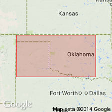
Whitehorse sandstone member of Woodward formation. [Introduced to replace preoccupied name "Red Bluff sandstone." Quotes Cragin's definition of "Red Bluff."] Extends from vicinity of Whitehorse Springs, Woods County, Oklahoma, southwest across the Cimarron to high divides beyond. Overlies Dog Creek shale and underlies Day Creek dolomite. [Age is Permian.]
Source: US geologic names lexicon (USGS Bull. 896, p. 2321).
- Usage in publication:
-
- Whitehorse sandstone
- Modifications:
-
- Revised
Summary:
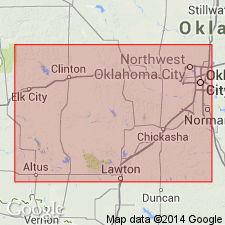
Proposed restricting Whitehorse sandstone to upper part of the Whitehorse, and named lower part Marlow formation. This usage did not prevail, and in 1929 Sawyer named his restricted Whitehorse sandstone the Rush Springs member of Whitehorse, and called the lower part the Marlow member. [Age is Permian.]
Source: US geologic names lexicon (USGS Bull. 896, p. 2321).
- Usage in publication:
-
- Whitehorse sandstone*
- Modifications:
-
- Revised
- AAPG geologic province:
-
- Anadarko basin
Summary:
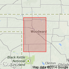
Stated that Day Creek dolomite overlies (instead of underlies) Cloud Chief gypsum, and treated the Cloud Chief as a member of the Whitehorse. [These proposed innovations are still (ca. 1936) under investigation.]
Source: US geologic names lexicon (USGS Bull. 896, p. 2321).

- Usage in publication:
-
- Whitehorse sandstone*
- Modifications:
-
- Overview
Summary:
Whitehorse sandstone. Is middle formation of Woodward group of northwestern, southwestern, and central southern Oklahoma. In central southern Kansas is in Cimarron group. The name has also been used by the Texas Geol. Survey in Texas. Age is Permian.
Source: US geologic names lexicon (USGS Bull. 896, p. 2321).
- Usage in publication:
-
- Whitehorse sandstone*
- Modifications:
-
- Mapped
Summary:
Whitehorse sandstone mapped in Double Mountain group in northwestern Texas. [Age is Permian.]
Source: US geologic names lexicon (USGS Bull. 1200, p. 4208-4209).
- Usage in publication:
-
- Whitehorse group
- Modifications:
-
- Revised
Summary:
Pg. 1526 (fig. 3), 1528. Whitehorse group. Used as group term to include Marlow, Rush Springs, and Cloud Chief formations. [Age is Permian.]
Source: US geologic names lexicon (USGS Bull. 1200, p. 4208-4209).
- Usage in publication:
-
- [Whitehorse formation]
- Modifications:
-
- Areal extent
Summary:
Pg. 422-433. Report reviews history of problem of Whitehorse nomenclature and correlation. Term Whitehorse has been loosely applied to sediments of Custer age [Permian] in Texas.
Source: US geologic names lexicon (USGS Bull. 1200, p. 4208-4209).
- Usage in publication:
-
- Whitehorse-Capitan
- Modifications:
-
- Revised
- AAPG geologic province:
-
- Permian basin
Summary:
Pg. 1706. The Whitehorse-Capitan [Eddy County, southeastern New Mexico] is subdivided from top downward into Carlsbad, Yates, Seven Rivers, and Queen. This involves redefinition of the Carlsbad. Gradation of Whitehorse into Capitan disposes of theory that Whitehorse is Triassic. [Age is Permian.]
Source: US geologic names lexicon (USGS Bull. 1200, p. 4208-4209).
- Usage in publication:
-
- Whitehorse sandstone*
- Modifications:
-
- Areal extent
- AAPG geologic province:
-
- Anadarko basin
- Sedgwick basin
Summary:
Pg. 1802-1811. In Kansas, Whitehorse sandstone can be divided into four members (ascending): Marlow, Relay Creek dolomite, an even-bedded sandstone member, and an upper shale member, the latter two representing Rush Springs-Cloud Chief members of Oklahoma section. Overlies Dog Creek shale; underlies Day Creek dolomite. Cimarron series.
Source: US geologic names lexicon (USGS Bull. 1200, p. 4208-4209).
- Usage in publication:
-
- Whitehorse group
- Modifications:
-
- Revised
Summary:
Pg. 66 (fig. 1). Chart of revised terminology shows Whitehorse group above El Ren (San Andres group). [Age is Permian.]
Source: US geologic names lexicon (USGS Bull. 1200, p. 4208-4209).
- Usage in publication:
-
- Whitehorse group
- Modifications:
-
- Areal extent
- AAPG geologic province:
-
- Permian basin
Summary:
Whitehorse group. Used as group term in Texas-New Mexico area to include (ascending) Grayburg, Queen, Seven Rivers, Yates, and Tansill formations. [Age is Permian.]
Source: US geologic names lexicon (USGS Bull. 1200, p. 4208-4209).
- Usage in publication:
-
- Whitehorse formation
- Modifications:
-
- Areal extent
Summary:
Pg. 313. Table shows Custer group comprises (ascending) Whitehorse formation, Day Creek dolomite, and Quartermaster formation. [Age is Permian.]
Source: US geologic names lexicon (USGS Bull. 1200, p. 4208-4209).
- Usage in publication:
-
- Whitehorse group*
- Modifications:
-
- Areal extent
- AAPG geologic province:
-
- Permian basin
Summary:
Pl. 2. Correlation chart shows Whitehorse group in central basin platform and Midland basin comprises (ascending) Grayburg formation, Queen sandstone, Seven Rivers formation, Yates sandstone, and Tansill formation; in eastern shelf area comprises (ascending) Childress dolomite member of Marlow formation, Eskota dolomite, and Claytonville dolomite; north-central Texas, near Red River (ascending) Marlow formation, Rush Springs formation, and Cloud Chief gypsum. Name Double Mountain group abandoned in this report. [Age is Permian.]
Source: US geologic names lexicon (USGS Bull. 1200, p. 4208-4209).
- Usage in publication:
-
- Whitehorse sandstone*
- Modifications:
-
- Areal extent
- AAPG geologic province:
-
- Anadarko basin
- Las Animas arch
- Las Vegas-Raton basin
Summary:
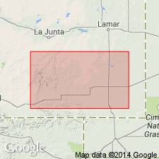
Extended into the subsurface of Otero County, Colorado, on the Las Animas arch, Las Animas County, Colorado, in the Las Vegas-Raton basin, and Baca County, Colorado, in the Anadarko basin. Is 95 to 310 feet thick. As mapped in this report, may include some of Dog Creek shale of Kansas. Overlies Blaine formation and underlies Day Creek dolomite. Age is Permian. Report includes correlation chart.
Source: Modified from GNU records (USGS DDS-6; Denver GNULEX).
- Usage in publication:
-
- Whitehorse sandstone*
- Modifications:
-
- Overview
Summary:
Pg. 36 (fig. 15), 37-38. Whitehorse sandstone of Quatermaster group. Comprises (ascending) Marlow sandstone member, Relay Creek(?) dolomite and sandstone member, even-bedded sandstone and siltstone member, and upper shale member. Thickness about 270 feet. Underlies Day Creek dolomite; overlies Dog Creek shale of Nippewalla group. [Age is Permian.]
[Misprint (US geologic names lexicon, USGS Bull. 1200, p. 4208): publication cited is Kansas Geol. Survey Bull. 89, not 81.]
Source: US geologic names lexicon (USGS Bull. 1200, p. 4208-4209).
- Usage in publication:
-
- Whitehorse group
- Modifications:
-
- Areal extent
- AAPG geologic province:
-
- Anadarko basin
- South Oklahoma folded belt
Summary:
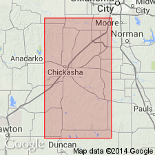
Pg. 57-81. As used in this report, name Whitehorse is group name applied to all Permian strata above El Reno group and below Cloud Chief formation. Divided into two formations (ascending) Marlow and Rush Springs. Limited above and below by unconformities. Summary of literature. [Age is Permian.]
Source: US geologic names lexicon (USGS Bull. 1200, p. 4208-4209).
- Usage in publication:
-
- Whitehorse formation
- Modifications:
-
- Overview
Summary:
Whitehorse formation comprises Marlow sandstone, Relay Creek dolostone, and unnamed member. Underlies Day Creek dolomite; overlies Dog Creek formation of Nippewalla group. Term Quatermaster group not used in this report. [Age is Permian.]
Source: US geologic names lexicon (USGS Bull. 1200, p. 4208-4209).
- Usage in publication:
-
- Whitehorse Group
- Modifications:
-
- Areal extent
- AAPG geologic province:
-
- Anadarko basin
Summary:
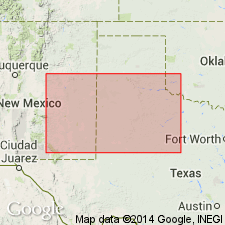
Term Whitehorse Group to be used in western OK for rocks equivalent to the newly named Artesia Group across the State line in NM and south in west TX. Name Artesia applied to the shelf sequence rocks. Geologic map. Correlation chart. Cross sections. Of late Guadalupian, Late Permian age.
Source: GNU records (USGS DDS-6; Denver GNULEX).
- Usage in publication:
-
- Whitehorse Sandstone
- Modifications:
-
- Areal extent
- AAPG geologic province:
-
- Permian basin
Summary:
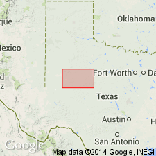
Area of report is central TX; in this area the Whitehorse Sandstone and Cloud Chief Gypsum are mapped undivided. Separately mapped units of Whitehorse and Cloud Chief include (ascending): Childress Dolomite, Eskota Gypsum, and Claytonville Dolomite. Whitehorse Sandstone and Cloud Chief Gypsum (undivided) are mapped in Nolan, Coke, and Stonewall Cos, TX; Whitehorse Sandstone, Cloud Chief Gypsum, and Blaine Formation (undivided) are mapped in Runnels and Nolan Cos, TX. Whitehorse, Cloud Chief, and Blaine (undivided) overlie Permian San Angelo Formation and underlie Permian Quartermaster Formation. Assigned to the Permian. Geologic map.
Source: GNU records (USGS DDS-6; Denver GNULEX).
- Usage in publication:
-
- Whitehorse Sandstone
- Modifications:
-
- Areal extent
- Dominant lithology:
-
- Sandstone
- AAPG geologic province:
-
- Amarillo arch
- Palo Duro basin
Summary:
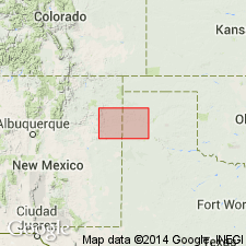
Is Permian formation mapped undivided with Quartermaster Formation and Cloud Chief Gypsum (above) in two areas along Canadian River drainage in TX Panhandle in this map sheet. Is mapped in northwest Oldham Co, TX (Palo Duro basin) and in vicinity of Tecoyas Creek in western Potter Co, TX (Amarillo arch). Map unit described as sandstone, sand, siltstone, shale, gypsum, and dolomite interbedded. Sandstone and sand, fine-grained quartz, scattered to locally abundant frosted and polished coarse quartz grains, silty, massive, friable to indurated, various shades of red and orange, orange-brown, and grayish-green. Shale and siltstone, sandy in part, indistinctly bedded to massive, indurated, thin interbeds and veins of satin spar in upper part, various shades of red and orange, reddish-brown, and grayish-green. Gypsum, white, gray, and pink.
Source: GNU records (USGS DDS-6; Denver GNULEX).
- Usage in publication:
-
- Whitehorse Sandstone
- Modifications:
-
- Areal extent
- Dominant lithology:
-
- Sandstone
- Dolomite
- Shale
- AAPG geologic province:
-
- Palo Duro basin
- Permian basin
Summary:
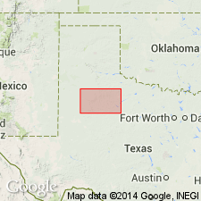
Is Permian formation mapped undivided with underlying Cloud Chief Gypsum (Permian) in mostly continuous north-south trending belt east of Caprock Escarpment in east-central part of map sheet in Motley and Cottle Cos, TX (Palo Duro basin) and in Dickens, King, Kent, and Stonewall Cos, TX (northeastern Permian basin). Overlain by Quartermaster Formation (Permian). Map unit described as sandstone, sand, shale, gypsum, and dolomite, interbedded. Sand and sandstone, fine-grained quartz, silty thin-bedded to massive, friable, orange brown, various shades of red mottled grayish green. Shale, sandy in part, indistinctly bedded to massive, red. Gypsum, massive, in part banded, beds up to 12 ft thick, white, pink. Dolomite, thin, discontinuous beds associated with gypsum, gray; units separately mapped include Claytonville Dolomite, at top, Eskota Gypsum, and Childress Dolomite, at base; Childress Dolomite forms scarp. Marine megafossils scarce. Thickness of undivided map unit 650+/-ft.
Source: GNU records (USGS DDS-6; Denver GNULEX).
For more information, please contact Nancy Stamm, Geologic Names Committee Secretary.
Asterisk (*) indicates published by U.S. Geological Survey authors.
"No current usage" (†) implies that a name has been abandoned or has fallen into disuse. Former usage and, if known, replacement name given in parentheses ( ).
Slash (/) indicates name conflicts with nomenclatural guidelines (CSN, 1933; ACSN, 1961, 1970; NACSN, 1983, 2005, 2021). May be explained within brackets ([ ]).

