- Usage in publication:
-
- Whalen group*
- Modifications:
-
- Named
- Dominant lithology:
-
- Gneiss
- Schist
- Quartzite
- Limestone
- AAPG geologic province:
-
- Northern Rocky Mountain region
Summary:
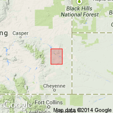
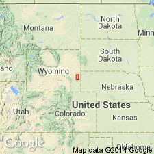
Named for occurrence in Whalen Canyon, secs 2 and 3, 9 and 10, 15 and 16, T27N, R65W and secs 34 to 36, 25 to 27, T28N, R65W, Goshen and Platte Cos, WY in the Northern Rocky Mountain region. No type locality designated. Extends to north edge of quad (T29N, R65W). Two small exposures mapped south of Laramie River in T25N, R66W. Composed of dark-gray, fine-grained quartzites, dark-gray to black, micaceous (muscovite and biotite) schists that contain some garnets, fine-grained amphibolite schists, and gray, pink siliceous limestone. Overlain by conglomeratic quartzite of the Carboniferous Guernsey formation (first used). Intruded by granite of Algonkian age. Assigned to Algonkian on basis of lithologic character and resemblance to rocks in Black Hills. Columnar sections. Geologic map.
Source: GNU records (USGS DDS-6; Denver GNULEX).
- Usage in publication:
-
- Whalen Group*
- Modifications:
-
- Biostratigraphic dating
- Age modified
- AAPG geologic province:
-
- Northern Rocky Mountain region
Summary:
Is a sequence of medium- to high-grade metamorphic and metavolcanic rocks about 3,600 m thick. Divisible into four informal units --A (at base), B, C, and D. Units A and D are dolomitic marbles that contain algal mounds. Unit A has HADROPHYCUS; unit D has STRATIFERA, GRUNERIA, and COLLUMNAEFACTA. These two occurrences of algal mounds are the 5th and 6th reported in North America. Only 12 occurrences of algal mounds are known world-wide. Is probably a shallow water deposit. Cut by the 2.58 Ga (Rb-Sr whole rock) granite of Rawhide Buttes. Metamorphosed between 2.6 and 1.7 Ga. Assigned to the Late Archean.
Source: GNU records (USGS DDS-6; Denver GNULEX).
- Usage in publication:
-
- Whalen Group*
- Modifications:
-
- Revised
- AAPG geologic province:
-
- Northern Rocky Mountain region
Summary:
Revised in that Whalen Group underlies the newly named Fremont Canyon Sandstone of Late Devonian age. Fremont Canyon replaces use of Deadwood Formation and use of Guernsey Formation in Hartville area, Platte Co, WY in the Northern Rocky Mountain region.
Source: GNU records (USGS DDS-6; Denver GNULEX).
- Usage in publication:
-
- Whalen Group*
- Modifications:
-
- Overview
- AAPG geologic province:
-
- Northern Rocky Mountain region
Summary:
Occurs in the Hartville uplift, southeast WY in the Northern Rocky Mountain region. Consists of 70 to 80 percent clastic or biochemical rocks and 20 to 30 percent extrusives or volcanic-derived sediments. Divisible into four informally named formations that total 3,700 m thick. The formation of Muskrat Canyon, 900-1,500 m thick whose base is not exposed, is a nearly pure tremolite dolomite in the southern part of the uplift and a siliceous or tremolite dolomite with layers of schist, graywacke, or quartzite in the central part of the uplift. The overlying metabasalt of Mother Featherlegs is 120 to 1,500 m thick, consists of amphibolite or chlorite schist, the lower part of which is massive and the upper part layered. The next younger formation is the schist of Silver Springs, a unit composed of schist, subgraywackes, graywackes, and quartz sandstone. The formation of Wildcat Hills, at the top, averages 450 m thick; it is composed mainly of siliceous stromatolitic dolomite that grades into dolomite and chondrodite dolomite that interfingers with peletic schist and layered amphibolite. Schist of Silver Springs is absent locally in the central part of the uplift. Shallow-water benthic microbial stromatolites found in formation of Wildcat Hills.
Source: GNU records (USGS DDS-6; Denver GNULEX).
- Usage in publication:
-
- Whalen Group*
- Modifications:
-
- Age modified
- AAPG geologic province:
-
- Southern Rocky Mountain Region
Summary:
Age modified from Late Archean to Late Archean or Early Proterozoic. Age of Whalen is equivocal because no internal isotopic ages are available. Whalen is known to be older than 1.98 Ga [Early Proterozoic] because unit is intruded by the 1.98 Ga granite of Flattop Butte and is probably older than 2.1 Ga which is authors' inferred age of deformation event D2. Zell E. Peterman (written comm., 1994) states that strontium isotope compositions of metamorphosed carbonate rocks of Whalen are permissive with an Early Proterozoic rather than Late Archean age. Early Proterozoic age is also supported by presence of Superior-type iron-formation which is characteristically Early Proterozoic age. Lastly, an Early Proterozoic age is supported by local occurrence of granite gneiss clasts within Whalen that can only be derived from an Archean basement and by moderately low metamorphic grade of supracrustal (Whalen) rocks. Study area is southeastern WY, Southern Rocky Mountain Region.
Source: GNU records (USGS DDS-6; Denver GNULEX).
For more information, please contact Nancy Stamm, Geologic Names Committee Secretary.
Asterisk (*) indicates published by U.S. Geological Survey authors.
"No current usage" (†) implies that a name has been abandoned or has fallen into disuse. Former usage and, if known, replacement name given in parentheses ( ).
Slash (/) indicates name conflicts with nomenclatural guidelines (CSN, 1933; ACSN, 1961, 1970; NACSN, 1983, 2005, 2021). May be explained within brackets ([ ]).

