The National Geologic Map Database is migrating to a new infrastructure. We apologize for any service disruptions during this process.
|
|---|


- Usage in publication:
-
- Weaverton [Weverton] sandstone*
- Modifications:
-
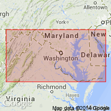
- Areal extent
- Dominant lithology:
-
- Sandstone
- AAPG geologic province:
-
- Piedmont-Blue Ridge province
Summary:
(As reported by G.H. Williams and W.B. Clark, in Maryland, its resources, industries, and institutions, chap. 3, p. 68. The formation was described, but not named, by Keith in Amer. Geol., v. 10, p. 365, 1892.) Weaverton sandstone. Gray massive sandstone, often coarse and feldspathic. Thickness 1,000 to 1,200 feet. Underlies Harper's Ferry shales [Harpers shale] and overlies Loudon shales [Loudoun formation]. Age is Early Cambrian.
[Named from exposures at Weverton (correct spelling), Washington Co., western MD. Recognized in VA, WV, MD, and southeastern PA.]
Source: US geologic names lexicon (USGS Bull. 896, p. 2314).
- Usage in publication:
-
- Weverton formation*
- Modifications:
-
- Revised
- AAPG geologic province:
-
- Piedmont-Blue Ridge province
Summary:
Weverton formation described in Elkton area, VA, where it is included in Chilhowee group. Divided into three members: lower, conglomerate and coarse-grained feldspathic quartzite; middle, persistent body of argillaceous shale; upper, contains numerous beds of quartzite, many of which are dark and ferruginous, between are layers of thin-bedded siltstone and fine-grained gray sandstone. Thickness 1,000 to 1,600 ft.
Source: GNU records (USGS DDS-6; Reston GNULEX).
- Usage in publication:
-
- Weverton Formation*
- Modifications:
-
- Age modified
- AAPG geologic province:
-
- Piedmont-Blue Ridge province
Summary:
The age of the Chilhowee Group is considered Late Proterozoic and Early Cambrian. The Weverton Formation is changed to Late Proterozoic and the overlying Harpers and Antietam Formations are of Early Cambrian(?) and Early Cambrian age, respectively.
Source: GNU records (USGS DDS-6; Reston GNULEX).
- Usage in publication:
-
- Weverton Formation
- Modifications:
-
- Revised
- AAPG geologic province:
-
- Piedmont-Blue Ridge province
Summary:
Nunan (1979: Univ. of NC Ph.D. thesis) measured and described type section of Weverton along U.S. 340 through South Mountain, where he subdivided unit into three members: Loft Mountain, Oregon Hollow and Dismal Hollow. Members are shown on table 1. Age is considered Early Cambrian.
Source: GNU records (USGS DDS-6; Reston GNULEX).
- Usage in publication:
-
- Weverton Formation
- Modifications:
-
- Revised
- AAPG geologic province:
-
- Piedmont-Blue Ridge province
Summary:
The Weverton Formation is divided into three members on the western side of the Blue Ridge in MD, VA, and PA (ascending): Buzzard Knob, Maryland Heights, and Owens Creek Members. The Buzzard Knob Member consists of medium-light-gray, medium- to coarse-grained, medium-bedded quartzite (125 to 175 feet thick). The Maryland Heights Member consists of interbedded, dark-greenish-gray, sandy metasiltstone, medium-gray, coarse-grained metagraywacke, and medium-light-gray quartzite (300 to 500 feet thick). The Owens Creek Member consists of medium- to dark-gray, medium-bedded, coarse-grained to conglomeratic metagraywacke (100 to 150 feet thick). Thickness of the Weverton is 550 to 825 feet. Overlies the Loudoun Formation and underlies the Harpers Formation.
Source: GNU records (USGS DDS-6; Reston GNULEX).
- Usage in publication:
-
- Weverton Formation*
- Modifications:
-
- Overview
- AAPG geologic province:
-
- Piedmont-Blue Ridge province
Summary:
Nasons Formation (new) of central VA correlates with Weverton Formation and basal part of Chilhowee Group exposed elsewhere along flanks of Blue Ridge anticlinorium.
Source: GNU records (USGS DDS-6; Reston GNULEX).
- Usage in publication:
-
- Weverton Formation*
- Modifications:
-
- Overview
- AAPG geologic province:
-
- Piedmont-Blue Ridge province
Summary:
The Weverton Formation is divided into lower and upper members. The lower member is a light-gray, medium- to fine-grained, well sorted, graded and cross-bedded quartzite. Lower member is massive to thick-bedded at base and top. The middle part of the lower member is thin-bedded and contains light-gray, phyllitic metasiltstone. Thickness of the lower member is 183 meters. The upper member is a dark-greenish-gray phyllitic metasiltstone, dusky-blue to dark-gray quartz-pebble conglomerate, and greenish-gray quartz-pebble conglomeratic quartzite. Upper member is poorly sorted, thick-bedded, graded and cross-bedded. Unit contains local accumulations of magnetite, ilmenite, red jasper, red and purple quartz, and phyllite clasts. The top of the upper member is placed at top of quartz-pebble conglomeratic quartzite; bottom of unit is placed at phyllitic metasiltstone overlying quartzite of the lower member. Thickness of the upper member is 122 feet. The Weverton Formation overlies the Catoctin Formation and underlies the Harpers Formation. Unit is of Early Cambrian age.
Source: GNU records (USGS DDS-6; Reston GNULEX).
- Usage in publication:
-
- Weverton Quartzite*
- Modifications:
-
- Revised
- Overview
- AAPG geologic province:
-
- Piedmont-Blue Ridge province
Summary:
Revised as Weverton Quartzite of Chilhowee Group [new rank term in Chilhowee]. Consists of grayish-white- to cream-weathering, massive to thickly bedded, vitreous orthoquartzite about 30-46 m (100-150 ft) thick. Overlies Loudoun or Catoctin Formations with apparently sharp contact; gradational contact with overlying Harpers Formation. Age is Early Cambrian. Report includes geologic map, cross sections, and correlation chart.
Source: GNU records (USGS DDS-6; Reston GNULEX).
- Usage in publication:
-
- Weverton Formation*
- Modifications:
-
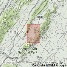
- Areal extent
- AAPG geologic province:
-
- Piedmont-Blue Ridge province
Summary:
Geographically extended the Buzzard Knob, Maryland Heights, and Owens Creek Members into easternmost WV. Members are mapped in MD, VA, and WV of the Harpers Ferry quad.
Source: GNU records (USGS DDS-6; Reston GNULEX).
For more information, please contact Nancy Stamm, Geologic Names Committee Secretary.
Asterisk (*) indicates published by U.S. Geological Survey authors.
"No current usage" (†) implies that a name has been abandoned or has fallen into disuse. Former usage and, if known, replacement name given in parentheses ( ).
Slash (/) indicates name conflicts with nomenclatural guidelines (CSN, 1933; ACSN, 1961, 1970; NACSN, 1983, 2005, 2021). May be explained within brackets ([ ]).