- Usage in publication:
-
- West Franklin limestone
- Modifications:
-
- Principal reference
- Dominant lithology:
-
- Limestone
- Shale
- AAPG geologic province:
-
- Illinois basin
Collett, John, 1884, Geology of Posey County, Indiana: Indiana Department of Geology and Natural Resources Annual Report, no. 13, p. 45-70.
Summary:
Pg. 61-62. West Franklin limestone. Fossiliferous calcareous shale and black limestone, 2 to 25 feet thick, in Coal Measures of Posey County, southwestern Indiana. Overlain by either thin-bedded limestone or thin-bedded schistose sandstone, and underlain by argillaceous shale. [Age is Pennsylvanian.]
[Named from exposures at West Franklin, Posey Co., southwestern IN, according to C.A. Malott, 1929.]
Source: US geologic names lexicon (USGS Bull. 896, p. 2307).
- Usage in publication:
-
- West Franklin limestone
- Modifications:
-
- Areal extent
- AAPG geologic province:
-
- Illinois basin
Esarey, R.E., 1927, The Tri-County oil field of southwestern Indiana: American Association of Petroleum Geologists Bulletin, v. 11, no. 6, p. 601-610.
Summary:
Somerville or West Franklin limestone. Age is Pennsylvanian.
Oil field located where Pike, Gibson, and Warrick Counties join, in secs. 7, 8, 9, 15, 16, and 17, T. 3 S., R. 8 W., [Oakland City and Lynnville 7.5-min quadrangles], southwestern IN.
Source: Publication; US geologic names lexicon (USGS Bull. 896, p. 2307).
- Usage in publication:
-
- West Franklin formation
- Modifications:
-
- Areal extent
- AAPG geologic province:
-
- Illinois basin
Shrock, R.R., and Malott, C.A., 1929, Structural features of West Franklin formation of southwestern Indiana: American Association of Petroleum Geologists Bulletin, v. 13, no. 10, p. 1301-1315.
Summary:
West Franklin formation. Consists of (descending): (1) dense gray crystalline limestone about 3 feet thick, rarely brecciated; (2) shale, 25 feet maximum; (3) hard blue to gray brecciated limestone, 5+/- feet. Consistently occurs 280 to 315 feet above coal V. Overlain by 0 to 30 feet of shale and sandstone which unconformably underlies Merom sandstone. Is same as Somerville limestone [of Fuller, 1902, 1904] and has priority. Age is Pennsylvanian (post-Allegheny).
[Authors credit name to Collett, 1884.]
Source: US geologic names lexicon (USGS Bull. 896, p. 2307).
- Usage in publication:
-
- West Franklin limestone
- Modifications:
-
- Areal extent
- AAPG geologic province:
-
- Illinois basin
Summary:
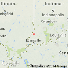
Pg. 126 (fig. 1), 128. West Franklin limestone. Only upper part of formation, a fossiliferous bed about 2 feet thick, is exposed in bed of small creek 3 mi east of Hazelton, in NE/4 sec. 26, T. 1 N., R. 10 W., [Union 7.5-min quadrangle, Gibson Co., IN]. South of Patoka River, it is a well known double bed of limestone about 200 feet above the Millersburg coal (coal VII). Underlies Ditney formation. Age is Pennsylvanian.
[Author states name West Franklin limestone was first applied to excellent exposures in bluff of Ohio River at West Franklin in southeast corner of Posey County, Indiana, by Leo Lesquereux, 1862, IN Richard Owen, Report of a geological recconoissance of Indiana, p. 294, [296]-297, and later it was used by John Collett, 1884, IN Indiana Dept. Geol. Nat. Hist. Ann. Rpt., no. 13, p. 61-62.]
Source: Publication; US geologic names lexicon (USGS Bull. 1200, p. 4184-4185).
- Usage in publication:
-
- West Franklin formation*
- Modifications:
-
- Areal extent
- AAPG geologic province:
-
- Illinois basin
Summary:
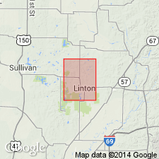
West Franklin formation. In Greene and Sullivan Counties, Indiana, underlies Shelburn formation (restricted). [Age is Late Pennsylvanian.]
Source: US geologic names lexicon (USGS Bull. 1200, p. 4184-4185).
- Usage in publication:
-
- West Franklin limestone member
- Modifications:
-
- Revised
- AAPG geologic province:
-
- Illinois basin
Summary:
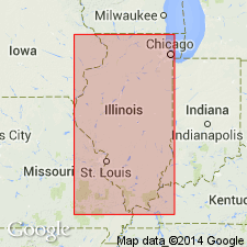
Pg. 37, 49 (table 1). West Franklin limestone member of Modesto formation (new) in southeastern Illinois. Complex member which may include [rocks of] Piasa limestone, DeGraff, Pond Creek, and Lake Creek coal members in part of area. Type locality noted (original reference to name and type locality credited to Collett, 1884, p. 61-62).
Type locality: in south-central part sec. 24, T. 7 S., R. 12 W., [West Franklin 7.5-min quadrangle], Posey Co., southwestern IN.
Source: Publication; US geologic names lexicon (USGS Bull. 1200, p. 4184-4185).
- Usage in publication:
-
- West Franklin Limestone Member
- Modifications:
-
- Revised
- AAPG geologic province:
-
- Illinois basin
Summary:
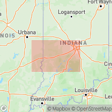
West Franklin Limestone Member of Shelburn Formation of McLeansboro Group. Revised to uppermost member of Shelburn Formation in Indiana. Age is Pennsylvanian (Conemaugh).
Source: Compendium of Indiana (IN Geol. Survey Bull. 43, p. 190-191); GNC index card files (USGS-Reston).
- Usage in publication:
-
- West Franklin Limestone Member
- Modifications:
-
- Principal reference
- Revised
- AAPG geologic province:
-
- Illinois basin
Summary:
Pg. 190-191 (article by C.E. Wier). West Franklin Limestone Member of Shelburn Formation.
Source: Publication.
- Usage in publication:
-
- West Franklin Limestone Member
- Modifications:
-
- Principal reference
- AAPG geologic province:
-
- Illinois basin
Summary:
West Franklin Limestone Member of Shelburn Formation of McLeansboro Group. Top member of Shelburn Formation. Correlates with Madisonville Limestone of Kentucky.
Source: Publication.
For more information, please contact Nancy Stamm, Geologic Names Committee Secretary.
Asterisk (*) indicates published by U.S. Geological Survey authors.
"No current usage" (†) implies that a name has been abandoned or has fallen into disuse. Former usage and, if known, replacement name given in parentheses ( ).
Slash (/) indicates name conflicts with nomenclatural guidelines (CSN, 1933; ACSN, 1961, 1970; NACSN, 1983, 2005, 2021). May be explained within brackets ([ ]).

