

- Usage in publication:
-
- West Canyon limestone member
- Modifications:
-
- Original reference
- Dominant lithology:
-
- Limestone
- Sandstone
- Siltstone
- AAPG geologic province:
-
- Wasatch uplift
Summary:
Pg. 13-14. West Canyon limestone member of Oquirrh formation. Proposed for basal limestone part of formation. Chiefly bioclastic limestones with some interbedded sandstone or siltstone and lesser amounts of chert. Limestones are calcarenites and calcilutites, medium blue-gray, thin- to thick-bedded, and blocky to slabby weathering. Many limestone units cherty or silicified. Some units reflect conditions of probably cyclic sedimentation. Sandstones are quartzose, very fine-grained, silty, calcareous-cemented, and olive-brown. Thickness 1,456 feet in type section; 1,245 feet thick in Provo area; 510 feet in Sardine Canyon section, near Logan. Conformably(?) underlies "sandy" part (gray siltstone) of formation. Conformably(?) overlies Mississippian to Pennsylvanian Manning Canyon formation (bleached calcareous siltstone). Age is Early Pennsylvanian (Morrowan). Fossils (crinoids, fusulinids; usually too broken for identification).
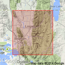
Type section: on divide between Threemile Canyon and Fourmile Canyon, tributaries to drainage of West Canyon, in E/2 sec. 23 and W/2 sec. 24, T. 5 S., R. 3 W., Fairfield quadrangle, Utah Co., northern UT. Named from excellent exposures along northeast side of West Canyon 6 to 9 mi north of Cedar Fort, UT, and northwest of town along base of ridge.
Source: US geologic names lexicon (USGS Bull. 1200, p. 4179-4180); supplemental information from GNU records (USGS DDS-6; Denver GNULEX).
- Usage in publication:
-
- West Canyon Limestone Member
- Modifications:
-
- Areal extent
- AAPG geologic province:
-
- Great Basin province
Summary:
Name used as basal member of Oquirrh Formation at Samaria Mountain, Oneida Co, ID in the Great Basin province. This nomenclature is preferred to Bridal Veil [Limestone] Member of Oquirrh, a term used in the central Wasatch Mountains. Crops out as a continuous band above the covered slopes of the Manning Canyon Formation. Separated from the younger middle member of the Oquirrh by an unconformity; contact placed below first major sandstone or sandy limestone above the ledge-forming limestone. The unconformity represents part of the Middle and lower part of Upper Pennsylvanian time. Correlation charts. Cross sections. Mapped (geologic map) from northern UT across border into southern ID. Cut off at north by Woodruff fault. Section 1,307 ft thick measured on Samaria Mountain. Forms step-like ledges 5-15 ft thick separated by less resistant ledges. Consists mostly of blue-gray limestone and of some cross-bedded orthoquartzite and calcareous quartz sandstone at base. Fossils: brachiopods, crinoids, bryozoans, algae, fusulinids, corals. Ranges in age from Morrowan to Atokan. Morrowan-age ANTHRACOSPIRIFER OCCIDUUS (Sadlick) at base. Atokan-age CHAETETES found in upper 400 ft. Brachiopods in upper part closely related to those of early Middle Pennsylvanian age found in Midcontinent rocks.
Source: GNU records (USGS DDS-6; Denver GNULEX).
- Usage in publication:
-
- West Canyon Limestone*
- Modifications:
-
- Revised
- Reference
- Biostratigraphic dating
- Dominant lithology:
-
- Limestone
- Quartzite
- Sandstone
- AAPG geologic province:
-
- Wasatch uplift
- Great Basin province
Summary:
Pg. A23-A27, A50, A51 (table 5). West Canyon Limestone Member of Nygreen (1958) adopted and redefined as lowermost of three formations in Oquirrh Group (rank raised) in the Bingham sequence, central and southern Oquirrh Mountains (Wasatch uplift and Great Basin province). Present in Stockton and Fairfield 15-min quadrangles; exposed on the east limb of Ophir anticline in Manning, Ophir, and Soldier Canyons, on west side of Oquirrh Mountains, as well as on the flanks of Long Ridge anticline in West Canyon (citing James Gilluly, 1932, USGS Prof. Paper 173, pl. 12). Location of type section given (see also fig. 4, section 4), thickness stated to be 1,450 feet (citing Nygreen, 1958, p. 14, 39). Consists principally of cyclical, clastic, arenaceous limestone (composed chiefly of quartz and calcite grains, and fossil fragments), interbedded with thin, cherty, argillaceous, dense crystalline limestone beds as much as 1 or 2 feet thick. Thin calcareous quartzite beds or partially silica-cemented calcareous sandstone, generally banded or cross-bedded, separate much thicker limestone strata. Limestone is generally medium-dark-gray; it weathers light- and medium-gray if pure or brownish-gray if arenaceous and contains tan and black chert nodules and lenses. Calcareous quartzite is medium-gray to tan; the sandy-weathered surface rind is of variable thickness and is tan to light-gray-brown. Evidence of small-scale rhythmic sedimentation may be seen, although environment favored formation of limestone. Toward upper contact of formation, the calcareous quartzite beds become thicker and more abundant. At reference sections in West Canyon and Soldier Creek, is 1,436 feet and 1,060 feet thick respectively; conformably overlies Manning Canyon Shale, contact poorly exposed; conformably and transitionally underlies Butterfield Peaks Formation (new) of Oquirrh, contact placed at base of a continuous, cross-bedded, silica- and carbonate-cemented orthoquartzite or calcareous sandstone that separates two less resistant argillaceous limestones. Megafossils (microfossils were not collected) identified in 7 collections from West Canyon and 4 collections from Soldier Canyon are listed (chiefly brachiopods; common bryozoans; rare corals, pelecypods, trilobite fragments); all are typical of the RUGOCLOSTUS zone. Fauna is similar to that found in upper part of Lake Point Limestone of Rogers Canyon sequence; differences with regards to abundance are noted. Occurrence of marginiferid productoid ELLIOTTELLA and first appearance of fossils of the RUGOCLOSTUS zone indicate an eastward transgression of base of Oquirrh Group from the Oquirrh Mountains to the Wasatch Range. Age is Early Pennsylvanian (Morrowan). Report includes measured sections, columnar sections, correlation chart.
Reference sections: (1) ridge on north side of West Canyon, opposite Maple Canyon, in NE/4 NW/4 sec. 27, T. 4 S., R. 3 W., Fairfield 15-min quadrangle, Utah Co., UT (see fig. 4, section 6a, and fig. 10); (2) begin at base of ridge on north side of Soldier Creek (Lat. 40 deg. 25 min. 45 sec. N., Long 112 deg. 16 min. 30 sec. W.), traverse N. 6 deg. E. to ridgetop, then N. 40 deg. E. to ridgetop west of peak 9075, in secs. 26, 27, and 34, T. 4 S., R. 4 W., Stockton 15-min quadrangle, Tooele Co., UT (see fig. 4, section 11); and (3) [described in Tooker, E.W., and Roberts, R.J., 1961, IN Cook, D.R., ed., Geol. Bingham mining dist. and northern Oquirrh Mountains, Utah Geol. Soc. Gdbk., no. 16, p. 17-35] on ridge west of Lewiston Peak, in sec. 29, 30, T. 5 S., R. 3 W., Fairfield 15-min quadrangle, Utah Co., UT, thickness 1,180 feet.
Source: Publication; Changes in stratigraphic nomenclature, 1970 (USGS Bull. 1354-A, p. A26-A27).
- Usage in publication:
-
- West Canyon Limestone*
- Modifications:
-
- Overview
- AAPG geologic province:
-
- Wasatch uplift
Summary:
Name applied to basal formation in the western Traverse and Northern Lake Mountains of Utah Co, UT on the Wasatch uplift. Geologic map. Conodonts suggestive of Morrowan age (listed) found at 5 localities. Overlies older Pennsylvanian and Mississippian rocks undivided. Underlies Butterfield Peaks Formation of Oquirrh Group.
Source: GNU records (USGS DDS-6; Denver GNULEX).
- Usage in publication:
-
- West Canyon Limestone*
- Modifications:
-
- Areal extent
- Age modified
- Biostratigraphic dating
- AAPG geologic province:
-
- Great Basin province
Summary:
Name used in north-central UT in the southern Oquirrh Mountains, the Cedar, Stansbury, Lake, Timpanogos, and Grassy Mountains of the Great Basin province, as the basal formation of the Oquirrh Group. Correlates with the Lake Point Limestone, basal formation of the Oquirrh Group in the northern Oquirrh Mountains, and with the newly named Bannock Peak Limestone, basal formation of Oquirrh Group in southeast ID. Correlation charts. Ranges in age from late Chesterian to Morrowan in the southern Oquirrh Mountains; the following conodont zones identified: RHACHISTOGNATHUS MURICATUS (late Chesterian), R. PRIMUS to IDIOGNATHOIDES SINATUS (Morrowan), and I. SINUOIS (Morrowan). Two conodont zones missing below I. SINUOSIS. Overlies Manning Canyon Shale. Underlies Butterfield Peaks Formation of Oquirrh Group; contact is gradational. Reference sections designated in Soldier Canyon where West Canyon is 307 ft thick. The major lithology is limestone but the abundance of sandy limestones and sandstones increase upward in the section, the opposite of what happens in the Bannock Peak.
Source: GNU records (USGS DDS-6; Denver GNULEX).
For more information, please contact Nancy Stamm, Geologic Names Committee Secretary.
Asterisk (*) indicates published by U.S. Geological Survey authors.
"No current usage" (†) implies that a name has been abandoned or has fallen into disuse. Former usage and, if known, replacement name given in parentheses ( ).
Slash (/) indicates name conflicts with nomenclatural guidelines (CSN, 1933; ACSN, 1961, 1970; NACSN, 1983, 2005, 2021). May be explained within brackets ([ ]).