


- Usage in publication:
-
- Weches Formation
- Modifications:
-
- Mapped 1:250k
- Dominant lithology:
-
- Sand
- Clay
- AAPG geologic province:
-
- Arkla basin
- East Texas basin
Summary:
Weches Formation. Glauconite, quartz sand, and clay interbeds. Glauconite and quartz sand, thin-bedded, locally cross-bedded to lenticular, grayish-green to grayish-olive-green. Clay, silty, muscovitic, thin-bedded, light-brown to moderate light-gray. Weathers moderate to dark reddish-brown, locally forms limonitic and sideritic iron ore, clay ironstone concretions, and rubble; forms prominent scarp, long ridges, and isolated hills. Thickness 10 to 50 feet, thins eastward. Lies above Queen City Formation and below Sparta Sand. Age is Eocene.
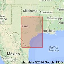
[Mapped in southeastern corner of map sheet, in Atlanta, TX, region, Morris and Cass Cos., northeastern TX, and Miller Co., southwestern AR.]
Source: Publication.
- Usage in publication:
-
- Weches Formation*
- Modifications:
-
- Revised
- AAPG geologic province:
-
- Gulf Coast basin
Summary:
Pg. D4 (table 1), D10-D11. Weches Formation of Claiborne Group. Raised to formation rank (Mount Selman Formation abandoned). Recognized from eastern Texas southwestward to eastern part of Rio Grande embayment north of Frio River. In eastern Texas, consists chiefly of fossiliferous glauconitic clay with some marl and limestone, thickness about 50 feet. Becomes a gypsiferous carbonaceous sandy clay at eastern margin of Rio Grande embayment, north of Frio River, southern Texas. Equivalent to upper part of El Pico Clay (new) south of Frio River. Overlies Queen City Sand and underlies Sparta Sand, both of Claiborne. Age is middle Eocene.
Source: Publication; Changes in stratigraphic nomenclature, 1968 (USGS Bull. 1294-A, p. A19).

- Usage in publication:
-
- Weches Formation
- Modifications:
-
- Mapped 1:250k
- Dominant lithology:
-
- Greensand
- Sand
- Clay
- AAPG geologic province:
-
- East Texas basin
Summary:
Weches Formation. Greensand, sand, and clay; greensand mostly glauconite in part marly, quartz sand common; interbedded with clay, silty, brown to gray; weathers light to dark reddish brown, locally forms layers of limonitic iron ore and clay ironstone concretions. Thickness 25 to 75 feet. Lies above Queen City Sand and below Sparta Sand. Age is Eocene.
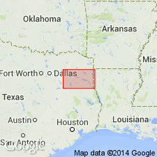
Mapped in Robertson and Leon Cos., eastern TX.
Source: Publication.

- Usage in publication:
-
- Weches Formation
- Modifications:
-
- Mapped 1:250k
- Dominant lithology:
-
- Greensand
- Sand
- Clay
- AAPG geologic province:
-
- Gulf Coast basin
Summary:
Weches Formation. Greensand, sand, and clay; greensand mostly glauconite, in part marly, quartz sand common, pale green to yellowish brown; interbedded clay, silty, glauconitic, dark brown to chocolate brown; weathers light to dark reddish brown; abundant marine megafossil fragments. Thickness 30 to 50 feet. Overlies Queen City Sand (Eocene); underlies Sparta Sand (Eocene). Age is Eocene.
Mapped in Wilson, Gonzales, Caldwell, Fayette, and Bastrop Cos., southeastern TX.
Source: Modified from GNU records (USGS DDS-6; Denver GNULEX).
- Usage in publication:
-
- Weches Formation
- Modifications:
-
- Mapped 1:250k
- Dominant lithology:
-
- Sand
- Clay
- AAPG geologic province:
-
- East Texas basin
- Arkla basin
Summary:
Weches Formation. Glauconite and quartz sand, grayish green to grayish olive green, thin-bedded, locally cross-bedded to lenticular, clay interbeds light brown to moderate light gray, silty, muscovitic, thin-bedded; weathers moderate to dark reddish brown, locally forms limonitic and sideritic iron ore and clay ironstone concretions; marine megafossils in southern part. Thickness 35+/- feet, range 0 to 70 feet. Occurs above Queen City Sand and below Sparta Sand. Age is Eocene.
[Mapped in Anderson, Camp, Cass, Cherokee, Harrison, Henderson, Marion, Morris, Smith, Upshur, Van Zandt, and Wood Cos., eastern TX.]
Source: Publication.

- Usage in publication:
-
- Weches Formation
- Modifications:
-
- Mapped 1:250k
- Dominant lithology:
-
- Sand
- Clay
- AAPG geologic province:
-
- Gulf Coast basin
Summary:
Weches Formation. Greensand, sand, and clay; greensand, mostly glauconite, in part marly, quartz sand common, pale green to yellowish brown; interbedded clay, silty, glauconitic, dark brown to chocolate brown; weathers light to dark reddish brown. Thickness 30+/- feet. [Correlative with upper part of El Pico Clay mapped southwest of Frio River. Overlies Queen City Sand; underlies Sparta Sand; locally in fault contact with Cook Mountain Formation.] Age is Eocene.
[Mapped northeast of Frio River, in Frio and Atascosa Cos., southern TX.]
Source: Publication.

- Usage in publication:
-
- Weches Formation
- Modifications:
-
- Mapped 1:250k
- Dominant lithology:
-
- Sand
- Clay
- AAPG geologic province:
-
- Gulf Coast basin
Summary:
Pamphlet [p. 3]. Weches Formation. Greensand, sand, and clay; greensand mostly glauconite, in part marly, quartz sand common, pale green to yellowish brown; interbedded clay, silty, glauconitic, dark brown to chocolate brown; weathers light to dark reddish brown; thickness 30+/- feet. Overlies Queen City Sand; underlies Sparta Sand. Correlative with upper part of El Pico Clay. Age is Eocene.
[Mapped in southeastern corner of map sheet east of Frio River, in Wilson and Atascosa Cos., southern TX.]
Source: Publication.
For more information, please contact Nancy Stamm, Geologic Names Committee Secretary.
Asterisk (*) indicates published by U.S. Geological Survey authors.
"No current usage" (†) implies that a name has been abandoned or has fallen into disuse. Former usage and, if known, replacement name given in parentheses ( ).
Slash (/) indicates name conflicts with nomenclatural guidelines (CSN, 1933; ACSN, 1961, 1970; NACSN, 1983, 2005, 2021). May be explained within brackets ([ ]).