

- Usage in publication:
-
- Weber quartzite*
- Modifications:
-
- Original reference
- Dominant lithology:
-
- Quartzite
- Sandstone
- AAPG geologic province:
-
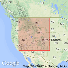
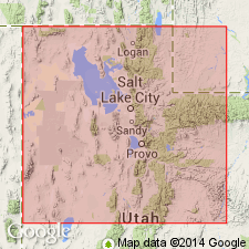
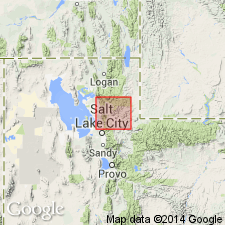
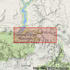
- Wasatch uplift
Summary:
Pg. 477-479. Weber quartzite. Quartzite with a few beds of red sandstone at base and occasional fine beds of shale interspersed at 3 or 4 horizons, varies to considerable extent by thin sheets of conglomerate and rounded quartz pebbles. Named from Weber Canyon of Wasatch Range, [Weber, Davis, and Morgan Counties], northeastern Utah. No fossils but is certainly referable to middle of Coal measures. Rests conformably on Wasatch limestone and is conformably overlain by Upper Coal measures. Thickness 6,000 to 10,000 feet. [The use of the name Weber was extended by the early workers into Colorado and Wyoming, to include great thicknesses of rocks that are probably older than Weber quartzite.]
Source: US geologic names lexicon (USGS Bull. 896, p. 2293-2294).
- Usage in publication:
-
- Weber quartzite
- Modifications:
-
- Revised
- AAPG geologic province:
-
- Wasatch uplift
Summary:
Pg. 517-542. In upper canyon of Weber River the conspicuous Weber quartzite is separated from the dark Mississippian limestones by a Pennsylvanian formation of red sandstone and shale with intercalated thin limestones, having a total thickness of about 500 to 2,000 feet. This formation was noted by geologists of Survey of 40th Parallel but was not named. Weeks [F.B.], in an unpublished manuscript on geology of northeastern Utah and adjacent regions, calls it Morgan formation, and in present paper that name is adopted. In Weber Canyon the Park City formation overlies Weber quartzite. Writer traced Weber quartzite north from its type locality and found that it grows thinner and finally disappears 7+/- miles north of Weber River, and that it is missing where the Pennsylvanian rocks reappear 4 to 5 miles to northwest, where the Pennsylvanian phosphatic series (Park City formation) rests on Mississippian limestone. In Big Cottonwood Canyon the Weber is 1,200 to 1,500 feet thick. It is uncertain whether Weber quartzite is a formation of local extent, or once far more extensive than now and removed by erosion from northern part of Wasatch region. There is probably an unconformity between Weber quartzite and overlying Park City phosphatic series. [The Morgan formation was included in Weber quartzite of King.]
Source: US geologic names lexicon (USGS Bull. 896, p. 2293-2294).

- Usage in publication:
-
- Weber quartzite*
- Modifications:
-
- Overview
- AAPG geologic province:
-
- Wasatch uplift
Summary:
Weber quartzite. In reports of early geologists the name Weber was applied to Carboniferous rocks in Colorado whose relations to the type Weber still remain undetermined, but which are believed to be older; and it was also applied in some areas to rocks now known to be Cambrian. The typical rocks in Weber Canyon are Pennsylvanian age, but in many parts of northern Utah the name has in recent years been incorrectly used to include at base several hundred feet of limestones, shale, and sandstones that apparently correspond to Morgan formation of northeastern Utah and are older than the typical Weber quartzite.
Source: US geologic names lexicon (USGS Bull. 896, p. 2293-2294).
- Usage in publication:
-
- Weber quartzite
- Modifications:
-
- Not used
- AAPG geologic province:
-
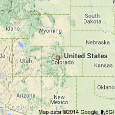
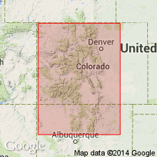
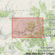
- Eagle basin
- Green River basin
- North Park basin
Summary:
Pg. 1384-1385. Names Weber and Maroon abandoned in Gore area, Colorado; term Battle Mountain proposed for sequence of Pennsylvanian clastics. In earlier reports, sequence here assigned to Battle Mountain was divided into six formations (ascending): Weber (divided into Weber shale and Weber grit), Robinson limestone, White Quail limestone, Maroon, Jacque Mountain limestone, and Wyoming. Term Belden shale member of Battle Mountain is here proposed to replace Weber shale.
Source: US geologic names lexicon (USGS Bull. 1200, p. 4162-4163).
- Usage in publication:
-
- Weber quartzite
- Modifications:
-
- Areal extent
- AAPG geologic province:
-
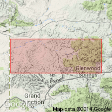
- Eagle basin
- Green River basin
- Piceance basin
Summary:
Consists of yellow, white, buff, fine- to medium-grained sandstone that gradationally overlies Morgan formation from area of Elk Springs, Rio Blanco Co, CO to northwest in CO in the Greater Green River basin. Overlies Maroon formation to southeast in northwest CO, Piceance and Eagle basins; Weber-Maroon contact is abrupt. Thins southeast from Yampa area where it is 900 ft thick, to Meeker area where it is 60 ft thick. A tongue of Weber 100 ft thick identified at South Canyon Creek and at Glenwood Springs. Cannot be traced with certainty into Eagle area. North of Eagle, a 46 ft thick sandstone in the redbed section between the Maroon and State Bridge may be Weber. No fossils found. Des Moines age suggested. May be a tongue of the Tensleep. Cross sections. Measured sections. Recognized in sections from Yampa River area, Moffat Co, CO, Greater Green River basin, across northern Piceance basin into Eagle Co at Eiby Creek east of Eagle, Eagle basin.
Source: GNU records (USGS DDS-6; Denver GNULEX).
- Usage in publication:
-
- Weber quartzite*
- Modifications:
-
- Principal reference
- AAPG geologic province:
-
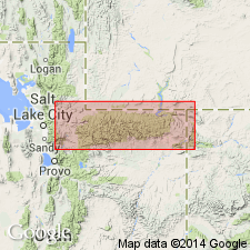
- Central Western Overthrust
- Wasatch uplift
Summary:
Pg. 833-834. At type section, herein described for first time, Weber quartzite is about 3,000 feet thick; overlies Morgan sandstone and underlies Park City formation. Lower sandstones, 730 feet thick, are overlain by 355 feet of limestone; remainder of unit is quartzite. [Age is Pennsylvanian and Permian.]
Source: US geologic names lexicon (USGS Bull. 1200, p. 4162-4163).
- Usage in publication:
-
- Weber sandstone
- Modifications:
-
- Revised
- AAPG geologic province:
-
- Green River basin
Summary:
Lower contact revised in that newly named Youghall formation underlies Weber in eastern Uinta Mountain area, Moffat Co, CO in the Greater Green River basin. Ranges between 800 and 1,000 ft thick in area. Includes buff, brownish, and gray, cross-bedded to massive, fine-grained sandstone, lenticular dolomite, and dolomitic sandstone. Conformably underlies Park City formation. No fossils found; age not determined. May all be Desmoinesian age. Measured section.
Source: GNU records (USGS DDS-6; Denver GNULEX).
- Usage in publication:
-
- Weber sandstone
- Modifications:
-
- Revised
- AAPG geologic province:
-
- Eagle basin
- Piceance basin
Summary:
Occurs in Uinta Mountains of UT and CO where it is a white or yellow, clean quartz sandstone up to 1,400 ft thick. In Moffat Co, CO, Weber is 800 to 900 ft thick, and it is about 60 ft thick near a district school on Flag Creek, Rio Blanco Co, CO. Isopach map. The sandstone on Flag Creek is a tongue of the Weber, and to that sandstone the designation Schoolhouse tongue on the Weber sandstone is applied in this report. Schoolhouse occurs at South Canyon near Glenwood Springs, Garfield Co, Piceance basin, and near McCoy and Eagle, Eagle Co, Eagle basin. Could be of Desmoinesian, Missourian, Virgilian, Wolfcampian, and Leonardian age. Correlation chart.
Source: GNU records (USGS DDS-6; Denver GNULEX).
- Usage in publication:
-
- Weber formation
- Modifications:
-
- Revised
- AAPG geologic province:
-
- Green River basin
- Uinta basin
- Uinta uplift
- Wasatch uplift
Summary:
Assigned as the upper formation of the newly named Durst group. Overlies the Morgan formation of the Durst. Underlies the Moenkopi formation. The Durst is known to extend from Morgan Co, UT on the Wasatch uplift east along the Uinta Mountains in Duchesne and Uintah Cos, UT in the Uinta basin, and on the north side of the mountains in Daggett Co, UT on the Uinta uplift, into Moffat Co, CO in the Greater Green River basin. Morgan-Weber contact not consistently selected at the same horizon by all workers. Weber changes in Duchesne Co. West of the county, Weber is a sandstone with a few interbedded limestones. East of the county Weber has a lower member of sandstone and limestone, and an upper member of cross-bedded sandstone. Limestones are best developed on southeast flank of Uintas. Lower Weber and Morgan may be contemporaneous. Cross sections. Correlation chart. Of Des Moines, Pennsylvanian age.
Source: GNU records (USGS DDS-6; Denver GNULEX).
- Usage in publication:
-
- Weber Sandstone*
- Modifications:
-
- Overview
- AAPG geologic province:
-
- Green River basin
- Uinta basin
- Wasatch uplift
Summary:
History of use explained. Occurs in the Wasatch Mountains, Wasatch uplift, east along the Uinta Mountains, Uinta basin, into northwest CO in the Greater Green River basin. Geologic map. Combined with Morgan Formation on an isopach map. Forms rugged canyons and cliffs. Relatively uniform in character. Has a lower unit of gray fossiliferous limestone and sandstone, and an upper unit exclusively of sandstone that is light gray to buff, fine to medium grained, massive, friable, well sorted, calcareous, and cross-bedded. Limestone occupies about 16 percent of the lower unit which may be fine grained, massive, cherty. Sandstone in the lower unit varies from gray to cream, calcareous to hard and quartzitic, and thick bedded to massive. Forms a conspicuous sloping ledge about 200 ft from top. This break in slope is accented by stands of pine and pinyon. Rocks above the ledge are darker than the underlying part. Also has small cavities or a honeycomb structure. Overlies Morgan Formation. Underlies Park City Formation. Is Pennsylvanian, probably Des Moines. Fossils-corals, brachiopods. Derived from the west. Is a shallow marine deposit. The sands could have been deposited as dunes on the shore. Limestones in lower unit deposited in shallow water.
Source: GNU records (USGS DDS-6; Denver GNULEX).
- Usage in publication:
-
- Weber Sandstone*
- Modifications:
-
- Overview
- AAPG geologic province:
-
- Green River basin
- Uinta basin
Summary:
Author discusses origin of Weber Sandstone and describes four sections measured in Dinosaur National Park of northeast UT (Uinta basin) and northwest CO (Greater Green River basin). In report area, formation overlies Des Moinesian and older rocks of Morgan Formation, and underlies Permian Park City Formation. Regionally it is correlated with Wells Formation and Tensleep Sandstone. Intertongues with Maroon Formation along its southwest margin near Glenwood Springs, CO. Text discussion of genetic units which are divided by many diastems, mineralogy, cementation characteristics, trace fossils, and sedimentary structures of Weber in the four sections. Cross-stratified units are either subaqueous or subaerial. Flat-laminated units resemble interdune deposits. Contorted stratified units are eolian origin. Small scale sedimentary structures--ripples, ripple laminations, raindrop imprints--are eolian and subaerial origin. Thin carbonates are interdunal pond deposits. Southward current direction suggests Weber was part of an eolian, rather than marine, system, deposited as the sea receded in Middle Pennsylvanian (Des Moinesian) to Early Permian (Wolfcampian) time.
Source: GNU records (USGS DDS-6; Denver GNULEX).
- Usage in publication:
-
- Weber Sandstone*
- Modifications:
-
- Revised
- AAPG geologic province:
-
- Piceance basin
Summary:
The Schoolhouse, formerly thought to be an eastward-extending tongue of the Permian and Pennsylvanian Weber Sandstone, is demonstrated to be a sandstone related to the Maroon Formation by its physical properties. The evident color distinction between Maroon and Schoolhouse is attributed to the acid reducing basinal fluids that dissolved carbonate cement and hematitic grain coatings. Schoolhouse is reassigned to the Maroon as its upper member. The eastern limit of Weber is uncertain; it may lie between Meeker and Thornburg on the west and the outcrops of Schoolhouse on Miller and Fawn Creeks on the east. Correlation chart. Maroon (and the Schoolhouse) correlate with the Weber of the Uinta Mountains and northwest CO.
Source: GNU records (USGS DDS-6; Denver GNULEX).
For more information, please contact Nancy Stamm, Geologic Names Committee Secretary.
Asterisk (*) indicates published by U.S. Geological Survey authors.
"No current usage" (†) implies that a name has been abandoned or has fallen into disuse. Former usage and, if known, replacement name given in parentheses ( ).
Slash (/) indicates name conflicts with nomenclatural guidelines (CSN, 1933; ACSN, 1961, 1970; NACSN, 1983, 2005, 2021). May be explained within brackets ([ ]).