The National Geologic Map Database is migrating to a new infrastructure. We apologize for any service disruptions during this process.
|
|---|


- Usage in publication:
-
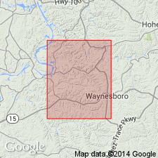
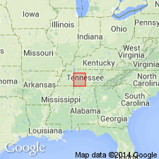
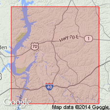
- Wayne formation*
- Modifications:
-
- Named
- Dominant lithology:
-
- Limestone
- Clay
- AAPG geologic province:
-
- Upper Mississippi embayment
Summary:
Name Wayne formation proposed by H.D. Miser because the rocks to which it is applied are widely exposed and typically developed in Wayne Co., western TN. Consists of five members (ascending): Osgood earthy limestone member (10 to 17 ft thick); Laurel limestone member (19 to 32 ft thick); Waldron clay member (2.5 to 5 ft thick); Lego limestone member (25 to 36 ft thick); and Dixon earthy limestone member (10 to 45 ft thick). Underlies Brownsport formation and overlies Brassfield limestone. Age is Silurian (Niagaran).
Source: GNU records (USGS DDS-6; Reston GNULEX).
- Usage in publication:
-
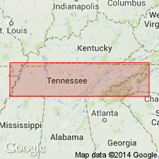
- Wayne group
- Modifications:
-
- Revised
- AAPG geologic province:
-
- Upper Mississippi embayment
Summary:
Pg. 244. Wayne group. Includes the following formations (ascending): Osgood limestone, Laurel limestone, Waldron clay, Lego limestone, and Dixon limestone. Age is Middle Silurian.
Source: US geologic names lexicon (USGS Bull. 1200, p. 4155).
- Usage in publication:
-
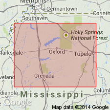
- Wayne Formation
- Modifications:
-
- Areal extent
- Overview
- AAPG geologic province:
-
- Upper Mississippi embayment
Summary:
Wayne Formation described in the subsurface of northern MS. Unit consists of varicolored limestone and brick-red to brownish and purplish shale. Overlies Patterson Sandstone. Age in this report is Early Silurian.
Source: GNU records (USGS DDS-6; Reston GNULEX).
- Usage in publication:
-
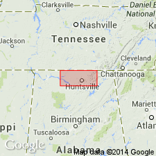
- Wayne Group
- Modifications:
-
- Areal extent
- AAPG geologic province:
-
- Cincinnati arch
Summary:
Mapped in north-central AL as Wayne Group. Overlies Brassfield Limestone (Lower Silurian) and unconformably underlies Chattanooga Shale (Upper Devonian). Age given as Middle Silurian.
Source: GNU records (USGS DDS-6; Reston GNULEX).
- Usage in publication:
-
- Wayne Formation
- Modifications:
-
- Revised
- AAPG geologic province:
-
- Cincinnati arch
Summary:
Unit is used as a formation rather than a group in this report, following the original definition. The Maddox limestone of Foerste (1903) is reinstated and assigned as basal member to the Wayne Formation, replacing the Osgood and Laurel. As revised here, the Wayne Formation is subdivided into (ascending) Maddox, Waldron, Lego, and Dixon Members. Overlies the Brassfield Formation and underlies the Brownsport Formation. Age is Silurian (latest Llandoverian to early Ludlovian).
Source: GNU records (USGS DDS-6; Reston GNULEX).

- Usage in publication:
-
- Wayne Group
- Modifications:
-
- Overview
- AAPG geologic province:
-
- Cincinnati arch
Summary:
Wayne Group used in AL. Formations within the group are not discussed. Unit is described as red, gray and green silty, argillaceous limestone; red and green shale; and grayish-green nonporous crystalline limestone containing a few scattered pink calcite crystals. Recognizable in the surface and subsurface in the interior Low Plateaus of northern AL. Thickness ranges from 0 to 144 ft. Age is Early and Late Silurian (Ontarian-Lockportian).
Source: GNU records (USGS DDS-6; Reston GNULEX).
- Usage in publication:
-
- Wayne Group*
- Modifications:
-
- Overview
- Age modified
- AAPG geologic province:
-
- Cincinnati arch
Summary:
Silurian Wayne Group in du Pont Geohydrological Survey well near Waverly, Humphreys Co., central TN consists of Osgood, Laurel, Waldron, Lego, and Dixon Formations. Conodont sampling has designated the Osgood and Laurel as Llandoverian and early Wenlockian. Upper part not as refined.
Source: GNU records (USGS DDS-6; Reston GNULEX).
For more information, please contact Nancy Stamm, Geologic Names Committee Secretary.
Asterisk (*) indicates published by U.S. Geological Survey authors.
"No current usage" (†) implies that a name has been abandoned or has fallen into disuse. Former usage and, if known, replacement name given in parentheses ( ).
Slash (/) indicates name conflicts with nomenclatural guidelines (CSN, 1933; ACSN, 1961, 1970; NACSN, 1983, 2005, 2021). May be explained within brackets ([ ]).