- Usage in publication:
-
- Wausau Member
- Modifications:
-
- Principal reference
- Dominant lithology:
-
- Till
- AAPG geologic province:
-
- Wisconsin arch
Summary:
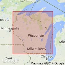
Pg. 4 (table 1); App., p. A2-1 to A2-3. Wausau Member of Marathon Formation. The lower member of the Marathon Formation (new) in the Chippewa Sublobe in Marathon and Wood Counties, Wisconsin, is here named the Wausau Member, following the informal usage of W.N. Mode (Univ. Wisconsin MS thesis, 1976), M.T. Stewart (Univ. Wisconsin MS thesis, 1973), and G.L. LaBerge and P.E. Myers (Wisconsin Geol. Nat. Hist. Survey Open-file Rpt., 1971). Consists of brown pebbly loam to clay loam till in which more than 30 percent of the clasts are rotted. Thickness <10 m. Unconformably overlies Precambrian bedrock. Is the surface unit in much of the area, or underlies the Edgar Member (new) of the Marathon or the Merrill Member (new) of the Lincoln Formation (new) to the north. Age is Pleistocene (early Wisconsinan or older), based on organic deposits on top of the overlying Merrill Member.
Type section (=Marathon Formation type section): gravel pit on west side of Ryan Street, 1.5 mi (2.4 km) south of Highway 29, in SW/4 SW/4 NE/4 sec. 27, T. 28 N., R. 8 E., [approx. Lat. 44 deg. 52 min. 50 sec. N., Long. 89 deg. 32 min. 24 sec. W.], Wausau 15-min quadrangle, Marathon Co., central WI.
Named from Wausau, Marathon Co., central WI; name credited to William N. Mode.
Reference section: roadside ditch exposure on west side of North 57th Street, about 50 m north of its intersection with East Butternut Road, in SE/4 SE/4 SE/4 sec. 4, T. 29 N., R. 8 E., [approx. Lat. 45 deg. 01 min. 15 sec. N., Long. 89 deg. 33 min. 10 sec. W.], Nutterville 7.5-min quadrangle, Marathon Co., central WI.
[Additional locality information from Syverson and others, 2011, Wisconsin lexicon of Pleistocene units, Wisconsin Geol. Nat. Hist. Survey Tech. Rpt., no. 1; supplemented from USGS historical topographic map collection TopoView, accessed on June 9, 2018.]
Source: Publication; US geologic names lexicon (USGS Bull. 1565, p. 346-347).
For more information, please contact Nancy Stamm, Geologic Names Committee Secretary.
Asterisk (*) indicates published by U.S. Geological Survey authors.
"No current usage" (†) implies that a name has been abandoned or has fallen into disuse. Former usage and, if known, replacement name given in parentheses ( ).
Slash (/) indicates name conflicts with nomenclatural guidelines (CSN, 1933; ACSN, 1961, 1970; NACSN, 1983, 2005, 2021). May be explained within brackets ([ ]).

