The National Geologic Map Database is migrating to a new infrastructure. We apologize for any service disruptions during this process.
|
|---|


- Usage in publication:
-
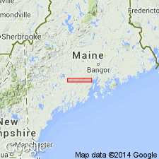
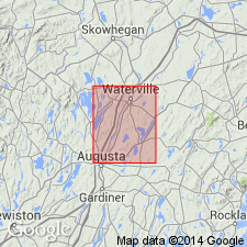
- Waterville shale
- Modifications:
-
- Named
- Biostratigraphic dating
- Dominant lithology:
-
- Shale
- Slate
- Sandstone
- Limestone
- AAPG geologic province:
-
- New England province
Summary:
Named for exposures at Waterville, Kennebec Co., central southern ME. Also called Waterville slate in same report. Consists of a series of shales, sandstones, and impure limestones, often pyrite-bearing. Two phases are typical. One phase consists of interbedded bluish calcareous shales and gray arenaceous shales. The second phase consists of dark-bluish slates interbedded with coarser quartzitic layers. To the southeast, passes into the Vassalboro sandstone through a series of transition beds consisting of interbedded shales and sandstones. Contains fossil trails, sea weeds, and graptolites. Graptolites are mid-Silurian (Clinton or Wenlock) age which makes the Waterville time-equivalent of the Quoddy shale in the Eastport region.
Source: GNU records (USGS DDS-6; Reston GNULEX).
- Usage in publication:
-
- Waterville Formation*
- Modifications:
-
- Revised
- Biostratigraphic dating
- Overview
- AAPG geologic province:
-
- New England province
Summary:
Revised as Waterville Formation. Previously included rocks now called Mayflower Hill Formation. Now designated as rocks found between the Mayflower Hill Formation and Vassalboro Formation, as well as rocks exposed west of the Mayflower Hill outcrop. For convenience, Waterville mapped east of the Mayflower Hill rocks is the eastern facies and Waterville to the west is the western facies. Eastern facies is mainly thinly laminated phyllite with a prominent 300-ft-thick limestone member in the middle of the section. The western facies contains abundant quartz wacke and limestone; limestone appears in several belts of outcrop which may represent a single folded unit or several units interbedded with wacke in a normal sequence. Eastern and western facies are considered lateral equivalents. Contact with underlying Mayflower Hill Formation is gradational; contact with overlying Vassalboro is drawn on first massive beds of wacke, although a local black phyllite also may occur at the contact. Preliminary observations suggest that the Waterville overlies the Mayflower Hill. Because the Mayflower Hill contains Monograptids of late Llandovery age, the Waterville must be late Llandovery or younger. On the basis of meager sedimentary features, stratigraphic position, and fossils of the Mayflower Hill, the Waterville is assigned a Wenlock or possibly Ludlow age.
Source: GNU records (USGS DDS-6; Reston GNULEX).
- Usage in publication:
-
- Waterville Formation
- Modifications:
-
- Revised
- Biostratigraphic dating
- AAPG geologic province:
-
- New England province
Summary:
Revised to include only the eastern facies as described by Osberg (1968). Western facies now assigned to Sangerville Formation. Sangerville includes graywacke and phyllite exposed in Skowhegan 15-min quad in part continuous with rocks of the western facies of the Waterville. Two fossil localities in the Waterville yield fossils ranging in age from Ordovician to Early Devonian, but a third yields fossils that narrow the age to late Llandoverian to Ludlovian [Silurian].
Source: GNU records (USGS DDS-6; Reston GNULEX).
- Usage in publication:
-
- Waterville Formation
- Modifications:
-
- Revised
- AAPG geologic province:
-
- New England province
Summary:
Anasagunticook assigned to top of Waterville Formation. Underlies Sangerville Formation, which in the Buckfield area is divided into (ascending): Moody Brook, Berry Ledge, Noyes Mountain, Patch Mountain, and Turner Members, replacing Buckfield Group. [Intent to revise the above units is not stated, but subdivision of the Sangerville and its lower contact are clearly shown in a stratigraphic column.] Order of younging within the sequence differs from reports of previous workers. Graded sequences suggest an inverted lithologic package. Rocks in this area were subjected to three deformational events. Age of Waterville is shown as Early Silurian.
Source: GNU records (USGS DDS-6; Reston GNULEX).

- Usage in publication:
-
- Waterville Formation*
- Modifications:
-
- Revised
- Age modified
- Biostratigraphic dating
- AAPG geologic province:
-
- New England province
Summary:
In Lewiston 15-min quad, Waterville Formation is composed of thinly bedded, gray to greenish-gray slate or pelitic schist with some wacke and calc-silicate rocks. Queried in Bryant Pond, Buckfield, Dixfield, and Farmington quads where previously mapped as Anasagunticook Member of Sangerville Formation by Moench and Pankiwskyj (1988) who interpreted it to be a fine-grained facies of the Sangerville. Anasagunticook not used here because of lithologic similarity to Waterville. Where previously mapped as Anasagunticook, typically composed of thinly interbedded, feldspathic metasandstone and pelitic schist; also contains local beds of coarse-grained, commonly graded and conspicuously cross- and convolute-laminated metasandstone. Waterville includes unnamed limestone member that ranges from highly metamorphosed coarsely crystallized calc-silicate rock to less metamorphosed micritic metalimestone, calcareous metasiltstone, and pelitic slate or schist, previously mapped as Berry Ledge Formation in Bryant Pond 15-min quad by Guidotti (1963). Also includes black shale lenses consisting of thin lenticular bodies of rusty-weathering, black sulfidic slate or phyllite. Age modified from Silurian (Llandoverian through Ludlovian) to Silurian (Llandoverian and Wenlockian) based on Wenlockian and late Llandoverian and Wenlockian graptolites found in Waterville east of map area (Osberg, 1988, and references therein).
Source: GNU records (USGS DDS-6; Reston GNULEX).
For more information, please contact Nancy Stamm, Geologic Names Committee Secretary.
Asterisk (*) indicates published by U.S. Geological Survey authors.
"No current usage" (†) implies that a name has been abandoned or has fallen into disuse. Former usage and, if known, replacement name given in parentheses ( ).
Slash (/) indicates name conflicts with nomenclatural guidelines (CSN, 1933; ACSN, 1961, 1970; NACSN, 1983, 2005, 2021). May be explained within brackets ([ ]).