- Usage in publication:
-
- Warsaw limestone
- Modifications:
-
- Original reference
- Dominant lithology:
-
- Limestone
- Marl
- AAPG geologic province:
-
- Illinois basin
- Iowa shelf
Summary:
Pg. 54-56. Warsaw or Second Archimedes limestone. Series of highly fossiliferous beds of blue "marlites" with intercalations of impure limestones, or in some places impure limestones separated by seams of blue marl. Overlain by arenaceous bed that sometimes contains small pebbles and is in turn overlain by St. Louis limestone [includes Spergen limestone]. Underlain by 10 feet of magnesian limestone (of local occurrence, probably) succeeded below by "Geode bed" (soft shaly or marly beds with geodes of quartz chalcedony), which rests on Keokuk limestone.
Source: US geologic names lexicon (USGS Bull. 896, p. 2276).

- Usage in publication:
-
- Warsaw shale*
- Warsaw limestone*
- Modifications:
-
- Overview
- AAPG geologic province:
-
- Black Warrior basin
- Appalachian basin
- Illinois basin
- Iowa shelf
- Ozark uplift
Summary:
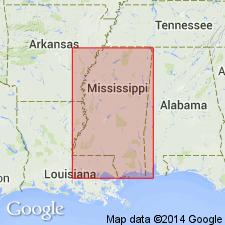
Warsaw shale (also Warsaw limestone) of Meramec group. Recognized in Iowa, Illinois, Indiana, Kentucky, Tennessee, eastern Missouri, northern Alabama, and northeastern Mississippi. Adopted by the USGS as basal formation of Meramec group, overlain by Spergen limestone and underlain by Keokuk limestone. As defined it includes at base the "geode bed," which in some reports has been included in Keokuk limestone. In western Kentucky and southern Indiana the Warsaw (formerly called "Harrodsburg limestone") is chiefly limestone and is called Warsaw limestone. Age is Mississippian.
J.M. Weller, 1934 (Illinois Acad. Sci. Trans., v. 26, no. 3, p. 106), proposed "to restore Warsaw formation to its early status," assigning to it all beds between Keokuk limestone and St. Louis limestone as these are now limited. This definition would include Spergen limestone in the Warsaw. The classification adopted by 9th Ann. Field Conf. Kansas Geol. Soc., Sept. 1935, did not include Spergen limestone in Warsaw, and this proposed change has not been considered by the USGS for its publications.
See also under Spergen limestone.
Named from exposures at Warsaw, Hancock Co., western IL. A typical exposure occurs along creek known as Soap Factory Hollow, which joins the Mississippi from the east about 0.5 mi south of Lower Warsaw, IL.
Source: US geologic names lexicon (USGS Bull. 896, p. 2276).
- Usage in publication:
-
- Warsaw limestone*
- Modifications:
-
- Areal extent
- AAPG geologic province:
-
- Anadarko basin
Summary:
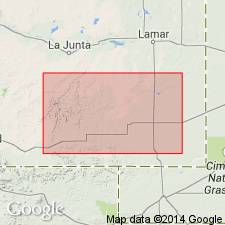
Extended into the subsurface of Baca County, Colorado, in the Anadarko basin, east of the Las Animas arch. Overlies Keokuk limestone and underlies Spergen limestone. Age is Early Mississippian (Kinderhookian). Report includes correlation chart.
Source: Modified from GNU records (USGS DDS-6; Denver GNULEX).

- Usage in publication:
-
- Warsaw Shale
- Modifications:
-
- Overview
- AAPG geologic province:
-
- Illinois basin
Summary:
Exposure at Geode Glen in Warsaw is designated as type section (based on data in Collinson, 1964, Illinois Geological Survey Guidebook 6). Warsaw Shale is present in bluffs of Mississippi and Illinois river valleys in western and southwestern IL. Consists of as much as 300 ft of siltstone in west-central IL, but thins to less than 100 ft in outcrop area, where it consists of gray shale containing beds of argillaceous limestone. Quartz geodes are common and locally abundant; some are replacements of fossils, some contain petroleum. Fossils include brachiopods, bryozoans (especially ARCHIMEDES), and crinoids. Coarse silt and fine sandstone differentiated as Bilyeu Member of Borden Siltstone in central IL continues westward where it becomes a member of Warsaw Shale. Underlies Sonora Formation or Ullin, Salem, or St. Louis Limestones. Overlies Keokuk Limestone. Age is Mississippian (Valmeyeran). Report includes geologic maps and correlation charts.
Source: GNU records (USGS DDS-6; Reston GNULEX).
- Usage in publication:
-
- Salem-Warsaw Formation
- Modifications:
-
- Revised
- AAPG geologic province:
-
- Appalachian basin
Summary:
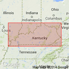
The Salem and Warsaw Formations in the southwestern part of the study area are treated as one unit and are identified only from subsurface logs. Composed of gray shales and fossiliferous, locally dolomitic limestones. Thickness 0 to 90 m. Where massive limestones dominate, they are included in the overlying Mount Vernon member (new, informal) of the Slade Formation. Overlies Fort Payne Formation or, where absent, the Borden Formation. According to the author, formal nomenclature presented in this report has been accepted by the Kentucky Stratigraphic Nomenclature Committee. Report includes correlation charts, cross-sections, and measured sections.
Source: GNU records (USGS DDS-6; Reston GNULEX).
- Usage in publication:
-
- "Warsaw"
- Warsaw Shale
- Warsaw Limestone
- Modifications:
-
- Areal extent
- AAPG geologic province:
-
- Illinois basin
Summary:
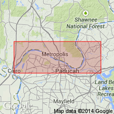
Name Ullin Limestone is this report is equivalent to the "Warsaw" as used by the oil industry and is approximately equivalent to the Warsaw Limestone as used in KY. Warsaw is less than 100 ft thick in the type area, but is as much as 300 ft thick in west-central IL where it consists primarily of siltstones. Although Ullin Limestone can be considered a facies equivalent of part of the Warsaw Shale, Ullin is more appropriate name for this limestone unit in most of the subsurface of southern IL. In KY and TN, the name Warsaw has also been used for limestones with approximately the same lithologies, contacts and age as the Ullin of IL. In western KY, the Warsaw, called "Big Light" by drillers, is 250 to 500 ft thick and is composed of light to medium gray biocalcirudite, biocalcarenite, or dolomitic limestone. Unit thins to the east and is only about 30 ft thick in central KY. The type Warsaw of IL is neither traceable nor lithologically similar to the Warsaw of KY and TN. It was suggested by Sable and Dever (1990: USGS Prof. Paper 1503) that the name should be abandoned for usage in KY and TN, but they did not suggest an appropriate replacement. They equated the Warsaw of western KY with the Ullin of IL and the Ramp Creek, Harrodsburg, and Muldraugh Formations of IN. Author here uses term Ullin for rocks in Reed quarry, western KY, formerly referred to Warsaw Limestone, and because the Ullin does not equate exactly with Kentucky's usage of Warsaw, the lower contact has been drawn approximately 70 ft lower in the section and includes the mound facies in the lower part of the Ullin, rather than in the underlying Fort Payne Formation.
Source: GNU records (USGS DDS-6; Reston GNULEX).
- Usage in publication:
-
- Warsaw Formation*
- Modifications:
-
- Mapped
- AAPG geologic province:
-
- Illinois basin
- Ozark uplift
Summary:
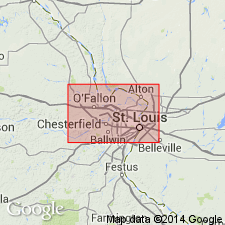
Warsaw Formation mapped in western IL and in eastern MO in St. Louis area, on both sides of Mississippi River.
Source: GNU records (USGS DDS-6; Reston GNULEX).
For more information, please contact Nancy Stamm, Geologic Names Committee Secretary.
Asterisk (*) indicates published by U.S. Geological Survey authors.
"No current usage" (†) implies that a name has been abandoned or has fallen into disuse. Former usage and, if known, replacement name given in parentheses ( ).
Slash (/) indicates name conflicts with nomenclatural guidelines (CSN, 1933; ACSN, 1961, 1970; NACSN, 1983, 2005, 2021). May be explained within brackets ([ ]).

