

- Usage in publication:
-
- Warm Creek Shale†
- Modifications:
-
- Abandoned
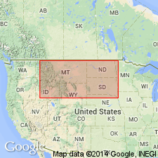
- AAPG geologic province:
-
- Williston basin
Summary:
†Warm Creek Shale of Collier and Cathcart (1922, p. 172) and Knechtel (1959, p. 740-741) in north-central Montana abandoned. Rocks reallocated to (ascending) Belle Fourche Shale, Greenhorn Formation, Carlile Shale, Niobrara Formation, and Telegraph Creek Formation.
Source: Changes in stratigraphic nomenclature, 1975 (USGS Bull. 1422-A, p. A42-A43, A66-A67).
For more information, please contact Nancy Stamm, Geologic Names Committee Secretary.
Asterisk (*) indicates published by U.S. Geological Survey authors.
"No current usage" (†) implies that a name has been abandoned or has fallen into disuse. Former usage and, if known, replacement name given in parentheses ( ).
Slash (/) indicates name conflicts with nomenclatural guidelines (CSN, 1933; ACSN, 1961, 1970; NACSN, 1983, 2005, 2021). May be explained within brackets ([ ]).